Download

1 / 30
300 likes | 483 Views
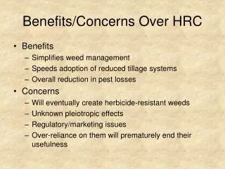
Benefits and Concerns when Constructing an Enterprise-scale Geodatabase. Larry Theller, presenter Agricultural and Biological Engineering Dept Purdue University Co-authors: Bernie Engel, Richard Farnsworth, Jin Yong Choi, Dwight Welch. Background. Campus has 125+ ArcGIS users

E N D
Benefits and Concerns when Constructing an Enterprise-scale Geodatabase Larry Theller, presenter Agricultural and Biological Engineering Dept Purdue University Co-authors: Bernie Engel, Richard Farnsworth, Jin Yong Choi, Dwight Welch
Background • Campus has 125+ ArcGIS users • My dept. provides GIS data for many groups who use same layers • First step was FTP/download site for 1998 orthos and statewide topo map layer. • Statewide DEM, NASS, 2003 orthos…
Our solution • SDE Geodatabase to act as library • Mostly static layers, users not editing • Fast raster delivery is critical • Off-campus use is a plus • Clients will be various GIS programs
The Geodatabase • ArcGIS native data format • Stores feature classes that have one geometry type • Can store feature and attribute behavior • Spatial and attribute data stored in RDBMS • Two physical implementations • Personal geodatabase • ArcSDE Geodatabse
Capabilities of Enterprise Geodatabase • Rule-based, Enhanced (network) topology • Multi-user (versioned) editing • Attribute validation (domains, subtypes) • Scaleable storage solutions • Referential Integrity in relationships • Custom features ( behavior of objects)
When do you need Geodatabase? • Raster data access drives ours • Can’t afford to move aerial photography • 150 casual users storing multiple copies of data. • We use distributed GIS client but with limited WEB access • So want one-stop data access • but…restrict “download” of some data
Purdue’s IT group now offers ArcGIS on Citrix This increases the need for “one-stop data shopping”
Just SDE? Or add IMS? • Physical overhead of SDE database connections versus cost of ArcIMS license. • Will the database be the sole source? -Will you need to interface files (images, changing vectors) with geodatabase features? • Consider AXL service in ArcIMS.
ArcIMS Feature Service • An ArcIMS Feature Service streams the actual data features to you over the Internet, similar to the way audio and video are streamed. Each feature service contains one or more ArcIMS feature classes. • A layer based on an ArcIMS feature class works the same as any other feature layer. An ArcIMS feature class is simply another feature data source for a layer, just as a shapefile is a feature data source for a layer. • If you add an ArcIMS Feature Service to ArcMap, you'll get a new group layer containing one sublayer for each of the feature classes in the service. • As its name suggests, an ArcIMS Feature Service cannot contain raster data.
Browser/viewer ArcExplorer 9 WMS viewers IE (thin client) Full-feature GIS ArcGIS Custom Models Client Software
Browser/viewer ArcExplorer 9 free No images from SDE direct No metadata Will support images from ArcIMS AXL WMS viewers User must customize Full-feature GIS ArcGIS Direct Connect ArcIMS connect Metadata from SDE Steeper learning curve price Client Software
Direct Connect to SDE One connection per client ArcCatalog ArcCatalog ArcCatalog ArcCatalog ArcCatalog SDE Database ArcMap ArcMap Issues on Windows XP ArcMap ArcMap
ArcIMS as broker to SDE ArcMap ArcCatalog ArcCatalog ArcMap ArcCatalog ArcCatalog ArcCatalog SDE Database ArcIMS Feature server Image Server ArcIMS uses 4 connections regardless of client load.
Using ArcCatalog “Add GIS Server”
Add URL of ARCIMS server NOT WEBPAGES!
You can get a list of Feature Data Sets. Each dataset may contain many feature classes. Restricted services are supported.
AXL-based services look like other map layer types to Arcmap, ArcCatalog and ArcExplorer
Groups of layers (“feature datasets” and raster layers) within the geodatabase
Metadata • ArcSDE – database has one format for direct connection • ArcIMS –axl service uses different format than web service • ArcIMS metadata server is still another different entity • ArcExplorer – can’t see anything but an embedded url. • Updates must cascade through different file formats and software products. • Needs (!!) to be streamlined by ESRI.
Metadata process • Import into SDE for ArcCatalog • Employ XML version for ArcIMS Metadata server to enable searching. • ArcExplorer users – can export a URL from an attribute - with poor results. • Provide in HTML for ArcIMS web thin clients.
Database SDE Connects to ArcIMS ArcMap ArcCatalog ArcMap ArcCatalog ArcCatalog ArcExplorer SDE Web Browser AXL Services Web Browser ArcIMS Feature server Image Server ArcIMS uses 4 connections regardless of client load. HTML services
Drawbacks of this approach • Design of master GDB is complex. • Requires database management experience (not as much GIS.) • Thin client (IE) aspects not robust. • Metadata: 3 client types, 3 separate copies! • Data presentation not uniform. • ArcIMS components add labor. • Requires more management than static GDB.
Conclusions • SDE Geodatabase is MUCH faster access to raster data than MrSid. • ArcIMS is key broker for multiple client TYPES. • ArcIMS adds significantly to management load. • Future development will be in ArcGIS Server (split-off thin client.)
Lessons • Create metadata for all layers, in XML and HTML. • Import Metadata to SDE from beginning • In retrospect, flat feature tree would be preferable. • Oracle’s unlimited table size is a plus.
Enterprise Geodatabase? Questions we asked • Raster and Vector? • Who is software client? • Full capability with all users? • Or are some just browsers • Will we allow multiple edits? • Read the books or buy training? • Which database? SQL or Oracle? • Who trains “shapefile” users?