Download
1 / 52
520 likes | 524 Views
Ecosystems. Environment & Resource Management. Ecosystems. Composition Survival of the Fittest The GTA Bioregion. Composition of an Ecosystem. An ecosystem (short for ecological system) is an ecological community together with its environment, functioning as a unit. Climate Soils

E N D
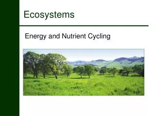
Ecosystems Environment & Resource Management
Ecosystems • Composition • Survival of the Fittest • The GTA Bioregion
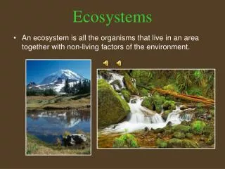
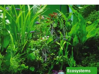
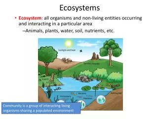
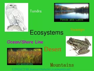
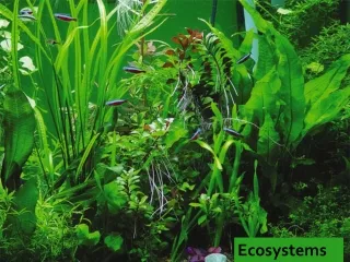
Composition of an Ecosystem • An ecosystem (short for ecological system) is an ecological community together with its environment, functioning as a unit. • Climate • Soils • Vegetation • Wildlife • People • All ecosystems are "open" systems in the sense that energy and matter are transferred in and out.
Composition of an Ecosystem • A combination of biotic, abiotic, and cultural factors lead to many different types of ecosystems. • Grassland • Rainforest • Desert • Coniferous Forest • Deciduous Forest
Composition of an Ecosystem • Biotic Factors • Plants • Animals • Microorganisms • Abiotic Factors • Air • Water • Rocks • Energy • Cultural Factors • People
Composition of an Ecosystem • Lined up in a spectrum, a tropical rainforest is at one end and a desert is at the other end • Rainforest = high temperature + high precipitation • Deciduous Forest = warm temperature + high precip. • Coniferous Forest = cool temperature + high precip. • Grasslands = warm temperature + moderate precip. • Desert = any temperature + low precip.
Composition of an Ecosystem • Climate has the greatest influence on ecosystems Polar Mid-Latitude Sub-Tropical Tropical
Composition of an Ecosystem • The tundra is a biome of short vegetation growing in climatically stressed environments of the Arctic and Antarctic and on mountaintops.
Composition of an Ecosystem • The boreal coniferous forest (or taiga) is extensive in northern regions of Canada, Alaska, and Eurasia.
Composition of an Ecosystem • The temperate deciduous forest contains various species of angiosperm trees, which drop their leaves in the autumn, plus some species of coniferous trees. This forest type is widespread south of the boreal forest.
Composition of an Ecosystem • Temperate grasslands are widespread in the dry interior of North America and other continents, and are dominated by species of grasses and other herbaceous plants.
Composition of an Ecosystem • Desert is a very sparsely vegetated biome of extremely dry environments.
Composition of an Ecosystem • Evergreen tropical forests occur in warm regions where rainfall is abundant throughout the year. This was the only photograph that wasn’t taken in Canada!
Composition of an Ecosystem • There are also several types of localized ecosystems that may not appear to fit with their surrounding dominant ecosystem. • Wetlands • Swamp • Marsh • Bog • Fen • Caves • Mountains
Composition of an Ecosystem • A swamp is a forested wetland.
Composition of an Ecosystem • A marsh is a relatively fertile wetland dominated by taller herbaceous plants, such as bulrush and cattail.
Composition of an Ecosystem • A bog or muskeg is a standing body of water with no underground spring. A form of moss grows and forms a thick mat of floating plants. These plants, over time, can fill in the pond or small lake with peat that will eventually be firm enough to support trees.
Composition of an Ecosystem • In fens, groundwater comes from glaciers that have melted, sitting upon layers of soil that are not permeable; thus keeping the water from sinking beneath the surface.
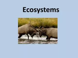
Survival of the Fittest • Fragility and resiliency of ecosystems • Survival of a species within an ecosystem • genetic characteristics • availability of habitat • population size
Our Local Ecosystem • Climate • temperature • precipitation • Watershed • Pringle Creek • Plants • planted • creekside • Animals • racoons
The GTA Bioregion • The City of Toronto includes a physical area of approximately 630 square kilometres and is bounded by Lake Ontario to the south, Etobicoke Creek and Highway #427 to the west, Steeles Avenue to the north, and the Rouge River to the east. • The Greater Toronto Area (GTA) defines the urban agglomeration extending from city boundaries and includes the regional municipalities of Halton, Peel, York, and Durham.
The GTA Bioregion • Both the city and the GTA are part of a larger, natural ecosystem known as the Greater Toronto Bioregion. This ecosystem is bounded by Lake Ontario, the Niagara Escarpment, the Oak Ridges Moraine, and includes several watersheds that drain into Lake Ontario.
GTA Ancient History • Oldest rocks in Ontario 1.5 billion years old • Canadian Shield rocks are visible in Muskoka and Haliburton • In the GTA, the Shield is covered by younger rocks and glacial settlements Moraine Escarp. Shield
GTA Modern History • 20 000 years ago, Toronto was covered by ice 4 times the height of the CN Tower • 12 000 years ago, Lake Ontario is 50 metres higher than it is today – covering Toronto completely • Higher ground is a refuge – found in the Niagara Escarpment & the Oak Ridges Moraine
Greater Toronto Area Today Lake Simcoe Niagara Escarpment Oak Ridges Moraine WHITBY WHITBY TORONTO TORONTO Lake Ontario
Origin of the Niagara Escarpment • Continental Drift created the Taconic Mountains in the northeastern United States and the “Michigan Basin” • As the mountains eroded, sediments were carried away, exposing older, less resistant rocks underneath • Today, the escarpment contains wetlands, forests, rock, and recreation
Niagara Escarpment Today Waterfalls Scenic Vistas Tall Cliffs
Antarctica – Toronto Style • Ice sheets expand and contract on a regular basis (over geologic time) • The last time the ice left the GTA was only about 10 000 years ago
Origin of the Oak Ridges Moraine • As the ice sheet last contracted, glacial meltwater ponded between the ice sheet and the Niagara Escarpment • A lake basin was formed into which gravel and sand were deposited • As the ice sheet melted, the ponded lake water drained, leaving the moraine high above the surrounding landscape.
Oak Ridges Moraine Today • Rain and snow that falls on the moraine replenish large reservoirs of groundwater that supply drinking water for over 200 000 people • The moraine’s sand and gravel filter the water and allow it to flow out of springs, forming the headwaters of the majority of the GTA’s watersheds
Varying Locations of Shorelines • As the ice sheet last contracted, meltwater flooded the Lake Ontario basin to form “Lake Iroquois” • Deposits along the shoreline of Lake Iroquois are now vital aggregate sources (sand, gravel, clay)
Varying Locations of Shorelines • The natural shoreline of Lake Ontario is at Front Street (Union Station, Hockey Hall of Fame, and the Royal York) • Since 1850, the shoreline has been extended by almost a kilometre by dumping millions of tons of fill • Originally used for industry and shipping, now for parks, hotels, etc.
Varying Locations of Shorelines Original Shoreline Today’s Shoreline
Rivers and Valleys • Rainwater and snow melt flows from higher lands like the Niagara Escarpment and Oak Ridges Moraine to lower lands and lakes through rivers • All the land drained by a river and its tributaries is known as a watershed • Major watersheds have their own conservation authority to manage them
Pavement Leads to Flooding • In a natural environment, some water will infiltrate into the soil • Pavement forces ALL of the water to flow over the land, flooding streams and rivers, causing erosion and increased sediments in the water • Developers now let rivers run their course and build stormwater ponds
Watershed Value • Rivers and streams perform important ecological functions such as providing habitats for fish and insects • Rivers and valley lands act as corridors for fish, animals, and birds and form some of the last green spaces in the urban portions of the GTA.
The Plains and Soils • As glaciers moved across the land, they left behind boulders, sand, and clay known as till – the parent material for our soil in the GTA • Water, chemical, and biological reactions created layers in the soil – decaying biotic life created humus for the topsoil which is good for agriculture
Soil Quality and Urbanization • The Canada Land Inventory ranks agricultural potential based on a variety of factors • Only 5% of Canada’s land is “prime agricultural land” • 80% of the GTA was originally “prime agricultural land” but urbanization is taking a toll the agriculture industry
Soil Quality and Urbanization Soil Quality