Download
1 / 43
430 likes | 567 Views
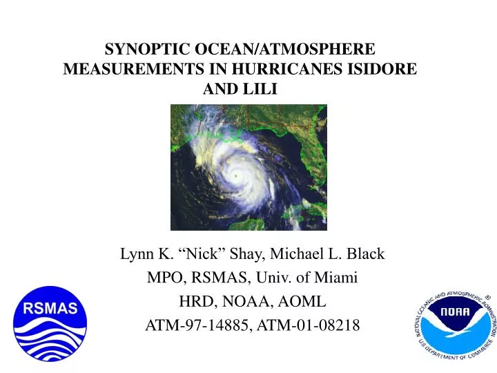
SYNOPTIC OCEAN/ATMOSPHERE MEASUREMENTS IN HURRICANES ISIDORE AND LILI. Lynn K. “Nick” Shay, Michael L. Black MPO, RSMAS, Univ. of Miami HRD, NOAA, AOML ATM-97-14885, ATM-01-08218. Acknowledgments:. Capt. Bob Maxsom and Jim McFadden (AOC) and the entire staff (pilots, engineers, technicians).

E N D
SYNOPTIC OCEAN/ATMOSPHERE MEASUREMENTS IN HURRICANES ISIDORE AND LILI Lynn K. “Nick” Shay, Michael L. Black MPO, RSMAS, Univ. of Miami HRD, NOAA, AOML ATM-97-14885, ATM-01-08218
Acknowledgments: • Capt. Bob Maxsom and Jim McFadden (AOC) and the entire staff (pilots, engineers, technicians). • Frank Marks (NOAA-HRD) for his continued support and HRD staff. • Collaborators: Peter Black and Joe Cione (HRD), Bob Cheney and Paul Chang (NOAA-NESDIS), Ed Walsh (NOAA-ETL), Eric D’Asaro (UW-APL),Tom Cook (UM), S. D. Jacob (UMBC), Eric Uhlhorn (HRD), Cdr. Sean White (HRD), Scott Guhin (UM). • Mark DeMaria (CIRA), Michelle Mainelli (NHC), Robbie Berg (NHC).
Outline: Goals/Objectives Introduction Motivation (and Relevance to the JHT) Hurricane Isidore Hurricane Lili Planned Analysis • Satellite Algorithms (OHC and SHIPS) • Ocean Mixing and Advection • Storm Structure Summary
Goal and Objectives: Long-term goal of the research is to understand the role of the upper ocean on hurricane intensity changes. Specific research objectives are: • Examine the roles of vertical current shears and horizontal advection of currents on the ocean heat content variability, and mixing processes; • Improve satellite algorithms in estimating heat content relative to in situ measurements (AX…, floats,) and; • Document the corresponding atmospheric structure of the storm and its intensity change.
Hurricane Isidore Flights: N42 Ocean Winds with Dr. Paul Chang (NOAA-NESDIS) • 18 Sep N43: Pre-storm (W. Caribbean). • 19 Sep N42:In-Storm; N43:Pre-storm (Gulf). • 21 Sep 2 P3s: In Storm. • 22 Sep 2 P3s: In Storm Yucatan Landfall. • 23 Sep N43: Post Storm. • 25 Sep 2-P3s: Landfall. • 17 -24 Sep 8 G-IV.
SST (left panels) and OHC (right panels) for Pre-Isidore (upper) and Post-Isidore (lower) Relative to Storm Intensity (SSTs processed by RSMAS Remote Sensing Laboratory).
Hurricane Isidore Pre-Storm, Storm, Post-Storm:AXCP/AXCTD/AXBTs
HYCOM Derived- Mixed Layer Temperatures: 10 Sept 02 • North Atlantic 32S-70N • 1/12 o Grid Spacing. • 6-hourly NOGAPS on monthly climatology ECMWF. • Data assimilation (O.-M. Smedstad) SSH from radar altimeters. • http://hycom.rsmas.miami.edu (E. Chassignet).
HYCOM Derived- Pre and Post Isidore Mixed Layer Temperatures: 10 and 25 Sept 02
Hurricane Lili Flights: N42 Ocean Winds • 29 Sep N42:In Storm; N43: Pre-storm (N.W. Caribbean). • 30 Sep 2 P3s: In Storm. • 1-2 Oct N43: In Storm (Gulf). • 2 Oct N42: In Storm. • 3 Oct 2-P3s: Landfall. • 4 Oct N43: Post Storm. • 28 Sept - 3 Oct G-IV: 7 Missions.
SST (left panels) and OHC (right panels) for Pre-Lili (upper) and Post-Lili (lower) Relative to Storm Intensity. (SSTs processed by RSMAS Remote Sensing Laboratory).
Isidore 19 Sept:42-21/23 Car. 21 Sept:42-28/28 Gulf 21 Sept:43-28/30 Gulf 23 Sept:43-17/20 Gulf Total: 94/101 Success ~93% Lili 29 Sept:43 22/22 Car 30 Sept:42 15/15 Car 30 Sept:43 12/17 Car 02 Oct:43 39/45 Gulf 02 Oct:42 34/41 Gulf 04 Oct:43 14/14 Gulf Total: 136/154 Success~ 88% GPS Deployments:
Hurricane Lili Pre-Storm, Storm, Post-Storm:AXCP/AXCTD/AXBTs
Hurricane Lili Storm GPS Transect (Less Height-Averaged Wind)
Surface Winds and Rain Rate from the SFMR (E. Uhlhorn)
Directional Wave Spectra In Hurricane Bonnie:(Courtesy of E. Walsh)
Gaspar KPP MY 2.5 PWP
Results from Gilbert at 2Rmax for TKE Mixing Parameterizations from HYCOM: Gaspar (blue), KPP (green), MY 2.5 (red), and PWP(cyan)
Improvement of Satellite Fields For OHC Estimation: Satellite-Derived OHC from radar altimeters: • Seasonal Climatology; • SSTs (Blended 7-Day Composites); • Processed Radar Altimetry (T/P, ERS-2, GFO); • 2 Layer Model. Improvements: • In Situ Data from Moorings/Floats/BTs……… • Daily SSTs (surface boundary condition) • Monthly Climatology Daily OHC Input Into SHIPS For Forecasting at NHC.
Hurricane Bret (1999): Heat Content Change and Isopycnal Displacement
OHC Based on Daily SST and a 7-Day Reynolds SST Composite After Lili.
3-D Atmospheric and Oceanic Structure relative to the depth of the OML observed during EPIC (NSF/NOAA)
Summary: Unique opportunity (ocean/atmosphere data sets) to sort out the contributions to Isidore and Lili intensity change. Envision observational, empirical, analytical, and numerical approaches Improve satellite algorithms for OHC/SHIPS Forecasting of TC Intensity in support of the Joint Hurricane Testbed. Document storm structure and relationships to interface processes. Excellent Teamwork Between NSF and NOAA. Aircraft are good platforms to conduct mesoscale to regional scale oceanographic studies ( e.g. EPIC).