Download
1 / 19
190 likes | 345 Views
Overview Global Observation of Forest Cover (GOFC): Fire. Chris Justice GOFC - Fire Implementation Team Leader University of Maryland. What is GOFC?. A n ambitious, multifaceted international strategy to bring the earth’s forests under continuous observation.

E N D
OverviewGlobal Observation of Forest Cover (GOFC): Fire Chris Justice GOFC - Fire Implementation Team Leader University of Maryland
What is GOFC? • An ambitious, multifaceted international strategy to bring the earth’s forests under continuous observation. • A vision to share data, information and knowledge, leading to informed action • A coordinated program of activities to ensure that earth observation and other data are used effectively for global monitoring of terrestrial resources and the study of global change • A network of participants implementing coordinated demonstration and operational projects • An international organization of space agencies and end users working together • A long term process of building an improved match between data products and user needs • All of the above
Background to GOFC • Developed originally under the Committee on Earth Observation Satellites (CEOS) initially as a pilot to test the concept of an Integrated Global Observing System • IGOS goals • To improve use of Earth Observation data to address major problems of global concern; • To improve coordination of national programs; • To improve co-operation between providers and users of Earth Observation data for regional and global applications. • Has become one of the Panels of the Global Terrestrial Observing System GTOS (FAO GTOS Secretariat) • Helping to address the Carbon Theme of the IGOS Partners
Who are the IGOS Partners? • Sponsors of the Global Observing Systems • (IOC of UNESCO, FAO, UNEP, UNESCO, WMO, ICSU) • Global Observing Systems • (GCOS, GOOS, GTOS) • Committee on Earth Observation Satellites (CEOS) • International Geosphere - Biosphere Programme (IGBP) • World Climate Research Programme (WCRP) • International Group of Funding Agencies (IGFA)
The Organization of GOFC Implementation Teams, Activities and Projects * Fire Monitoring and Mapping…….. * Cover Characteristics and Changes.. * Biophysical Parameters…………… Scientific and Technology Board Regional Activities and Networks Collaborations e.g. WGISS and WGCV
GOFC Regional Networks • Provide guidance on regional user needs and capabilities • Utilizing existing science networks • GOFC interface to national mapping and monitoring activities • Foster lateral transfer of technology and experience between countries and regions • Intended to provide transition to operational continuity • Current network initiatives: • South East Asia - SEARIN • Central Africa - OSFAC • Southern Africa – Miombo • Boreal (initial meetings – W. Russia/Fennoscandia, Far East) • Asia and South America (under discussion)
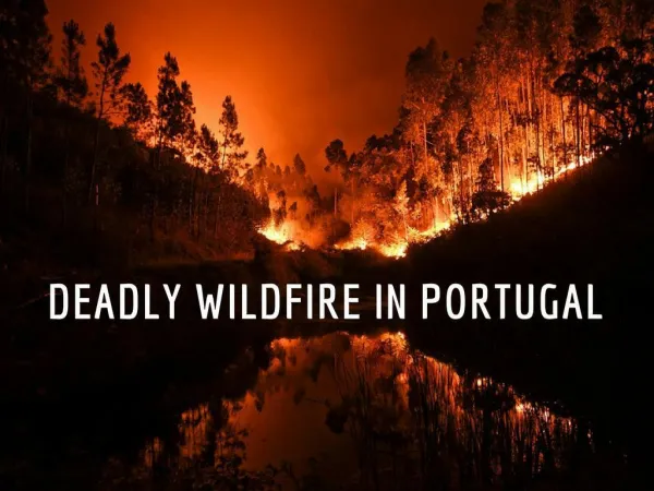
GOFC Fire: rationale • Extreme fire events are raising public awareness –as to the significance of fire monitoring and management • Fires are an important resource management issue and an important aspect of global change research • Fires are a hazard - a topic of the IGOS-P Disaster Management Support Group (DMSG) which is focusing on data requirements • Currently remote sensing of fire falls largely in the research domain – there is a need to transition tested methods and techniques into the operational domain and to develop robust procedures to provide improved information – building a strong operational user base • Most fire management communities do not utilize the currently available satellite fire data • Current information on fire does not meet the needs of the global change research community - a significant improvement is needed (and is feasible) in the provision of operational satellite and in-situ fire data– and is largely a question of coordination and agency commitment
Current Status • The operational satellite agencies have not traditionally supported fire products (e.g. NOAA/EUMETSAT) but could do ! • A number of groups are developing fire products and systems using data from the operational and experimental satellites. A number of these could be considered as prototype components for operational fire monitoring systems. Few of these products can be considered as validated (i.e. with known accuracy). • Users are often unaware of what is available or how to get the data. Poor access to the data can be an obstacle to efficient data use. • In-situ data on fires are collected by fire management agencies, these data are often unavailable to the research community. • Current observations are largely inadequate to meet answer needs e.g. to drive fire emissions models (emission factors, fuel load, moisture content, fire severity). • There is a preponderance of case studies but few operational systems
GOFC - Fire Goals • Increased User Awareness – increased understanding of the utility of satellite fire products for global change research, fire management and policy. • Geostationary Global Fire Network – providing operational standard fire products (active fire) in a timely fashion. • Polar Orbiters providing operational global monitoring: • sensing systems designed for monitoring fire, burned area, emissions products • providing operational moderate resolution long-term global fire products to meet user requirements and distributed ground stations providing regional products of known accuracy (active fire/burned area) • operational high resolution data acquisition allowing post-fire assessments
GOFC - Fire Goals (Contd.) • Fire Product Accuracy - fire validation sites, protocols and nomenclature established providing accuracy assessment for all operational products and test bedfor new or enhanced products. • Fire Emissions Product Suites - developed and implemented at the regional scale – input data and annual estimates being provided. • Enhanced User Products - operational multi-source fire / GIS products – interoperable catalogues, access to distributed data servers - initial regional focus - Web based systems – model outputs.
Priorities for GOFC Fire • Ensure future operational systems include fire monitoring capability e.g. NPOESS Fire Detection (via NPP VIIRS and DMSP). • Establish a Fire Product Validation Group undertaking product validation activities and setting up long-term fire validation sites. • Develop improved understanding of needs and capabilities between satellite fire data producers and users. • Develop automated Global Burned Area Monitoring capability. • Put in place operational rapid response data systems to support fire management. • Develop the capability to merge active fire data from multiple satellite sources in a Geographic Information System to form an Integrated Multi-source Fire Detection System. • Develop standardized emission fields and haze products/ monitoring combining satellite data in dynamic emissions models. • Provide programmatic and technical guidance concerning operational satellite-based fire monitoring for science and policy e.g. Millennium Ecosystem Assessment, UN IAWG on Wildland Fire.
Fire IT Members • Olivier Arino, ESA/ESRIN, Italy • Chris Elvidge, NOAA/NGDC, USA • Johann Goldammer, GFMC, Germany • Jean-Marie Gregoire, JRC, Italy • Chris Justice (Chairman), UMd, USA • Mastura Mahmud, UKM, Malaysia • Elaine Prins, NOAA/NESDIS/ASPT, USA • Brian Stocks, CFS/GLFC/IRM, Canada • TBD
Examples of Needed GOFC-Fire Projects • The expansion of the World Fire Web active fire monitoring network to provide global coverage with <24-hour turnaround time – multiple satellite and ground station sources • The production of 1 km resolution regional and global area burned products, with moderate resolution sensors, such as ATSR , VGT and MODIS with known accuracy • Develop a network of fire validation sites with standard data collection protocols and reporting – providing accuracy assessment of fire products • Community (producers and users) demonstration projects for selected regions : • integration of enhanced multi-source satellite data and GIS • satellite and modeled emissions • role of fire in the carbon budget • Regional case studies of operational use of satellite fire data for • fire management • emissions estimation and smoke trace gas monitoring • end to end fire monitoring system (fire risk, fire monitoring, fire recovery)
GOFC Fire Progress To Date • GOFC Fire Coordination Workshop – JRC Ispra (1999) • Fire Book (papers and discussion groups ) • S Africa Miombo GOFC Fire Workshop – Matopos (1999) • Burned Area Validation Protocols (SAFARI 2000) Zambia (2000) • Southeast Asia GOFC Fire Workshop – Tokyo (2001) • WGISS TF GOFC Workshops – Bangkok/ Tokyo (2000/2001) • GOFC-Fire presentation / discussions – EARSeL / Paris (2001) • GOFC Fire Validation Workshop – Lisbon (July ‘01) • GOFC Fire Presentation / discussion – Sivam, Brazil ( ‘01) ? • GOFC Fire Emissions Workshop - Washington (‘02) ? (planned workshops)
Highlights Since Ispra 1999 • GOFC Fire Book – from the Ispra Report (coming soon) • SAFARI 2000 – intensive campaign and EOS validation • CEOS CVWG on Land Product Validation (LPV) established • UN Interagency Task Force for Disaster Reduction developed WG# 4 on Wildland Fire (May 2001) • UN FAO Public Policy Report Published • EOS TERRA launched – MODIS Fire • JRC World Fire Web – currently in transition ? • Agencies Supporting GOFC e.g. • NASA LCLUC funded GOFC Projects • ESA support for new Fire Products and Initiatives • START GOFC Fellowship Program • Strengthening of Regional Networks – SEARIN • Increased use of WWW for fire data access • GOFC Science and Technology Board Meeting • broadening scope
GOES Wildfire ABBA Data Distribution System Animations of Wildfire ABBA composite image products are being provided via anonymous ftp and the web every half-hour at: http://cimss.ssec.wisc.edu/goes/burn/wfabba.html Displays include three overviews and 35 regional views providing coverage of the entire Western Hemisphere. Examples of Regional View Sectors
NASA MODIS Fire Rapid Response Data System Using a prototype streamlined fire and surface reflectance code and a ~4 hour delay feed of L0 MODIS data, we produce and distribute fire detections and RGB imagery via the Internet using FTP and ArcIMS feature server http://rapidfire.sci.gsfc.nasa.gov http://maps.geog.umd.edu
World Fire Web Access via Internet Browser http://opengis.jrc.it Open GIS viewer allows users to overlay fire and vegetation maps using internet browser e.g. Netscape.