Download
1 / 26
260 likes | 345 Views
More about the Weather . Hum for a Blustery Day

E N D
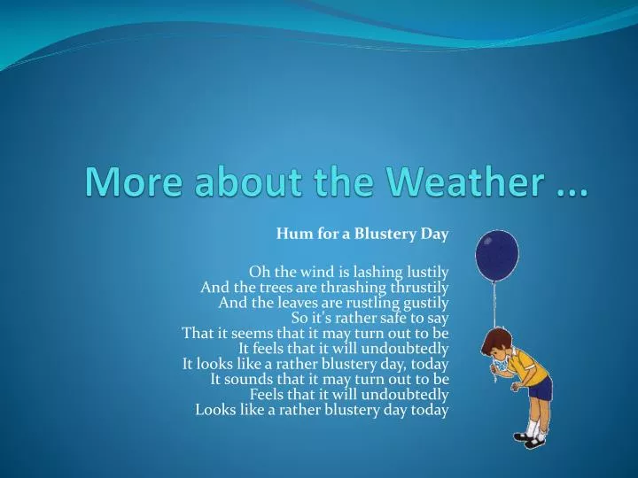
More about the Weather ... Hum for a Blustery Day Oh the wind is lashing lustilyAnd the trees are thrashing thrustilyAnd the leaves are rustling gustilySo it's rather safe to sayThat it seems that it may turn out to beIt feels that it will undoubtedlyIt looks like a rather blustery day, todayIt sounds that it may turn out to beFeels that it will undoubtedlyLooks like a rather blustery day today
Atmospheric Pressure and Winds • Atmospheric pressure is the pressure exerted by the atmosphere at the surface of the Earth. It is due to the weight of the air. • Atmospheric pressure is measured using a barometer. • The unit of atmospheric pressure is the millibar (mb). • The average sea-level value is 1013 mb. • Points of equal atmospheric pressure are shown on a weather map by lines called isobars.
More about Pressure ... • The layers of the atmosphere closest to the ground surface have the greatest weight acting upon them, so pressure is greatest here. • Consequently, air pressure decreases with altitude. At the top of the highest mountains it is very low. • Climbers need to take similar precautions to surfacing divers to guard against falling air pressure. • Air passengers are protected from low air pressure in the upper atmosphere by pressurised cabins.
But ... • Atmospheric pressure also varies horizontally, because it is a direct function of temperature. • When the temperature rises, air expands and rises by convection, and pressure decreases. • Conversely, when the temperature falls, air contracts and becomes denser, causing an increase in pressure.
Pressure and the Weather • High pressure occurs where air is descending and is associated with dry weather. This is because air warms as it descends, leading to the evaporation of most water vapour. • Low pressure occurs where air is rising. It is generally linked to precipitation and windy conditions. As it ascends air cools, and as a consequence it cannot hold as much water vapour. The water condenses into droplets, which become clouds at condensation level.
The general atmospheric circulation system • The differential heating of the Earth’s surface is sufficient to create a pattern of pressure cells. The movement of air within each cell is generally circular and, overall, is responsible for the transfer of surplus energy from equatorial regions to other parts the Earth. • Athree cell model forms the basis of our understanding of global circulation. • The three cells in each hemisphere are known as the Hadley cell, the Ferrel cell and the Polar cell.
The Hadley Cells • The two Hadley cells, one in each hemisphere, form the basis of tropical air circulation. • They are responsible for the seasonal changes in the climate of these regions which experience a wet and dry climate. And just to make it even more fun ... Each Hadley Cell can be divided into 4 components!
1) The Inter-Tropical Convergence Zone (ITCZ) Between the two Hadley Cells there is an area of low pressure in equatorial latitudes which is known as the inter-tropical conver- gence zone or ITCZ. As the sun is always high in the sky, the ground heats rapidly by day and there is much surface evaporation. As the hot air rises in convection currents, an area of low pressure develops. This rising air cools and the water vapour eventually condenses, giving heavy rainfall.
2nd Component ... At high altitudes the air moves polewards. This air usually circulates as upper westerly winds around the planet due to the deflection effect of the rotation of the Earth, known as the Coriolis effect. The net effect, though, is still for the air to move polewards.
3rd Component ... Around 30ºN and 30ºS the colder air at higher altitudes begins to sink, or subside, back to the Earth’s surface. As this air descends, it warms and any residual moisture evaporates. At the surface, high pressure is created, with cloudless skies. These areas are known as the subtropical anticyclones.
4th component ... On reaching the ground, some of the air returns towards equatorial areas as consistent winds known as the trade winds. These air movements are also subject to the Coriolis effect and are deflected to the right in the northern hemisphere and to the left in the southern hemisphere. As a result they blow from a northeasterly direction in the northern hemisphere and from the southeast in the southern hemisphere. The two trade wind systems move air towards the equator where it forms the ITCZ.
The Ferrel and Polar cells • A second cell called the Ferrel cell occurs at higher latitudes (between 30º and 60ºN and 30º and 60ºS). This is responsible for the climate types occurring in the mid-latitudes. • Here, air on the surface is pulled toward the poles, forming the warm southwesterly winds in the northern hemisphere and the warm northwesterlies in the southern hemisphere. • These winds pick up moisture as they travel over the oceans. At around 60ºN and 60ºS, they meet cold air, which has drifted from the poles. • The warmer air from the tropics is lighter than the dense, cold polar air and so it rises as the two air masses meet. This uplift of air causes low pressure at the surface and the resulting unstable conditions result in the mid-latitude depressions, characteristically experienced in the cool temperate western maritime (CTWM) climate ... Yes, that’s us folks!!
What happens next? • On reaching the troposphere, some of this rising air eventually returns to the tropics as part of the Ferrel cell circulation; some is diverted polewards, as part of the Polar cell. • On the surface at the north and south poles, descending air from the Polar cell results in high pressure. Remember that winds always blow from areas of high pressure to areas of low pressure. • In both the northern and southern hemispheres they are pulled towards the mid-latitude low-pressure belt, which occurs at around 60ºN and 60ºS.
If only that was the whole story ... • The three cell model does not allow for the influence of depressions/anticyclones or high level jet streams in the redistribution of energy. • So ... more recent approaches, known as wave theory models have now been developed to explain the behaviour of the upper air westerly air streams (Rossby waves) and jet streams.
A strange phenomenon ... • It is known that in the upper atmosphere winds blow around the Earth in a westerly direction. • Pilots first noticed these when they were blown off course when flying north to south, and they also found that they could travel much more quickly than expected when flying from west to east! Oops
Rossby Waves • Rossby waves follow a wavy undulating, pattern as they travel around the Earth’s upper atmosphere. • The reason for their existence is not entirely clear but some people believe that they are due to the upper air flow being forced to divert around the great north-south mountain ranges of the Rockies and Andes in the northern and southern hemispheres respectively. • The waves occur between four and six times in each hemisphere and they can stretch from the polar latitudes to the tropical latitudes. • Once a wave motion has begun, it is perpetuated around the planet. • The waves have considerable variation in amplitude during the year.
Rossby Waves and the Jet Stream
Jet Streams I • Within the upper westerly winds are bands of extremely fast moving air (up to 250 km/hr) called jet streams. • A jet stream can be hundreds of kilometres in width but with a vertical thickness of just one to two thousand metres. • On average they are found at altitudes of 10,000 metres. • They are the product of a large temperature gradient between two air masses which have markedly different temperatures. There are two main locations of jet streams:
Jet Streams II The polar front jet stream (PFJS) The sub-tropical jet stream (STJS) • This is a westerly band of wind, associated with the meeting place of cold polar and warm tropical air high above the Atlantic Ocean, somewhere between latitudes 40 and 60º N and 40 and 60ºS. • The precise location of the jet stream varies, but airplane pilots seek to ride in it when going from west to east, and to avoid it when flying from east to west. • It marks the division between the Polar and Ferrel cells, and helps to explain the formation of mid-latitude low pressure weather systems, or depressions. • This is another generally westerly band of wind and is associated with the pole-ward ends of the Hadley Cells at approximately 25ºN and 35ºS. • However, in summer above West Africa and Southern India this jet may become easterly. • This is due to temperatures over the land in these areas being higher than over the more southerly sea areas.
Oceanic circulation • The large-scale movement of water within the oceans is part of the horizontal transfer of heat from the tropics to the Polar regions and is responsible for around 20% of the total transfer of heat within the energy budget. • Each ocean has its own particular circular pattern of currents (called a gyre) that are produced as masses of water move from one climatic zone to another, but they all share a pattern which is similar as they are all initiated by the same factors. • Ocean currents are largely set in motion by the prevailing surface winds, associated with the general atmospheric circulation. They allow heat to become more equitably distributed throughout the world’s major climate zones. The direction of water movement is also deflected by the Coriolis force.
Ocean Currents: The World’s major ocean currents are particularly dominant along the western sides of the ocean basins and currents that are less well-defined and relatively weak are on the eastern sides.
And finally ... • Heat is transferred by warm ocean currents, such as the North Atlantic Drift in the Atlantic Ocean, from the low to high latitudes. • This warming influence is particularly dominant between latitudes 40º to 65º where winds blow onshore, on the western sides of continents and is confined to the winter season. • Cold ocean currents generally have less effect upon temperatures because they usually lie under off-shore winds. One exception is the Labrador Current off the East coast of North America.
That really is all ... But do check out this website! http://oceans.greenpeace.org/en/the-expedition/news/trashing-our-oceans/ocean_pollution_animation