Download
1 / 24
240 likes | 244 Views
Learn about climate resilience works (CRWs) and its technical aspects in the context of MGNREGS. Discover how infrastructure and livelihood modifications can ensure resilience to climate change.

E N D
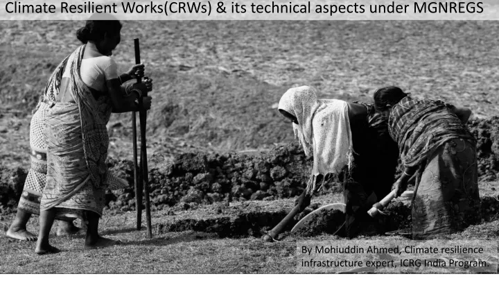
Climate Resilient Works(CRWs) & its technical aspects under MGNREGS By Mohiuddin Ahmed, Climate resilience infrastructure expert, ICRG India Program.
What is climate resilience? Resilience is the ability of a system or community to survive disruption and to anticipate, adapt, and flourish in the face of change
What is Climate resilience work (CRW)? Hence Climate resilience Works means: Resilience of two aspects:- The works or activities those can sustain the affect of present or future climate change as well as those can also provide benefits/alternatives to the users during the course of present and future climate changes. • 1. Making the created assets/works climate resilience : How? • Answer: • New infrastructure can be climate resilient by ensuring that an asset is located, designed, built and operated with the current and future climate in mind. • As infrastructure assets have long operational lifetimes they are sensitive not only to the existing climate at the time of their construction, but also to climate variations over the decades of their use • Following INRM and Ridge to Valley approaches. 2. Making the users/community climate resilience : How Answer: Creating multiple options of livelihoods by addition or modifications in the design of existing/new works under MGNREGA.
Let us see a short film to understand INRM and Ridge to Valley approaches
Making NRM works more Cimate Resileince under MGNREGA • Slight modification in the design as per the needs • Measurement of biophysical indicators of climate change • Linking/creating institutional arrangement for maintenance of created assets for longer durability and benefits. • Setting of out put of the CRWs to be created • Plan for better utilization of water through crop planning and water budgeting • measurement of impacts/outcome against set indicators, • Documentation of the pilot (process, design and impact as case studies) for future replication.
Modification in the design The design that create multiple options for livelihoods so that even in any climate variations the beneficiaries can have at least one option for livelihood to sustain from climate adversity. The modification that needs low investment but will create another option of livelihood. The modification that is acceptable by the community and will not damage the main asset and any beneficiaries land or any asset. The modification that fits well with the livelihood option that need to be created.
Engineering modifications/addition(1/4) 1. For check dams, surplus,village/farm pond/tanks etc -Provision of fish nets Provision of fish net on surplus.pptx -seepage control wall or core wall with cut off trench even in lower side embankment of a village pond. -rubber sluice, or rubber shutters in check/stop dams rubber shutter -earthen dams with filter provision/core wall to pass the phreatic/seepage line below the ground surface. -Use of bentonite clay or cow dung (specially fish grow pond/tank) to reduce seepage from tank bed. bentonite clay.jpg -use of ferrocement technology to construct water tank, lining of farm pond and canal etc. to check seepage. IMG-20170403-WA0001.jpg
Engineering modifications/addition (2/4) • 2.Spring water management/Diversion base irrigation (DBI)/artisan well. • -Modification or addition of activities those can make the system as multipurpose uses, such as addition of filtering mechanism for drinking and domestic use. Similarly if the system is build for drinking purpose and there is enough water then additional arrangement can be made to use surplus water for irrigation with minimal added cost. • Exploration of Artisan well in hilly area and connect that source to village through pipeline like DBI for domestic and irrigation uses (eg. Talakainsari, Banspal, Keonjhar).
Engineering modifications/addition (3/4) • 3. For soil moisture conservation and water harvesting (area treatments) • In 30x40 model, if land will be used for agriculture purposes, then to make the bund strong we must increase the bund size, actually the model has been developed for plantation only that need moisture conservation of 3 years, however if there is good soil then agriculture can be done (e.g. Khandband, GP-Rugudi, Block-Jahsipur) Modification in 30x 40 model.pptx • Modification that solve the objective, incase of field/countour bunds, it is not necessary that the borrow pits should be near the bund, if the land is undulated, sloppy, then to make the land level and suitable for cultivation, excavation can be done accordingly. • Designing proper inlets and outlets as per rainfall and surface runoff. • Integration of Farm ponds, dug wells etc in suitable places • Integration of activities (Nadeep pits, Vermicompost and Barclay compost) to develop soil or improve soil health, so that even in low rainfall there will be average production. Vermi compost.JPG
Engineering modifications/addition (4/4) • 3. Promotion/introduction of water saving devices • Drip system fro vegetable (PMKSY- per drop more crop) • Sprinkler system for cereal crops. 100_0151.JPG • Low cost micro irrigation system such as pepsi drip for vegetable cultivation. • KB pump for farm pond, or shallow dug well etc. pepsidrip n KB pump • Portable drum base (water wheel) drip irrigation system for marginal and small farmers (under research at IIWM, Bhubaneswar). drip system for nano orchard.pdf • Use of Hydrogel crystals for orchards. Super-Absorbent-Hydrogel.jpg
Biophysical interventions and indicators • Bund plantation by drumstick plant and along with considering climate factors such as carbon sink. Some species such as simuletc having higher growth and also having high return. • Arhar cultivation to utilize the bund area to create another option of livelihood. Other grass seeds to increase the vegetative cover and fodder availability. • Proper selection of crops/plantation as per land type and soil type as well as CB ratio. • Some facts on trees: • One full grown tree can provide oxygen to two adult for lifetime. • A tree stored 50% of carbon of its total biomass . If a tree having 2 tons of biomass then it stored 1 ton of carbon. I ton of carbon equivalent to 3.67 tons of CO2
Social interventions • Breaking the barrier of misperception by downstream/ low land farmers’. Thinking like all water will be conserve in the up/medium land then they will not get water for cultivation. • Created assets have to be linked with existing institution or have to be created new institution for the maintenance of assets and for longer durability and bring equity in benefit sharing. • Fact: We consume 12-14 kg of air in a day (24 hours) that is 3-4 times more than water we consumed in a day.
How demonstration works are climate resilience ? All CRWs are creating irrigation facilities to generate additional livelihoods by introducing second crop such as rabi . Hence if there is climate impact such as drought, late rain or long dry spell then these sources will provide lifesaving irrigation for kharif as well as for rabi. Most of the structure and demonstration work are creating water storage facilities, hence it will help to check runoff and store more water in case of excess rainfall. Thus reducing negative impact of flash flood on crops. There is integration of land development, soil moisture conservation with WHS hence degraded catchment area could be recovered under plantation and vegetative cover. Conservation of natural resources such as soil and water will be conserve effectively. There is a proposal for keeping provision of connecting fish nets in WHS/tanks so that fish cultivation can be done. This is another livelihood option. Capacity building (skill development) of farmers will increase crop productivity and will enable the farmers to choose appropriate variety of crops/combination of crops which will result in minimizing the climate risk.
Some major Indicators to measures CRW • Ground water recharge • In-situ soil moisture conservation and control of soil erosion • Provisioning of water for irrigation • Reclamation of degraded land for agriculture • Improved soil fertility and organic carbon • Conservation and regeneration of biomass & carbon stock through (Area under plantation) • Increase of productivity • Improved drinking water availability • Regulated local climate
Setting of out put of the CRWs to be created • Technical design has been always done to solve some purposes in NRM work such as how much volume of water will be stored/conserved, available supply form the catchment, demand for command area etc. However these factors are consider only for big structures. But same is also required for micro structure such as a village pond (marudi Bandh), small check/stop dam, and even for field/contour bunds & trenches. • Measuring the output (though it will be fluctuate as per rainfall), is required to gain trust and ownership of the land owner as well as community. It required to tell the community that how much water is going to be stored/conserved. As community actually did the execution, while they understand it, then the quality of the work improves as they own it and can visualize the future benefits.
Setting of out put of the CRWs to be created Question is how to set the output during selection? - Though the calculation methods varies for different structure, but now a days due to improved technology, and availability of data we can do it up 90% accuracy. For example, earlier for earthen dam we had to do the grid survey, then prepare the contour and using mean area method we used to calculate the storage volume. But now as we have GPS instrument, we can do the survey quickly and using GIS software calculation can be done easily. Even simply using Google earth we can calculate the catchment area, command area and also the storage area. deepening of Khaliya Bandha.jpg -To avoid the failure of the structure or partial success, it is very important to find out the relationship of catchment, command and storage area.
Plan for better utilization of water through crop planning and water budgeting • In Samarthy training manual, water budgeting has been already given for village or micro watershed. However, here we will be discussing about water budgeting of a particular structure/sources • What are requirements to do water budgeting? • -Map of the command area • -Crops to be grown on the command area • -Water requirement of the crop-Delta, duty, base period • Available water in the structure/resources • Data on conveyance efficiency, evaporation, percolation losses ,irrigation methods etc
Plan for better utilization of water through crop planning and water budgeting Q1. Nuapada district has total geography of 3852 sq km. If Nuapada distinct will receive 1286mm of rainfall this year, considering average evaporation loss of 10% of total rainfall during rainy season, 40% water infiltrate into the ground and out of these 40%, 25% contribute to different types of aquifers and rest 15 % flow as subsurface water and contribute to streams, rivers and other water bodies. Rest 50% flow as surface runoff. If 70% of surface runoff water can be harvested then how much area in ha will be required as storage area considering 1m of depth of water. What would be total volume of water the Nuapada district will receive as rainfall this year in liters? How much liter of water will be added as ground water recharge in different aquifers? excercise on water budgeting.xlsx
Plan for better utilization of water through crop planning and water budgeting Q2: One earthen dam having storage capacity of 5 ha-m and command area of 7 ha or more. The type of land in the command area is suitable for Rice, Wheat and mustard. 3 ha of land is low land only rice can be grown and rest land is medium suitable for both wheat and mustard. The base period of the rice is 110 days, wheat is 100 days and mustard is 80 days. Through traditional methods The Rice required 10 cm of water per irrigation in an interval of 10 days. Wheat required 7.5 cm of water in an interval of 20 days and mustard required 12 cm of water in 28 days. There is available medium land command area. Please do the crop planning and water budgeting for the above. If for Rice SRI method is used and water saving devices are used for wheat and mustard then how much command area can be increased. In SRI methods 30% water can be saved, for wheat using sprinkler system only 5cm water is required per irrigation, and for mustard 7.5 cm water per irrigation is required through sprinkler irrigation