Download
1 / 27
270 likes | 485 Views
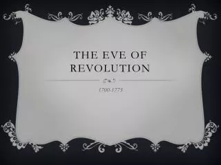
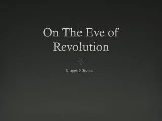
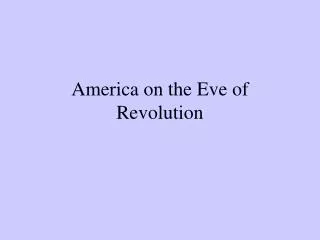
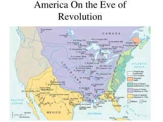
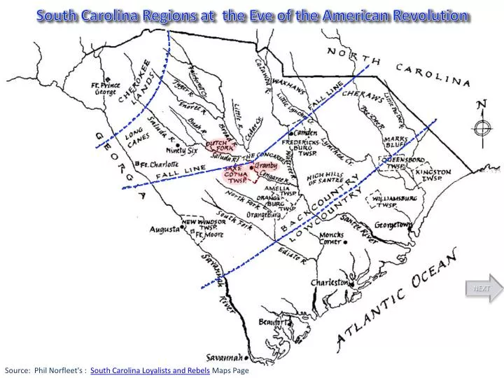
South Carolina Regions at the Eve of the American Revolution. NEXT. Source: Phil Norfleet's : South Carolina Loyalists and Rebels Maps Page. South Carolina County Boundaries 1682 - 1785. Craven 1682 Berkeley 1682 Colleton 1682 Granville 1710. BACK. NEXT.

E N D
South Carolina Regions at the Eve of the American Revolution NEXT Source: Phil Norfleet's : South Carolina Loyalists and Rebels Maps Page
South Carolina County Boundaries 1682 - 1785 Craven 1682 Berkeley 1682 Colleton 1682 Granville 1710 BACK NEXT Map Source: http://sc_tories.tripod.com/
James Cook Map of South Carolina 1773 BACK NEXT Map Source: David Rumsey Map Collection, Cartography Associates, http://www.davidrumsey.com
South Carolina Precincts & Townships 1779 BACK NEXT Map Source: http://www.usgwarchives.org/sc/maps/sc_1779.jpg
Samuel Lewis Map of South Carolina 1812 BACK NEXT Map Source: David Rumsey Map Collection, Cartography Associates, http://www.davidrumsey.com
Robert Mills Atlas of South Carolina 1825 BACK NEXT Map Source: David Rumsey Map Collection, Cartography Associates, http://www.davidrumsey.com
Robert Mills Atlas of South Carolina 1825 With Current Lexington County Boundary BACK NEXT
History of the Formation of Present Day Lexington County Chronology 1. Lexington, 12th March, 1785 Lexington created within Orangeburg District (overlapped part of Newberry, creating disputed jurisdiction with Newberry not settled until 29 January 1788). (S.C. Statutes, 4:661-666; S.C. Acts 1797, pp. 144-145) 2. Lexington, 29th February, 1788 Lexington gained undisputed jurisdiction of 12 March 1785 overlap with Newberry. (S.C. Statutes, 7:248) 3. Lexington, 19th February, 1791 Lexington effectively eliminated as county administrative unit by reform of judicial district system, but unlike the other counties eliminated by this change Lexington did not become entirely defunct. (S.C. Acts 1791, Jan. sess., pp. 20-21, 28-29) 4. Lexington, 17th December, 1803 Lexington (Saxe Gotha election district) lost to Orange Parish and lost territory in boundary adjustment with St. Matthew Parish, as a result of omnibus act to delineate boundaries of counties, election districts, and parishes. (S.C. Acts 1803, p. 38) 5. Lexington, 16th April, 1868 Lexington District eliminated when new state constitution abolished all judicial districts. Lexington County continued, with boundaries matching those of Lexington District on 20 December 1832. Lexington assumed all functions of local government from both judicial districts and parishes. (Swindler, 8:497) 6. Lexington, 10th March, 1871 Lexington lost to creation of Aiken. (S.C. Acts 1871, no. 420, sec. 1/p. 695) 7. Lexington, 19th February, 1901 Lexington lost to Newberry. (S.C. Acts 1901, no. 380, sec. 1/pp. 661-662) 8. Lexington, 14th February, 1908 Lexington lost to creation of Calhoun. (S.C. Acts 1908, no. 567, sec. 1/pp. 1279-1281) 9. Lexington, 9th February, 1912 Lexington lost to Richland. (S.C. Acts 1912, no. 457, sec. 1/pp. 821-823) 10. Lexington, 13th February, 1913 Lexington lost to Richland. (S.C. Acts 1913, no. 68, sec. 1/pp. 107-108) 11. Lexington, 29th March, 1920 Lexington lost to Newberry. (S.C. Acts 1920, no. 547, sec. 1/pp. 976-978) 12. Lexington, 11th March, 1922 Lexington lost to Richland. (S.C. Acts 1922, no. 551, sec. 1/pp. 977-978) 13. Lexington, 12th May, 1953 Lexington lost to Newberry. (S.C. Acts 1953, no. 323, sec. 1/pp. 416-417) 14. Lexington, 14th July, 1969 Boundary between Lexington and Richland redefined [no change]. (S.C. Acts 1969, no. 465, secs. 1-3/pp. 819-822) (4A-4E. Lexington District, 1804-1868, See next page for index details) NEXT BACK Source: Atlas of Historical County Boundaries The Newberry LibraryDr. William M. Scholl Center for American History and Culture Web Link: http://publications.newberry.org/ahcbp/project.html Map Eve of the Revolution Source: Phil Norfleet's: South Carolina Loyalists and Rebels Maps Page Source Precincts & Townships 1779 Map: http://www.usgwarchives.org/sc/maps/sc_1779.jpg
Lexington District 1804 - 1868 Chronology 4A. Lexington District, 21st December, 1804 Lexington District created from Orangeburg District (with altered 1803 LEXINGTON County boundaries). Between 1 January 1800 and 16 April 1868, judicial districts were the principal administrative subdivisions of the state, while counties survived mostly as geographical references. (S.C. Acts 1804, Nov. sess., p. 16) 4B. Lexington District, 19th December, 1805 Lexington District lost to Orange Parish, as a result of omnibus act to delineate boundaries of counties, election districts, and parishes. (S.C. Acts 1805, p. 94) 4-X. Lexington District, 19th December, 1807 (No Map) Lexington District gained from Non-District Area; Non-District Area eliminated. (S.C. Acts 1807, p. 56) 4C. Lexington District, 20th December, 1832 Lexington District gained from Orangeburg District. (S.C. Acts 1832, Nov. sess., ch. 15, sec. 1/p. 19) 4D. Lexington District/County, 16th April, 1868 Lexington District eliminated, became Lexington County when new state constitution abolished all judicial districts. LEXINGTON County assumed all functions of local government from both judicial districts and parishes. (Swindler, 8:497) Source: Atlas of Historical County Boundaries The Newberry Library Dr. William M. Scholl Center for American History and Culture BACK NEXT
Lexington 1785 - 1788 1. Lexington, 12th March, 1785 Lexington created within Orangeburg District (overlapped part of Newberry, creating disputed jurisdiction with Newberry not settled until 29 January 1788). (S.C. Statutes, 4:661-666; S.C. Acts 1797, pp. 144-145) BACK TO INDEX BACK NEXT
Lexington 1788 - 1803 (Saxe Gotha Election District) 2. Lexington, 29th February, 1788 Lexington gained undisputed jurisdiction of 12 March 1785 overlap with Newberry. (S.C. Statutes, 7:248) 3. Lexington, 19th February, 1791 Lexington effectively eliminated as county administrative unit by reform of judicial district system, but unlike the other counties eliminated by this change Lexington did not become entirely defunct. (S.C. Acts 1791, Jan. sess., pp. 20-21, 28-29) BACK TO INDEX BACK NEXT 4. Lexington, 17th Dec, 1803 Lexington (Saxe Gotha Election District) lost to Orange Parish and lost territory in boundary adjustment with St. Matthew Parish, as a result of omnibus act to delineate boundaries of counties, election districts, and parishes. (S.C. Acts 1803, p. 38)
Lexington 1803 - 1868 (Saxe Gotha Election District) 4. Lexington, 17th Dec, 1803 Lexington (Saxe Gotha Election District) lost to Orange Parish and lost territory in boundary adjustment with St. Matthew Parish, as a result of omnibus act to delineate boundaries of counties, election districts, and parishes. (S.C. Acts 1803, p. 38) Became Lexington District 21th December, 1804 BACK TO INDEX BACK NEXT 5. Lexington, 16th April, 1868 Lexington District eliminated when new state constitution abolished all judicial districts. April 16th, 1868 Became Lexington County
Lexington District 1804 - 1805 4A. Lexington District, 21st December, 1804 Lexington District created from Orangeburg District (with altered 1803 Lexington County boundaries). Between 1 January 1800 and 16 April 1868, judicial districts were the principal administrative subdivisions of the state, while counties survived mostly as geographical references. (S.C. Acts 1804, Nov. sess., p. 16) BACK TO INDEX BACK NEXT
Lexington District 1805 - 1807 4B. Lexington District, 19th December, 1805 Lexington District lost to Orange Parish, as a result of omnibus act to delineate boundaries of counties, election districts, and parishes. (S.C. Acts 1805, p. 94) BACK TO INDEX BACK NEXT
Lexington District 1807 - 1832 4C. Lexington District, 20th December, 1832 Lexington District gained from Orangeburg District. (S.C. Acts 1832, Nov. sess., ch. 15, sec. 1/p. 19) BACK TO INDEX BACK NEXT
Lexington District 1832 - 1868 16 april 1868 Became Lexington County 4D. Lexington District/County, 16th April, 1868 Lexington District eliminated, became Lexington County when new state constitution abolished all judicial districts. Lexington County assumed all functions of local government from both judicial districts and parishes. (Swindler, 8:497) BACK TO INDEX BACK NEXT
Lexington County 1868 - 1871 5. Lexington County, 16th April, 1868 Lexington District eliminated when new state constitution abolished all judicial districts. 6. Lexington County, 10th March, 1871 Lexington lost to creation of Aiken. (S.C. Acts 1871, no. 420, sec. 1/p. 695) BACK TO INDEX BACK NEXT
Lexington County 1871 - 1901 6. Lexington County, 10th March, 1871 Lexington lost to creation of Aiken. (S.C. Acts 1871, no. 420, sec. 1/p. 695) 7. Lexington County, 19th February, 1901 Lexington lost to Newberry. (S.C. Acts 1901, no. 380, sec. 1/pp. 661-662) BACK TO INDEX BACK NEXT
Lexington County 1901 - 1908 7. Lexington County, 19th February, 1901 Lexington lost to Newberry. (S.C. Acts 1901, no. 380, sec. 1/pp. 661-662) 8. Lexington County, 14th February, 1908 Lexington lost to creation of Calhoun. (S.C. Acts 1908, no. 567, sec. 1/pp. 1279-1281) BACK TO INDEX BACK NEXT
Lexington County 1908 - 1912 8. Lexington County, 14th February, 1908 Lexington lost to creation of Calhoun. (S.C. Acts 1908, no. 567, sec. 1/pp. 1279-1281) 9. Lexington County, 9th February, 1912 Lexington lost to Richland. (S.C. Acts 1912, no. 457, sec. 1/pp. 821-823) BACK TO INDEX BACK NEXT
Lexington County 1912 - 1913 9. Lexington County, 9th February, 1912 Lexington lost to Richland. (S.C. Acts 1912, no. 457, sec. 1/pp. 821-823) 10. Lexington County, 13th February, 1913 Lexington lost to Richland. (S.C. Acts 1913, no. 68, sec. 1/pp. 107-108) BACK TO INDEX BACK NEXT
Lexington County 1913 - 1920 10. Lexington County, 13th February, 1913 Lexington lost to Richland. (S.C. Acts 1913, no. 68, sec. 1/pp. 107-108) 11. Lexington County, 29th March, 1920 Lexington lost to Newberry. (S.C. Acts 1920, no. 547, sec. 1/pp. 976-978) BACK TO INDEX BACK NEXT
Lexington County 1920 - 1922 11. Lexington County, 29th March, 1920 Lexington lost to Newberry. (S.C. Acts 1920, no. 547, sec. 1/pp. 976-978) 12. Lexington County, 11th March, 1922 Lexington lost to Richland. (S.C. Acts 1922, no. 551, sec. 1/pp. 977-978) BACK TO INDEX BACK NEXT
Lexington County 1922 - 1953 12. Lexington County, 11th March, 1922 Lexington lost to Richland. (S.C. Acts 1922, no. 551, sec. 1/pp. 977-978) 13. Lexington County, 12th May, 1953 Lexington lost to Newberry. (S.C. Acts 1953, no. 323, sec. 1/pp. 416-417) BACK TO INDEX BACK NEXT
Lexington County 1953 - 2012 13. Lexington County, 12th May, 1953 Lexington lost to Newberry. (S.C. Acts 1953, no. 323, sec. 1/pp. 416-417) 14. Lexington County, 14th July, 1969 Boundary between Lexington and Richland redefined [no change]. (S.C. Acts 1969, no. 465, secs. 1-3/pp. 819-822) BACK TO INDEX BACK NEXT Lexington County 2012
Lexington County 2012 BACK TO INDEX BACK START OVER
Historic Map Resources • http://archives.sc.gov/sccountymaps/Pages/default.aspx • http://publications.newberry.org/ahcbp/statepages/South_Carolina.html • http://publications.newberry.org/ahcbp/downloadfiles.html • http://randymajors.com/p/maps.html • http://www.davidrumsey.com • http://www.sciway.net/hist/maps/