Download
1 / 31
310 likes | 518 Views
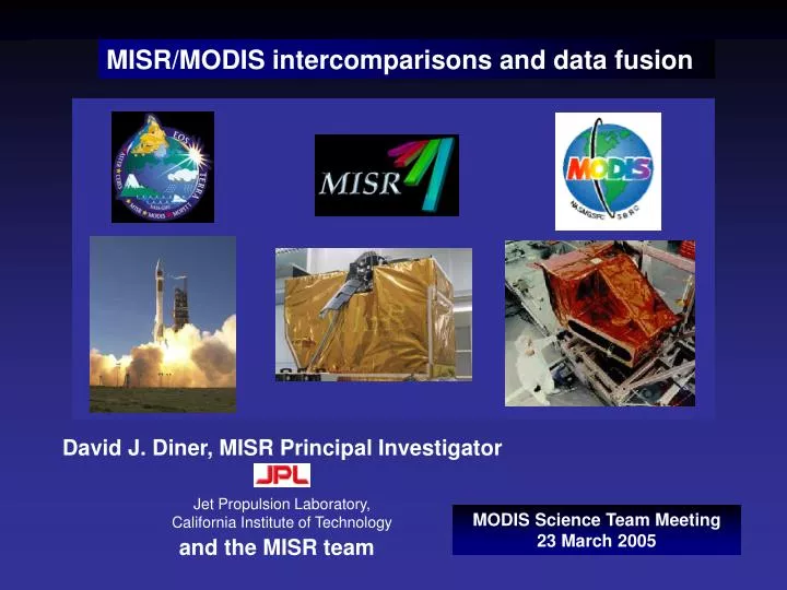
David J. Diner, MISR Principal Investigator. Jet Propulsion Laboratory, California Institute of Technology. and the MISR team. MISR/MODIS intercomparisons and data fusion. MODIS Science Team Meeting 23 March 2005. MISR characteristics. 9 view angles at Earth surface:

E N D
David J. Diner, MISR Principal Investigator Jet Propulsion Laboratory, California Institute of Technology and the MISR team MISR/MODIS intercomparisons and data fusion MODIS Science Team Meeting 23 March 2005
MISR characteristics 9 view angles at Earth surface: 70.5º forward to 70.5º aftward Four spectral bands at each angle: 446 nm ± 21 nm 558 nm ± 15 nm 672 nm ± 11 nm 866nm ± 20 nm 275 m sampling in all nadir bands and red band of off-nadir cameras 1.1 km for the other channels 400-km swath: Complete zonal coverage 9 days at equator 2 days at poles 7 minutes to observe each scene at all 9 angles Digitization: 14 bits Standard products are processed and archived at the NASA Langley Atmospheric Sciences Data Center eosweb.larc.nasa.gov
MISR On-Board Calibrator Railroad Valley Lunar Lake Vicarious calibrations and validations over desert playas and dark water sites MISR lunar images AirMISR MISR calibration A comprehensive review of these data sources in 2003-2004 led to downward revision of the MISR radiances by 3% in the red and 2% in the NIR
MISR ocean aerosol optical depths prior to 2004 calibration revision MODIS AOD MODIS AOD MISR-AERONET difference was ~0.05 at 558 nm Similar differences were seen with airborne sunphotometer (AATS-14) data and with MODIS MISR AOD R. Kahn, W-H. Li, W. Abdou, L. Remer
AOD, new - old dust models AOD, new - old calibration AOD, old calibration AOD, old dust models Effect of recent product revisions on retrieved MISR AOD over water Calibration revisions New dust models Medium-sized weakly-absorbing (1% hematite) grain-shaped dust models provide the best fit to MISR radiances over dust plumes Initial MISR-AERONET-AATS 14 comparisons suggest that the MISR ocean AOD bias has been eliminated R. Kahn, O. Kalashnikova, D. Diner
center of field of view edge of field of view Comparison of revised radiometric scale with 5 years of MISR vicarious calibration history C. Bruegge, W. Abdou
MISR revised calibration compared to MODIS and other sensors C. Bruegge, W. Abdou
MISR/MODIS radiance intercomparison in the Arctic Arctic Ocean/Greenland/Baffin Bay/Baffin Island Terra path 26—15 orbits from 2002 MODIS image Red band E. Clothiaux
Terminator: long solar slant path 3% difference - Dark, open water - - Details of MISR/MODIS radiance intercomparison MISR: 672 nm MODIS: 645 nm Not adjusted for spectral shift, ozone MISR-MODIS difference (%) as function of radiance MISR-MODIS difference (%) as function of location E. Clothiaux
MISR/MODIS standard product complementarity: MISR retrievals over bright surfaces R. Kahn, J. Martonchik, W. Abdou, B. Gaitley, D. Diner
Phase function Scattering angle (deg) Synergistic sensitivities to aerosol particle properties MODIS: broad spectral coverage enhances sensitivity to size, particularly coarse mode MISR: multiangle data provides sensitivity to shape O. Kalashnikova, R. Kahn, D. Diner
MISR/MODIS cirrus case study at ARM Oklahoma site MISR nadir view image Ice scattering properties from Yang et al. (2000) Ice scattering properties from Yang et al. (2000) Millimeter wave radar reflectivity MISR is sensitive to particle shape MODIS is sensitive to particle size S. McFarlane, R. Marchand, T. Ackerman
Morphological diversity of marine stratocumulus clouds R. Davies
Multiangle tests of cloud homogeneity 1-D theory fits MISR observations 1-D theory does not fit MISR observations Multiangle data provides a physical consistency check on MODIS 1-D cloud retrieval assumption Cloud morphology, along with cloud microphysics, plays a major role in determining TOA bidirectional reflectance A. Horvath, R. Davies
MODIS LWP (g/m2) boundary layer clouds TMI LWP (g/m2) Application to retrievals of cloud liquid water: MODIS/MISR/TMI fusion Reasonable consistency (±25%) is obtained between MODIS and TRMM Microwave Imager (TMI) LWP for shallow, boundary layer clouds. MISR is used as a check on the applicability of 1-D retrieval theory. MODIS/TMI consistency is much poorer for deep clouds. Oblique views make it possible to scan down the sides of deep clouds: MISR 60º image of deep cloud A. Horvath, R. Davies
0 2.5 5 km MISR stereo retrievals of cloud top heights (CTH) Trade wind cumuli: high sensitivity MISR cloud heights --independent of radiometric calibration, atmospheric temperature profiles, cloud emissivity Typhoon Sinlaku
Clear-sky or opaque cloud top Broken boundary layer clouds Semi-opaque cirrus Thin cloud over other clouds (MISR determines the height of the lower cloud tops) Thin cloud over surface Comparison of MISR stereo heights with radar/lidar ARM SGP ARM Nauru ARM Barrow Radar/lidar maximum height MISR stereo height MISR stereo height MISR stereo height R. Marchand, T. Ackerman
MISR/MODIS CTH comparisons ARM SGP Chilbolton MISR and MODIS in good agreement for single-level mid-high clouds (accuracy ~500 m) MISR performs well for low clouds, MODIS 11 m brightness temperatures problematic Multi-layer situations problematic for MISR operational (near-nadir) stereo, altitude detected depends on high cloud optical depth Typically MODIS CTH > MISR CTH (difference ~600 m) C. Naud, J-P. Muller, E. Clothiaux
Stereo Arctic, near Queen Elizabeth Islands, 28 August 2000 Angular reflectance signature Antarctica, 2 April 2001 Bidirectional reflectance factor Stereoscopically-derived cloud-top height Band-differenced angular signature Red band bidirectional reflectance factor Discriminating polar clouds from snow and ice with MISR L. Di Girolamo, M. Wilson, C.Moroney
Strength of MISR/MODIS fusion for polar clouds Overall classification accuracies relative to “expert” labels MODIS: 86% [detects the highest cloud, whether optically thick or thin] MISR stereo only: 75% [locates the first (from space) optically thick surface; thin clouds problematic for near-nadir stereo] MISR stereo + angular signatures: 92% MISR + MODIS: 95-97% Terra CERES-MISR-MODIS fusion Capitalizes on excellent separation of clouds from ice for understanding polar radiation budget CALIPSO and CloudSat synergy can be used to quantify cloud optical depths giving rise to MODIS high cloud/MISR low cloud detections Arctic Ocean/Greenland/Baffin Bay/Baffin Island Terra path 26—15 orbits from daylight season of 2002 T. Shi, B. Yu, A. Braverman, D. Groff, E. Clothiaux
TOMS Aerosol Index (AI) Direct height retrieval of UT/LS smoke from the Chisholm fire, 29 May 2001 MODIS MISR near-nadir stereo oblique stereo M. Fromm, D. Diner, C. Moroney, C. Averill
MODIS fire/MISR stereo fusion for wildfire studies MODIS: Thermal channels pinpoints fire locations MISR: Oblique views enhance plume sensitivity Stereo retrieves plume heights Provides smoke injection data for CTMs Southern California, 26 October 2003
Example of MISR surface directional reflectance retrieval J. Martonchik
MISR/MODIS land surface product intercomparisons Land surface albedo (B. Pinty, S. Liang, H. Fang) LAI/FPAR over sparsely vegetated land (shrubs account for 25% of global vegetation) (R. Myneni, Y. Knyazikhin, J. Hu)
MISR/MODIS synergy/fusion over land surfaces Bell-shaped BRF: Tree crowns of medium-high density against bright background Bowl-shaped BRF: Sparse vegetation and dense, closed canopies Map: Australian Surveying and Land Information Group B. Pinty, N. Gobron, J-L. Widlowski, M. Verstraete MISR along-track multiangle data provide independent structural information MISR/MODIS fusion studies: B. Braswell et al.: Amazon deforestation and regrowth M. Chopping et al.: Woody biomass incursion into arid grasslands
Conclusions Simultaneous broad spectral coverage from MODIS and wide angular coverage from MISR makes a uniquely valuable combination: Having independent retrievals of related parameters from each sensor using different methodologies is a key element of a robust observing system. Data fusion capitalizes on complementary sensitivities to aerosol, cloud, and surface properties. MISR/MODIS data fusion is currently being done in research mode Products using joint retrievals can be considered— Aerosols Polar clouds Fires Land surface Some of these were described in the Terra extension proposal (Senior Review). Joint data analysis tool development would also be a great benefit to the scientific community.