Download
1 / 67
670 likes | 802 Views
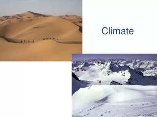
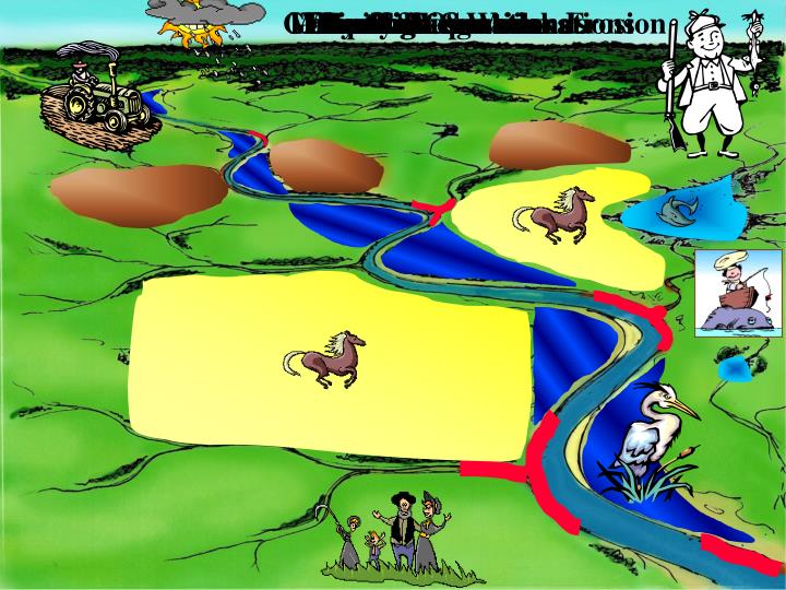
Gully & Streambank Erosion. Watershed Considerations. Lakes & Reservoirs. Farming Operations. Family Recreation. Climate. Livestock. Hunting. Riparian &Wetlands. Fishing. Where do the Pollutants Come From ?. Pollutant Loading Assessment Point for TMDL’s.

E N D
Gully & Streambank Erosion Watershed Considerations Lakes & Reservoirs Farming Operations Family Recreation Climate Livestock Hunting Riparian &Wetlands Fishing
Where do the Pollutants Come From ? Pollutant Loading Assessment Point for TMDL’s
AGNPS 2001 Watershed Evaluation Tool Lake Models LAKES AnnAGNPS (RUSLE) FIELDS RIPARIAN ZONES REMM CHANNEL EVOLUTION CCHE1D & CONCEPTS SIDO, SNTEMP, etc. STREAM HABITAT GEM WEATHER
AGNPS 2001 A partnering effort between the: Agricultural Research Service and Natural Resource Conservation Service
AGNPS 2001 • Input/OutputGIS support, TOPAZ, Visual Basic Editor. • Climate synthetic weather generator (GEM) • AnnAGNPSpollutant loadings (sediment & chemicals). • CONCEPTSinstream hydrodynamic processes. • SNTEMPstream network water temperature. • SIDOsediment intrusion & dissolved oxygen for redds. • Fry Emergencemortality of salmonid fry. • Salmonid Total Life Stagesspawning-to-return spawners. • Salmonid Economicsnet economic value of salmonids in Pacific Northwest.
AnnAGNPS • Annualized Agricultural Non-Point Source Pollution computer model. • Continuous simulation, surface runoff pollutant loading (PL) computer model. • Replacement for single-event AGNPS 5.0. • Written in standard ANSI Fortran 95no memory limits.
AGNPSAnnAGNPS • Convert from AGNPS 5.0 • Single-event • Sediment - USLE • Limited input • No daily climate file • Initial or converted • Continuous-simulation • Sediment - RUSLE • Full input capability • Daily climate file required AnnAGNPS: operational modes
AnnAGNPS: Uses NRCS Standards Processes Databases • Soils - NASIS • Crops and Operations – Set by NRCS State Agronomists • HUWQ Databases – Fertilizer, Pesticides, Animal Wastes, etc. • Weather Generation - GEM • Runoff – SCS Curve Number • Peak Runoff – TR-55 • Erosion - RUSLE • Sediment Delivery - HUSLE
AnnAGNPS: the pollutant loading model Loadings by kind of pollutant : • Waterrainfall, snowmelt, irrigation, & point sources. • Sediment by particle size-class: • clay; • silt; • sand; • small aggregate; and • large aggregate. • Chemicals (adsorbates & solutes): • nutrientsnitrogen, phosphorous, & organic carbon; and • pesticidesany number, any kind.
AnnAGNPS: the pollutant loading model Loadings by source of pollutant: • Cells (land areas)water, sediment, & chemicals. • Feedlotssoluble nutrients. • Gulliessediment and chemicals. • Point Sourceswater and chemicals. • Reachessediment yield & chemical transport. • Impoundmentssediment deposition.
cell A Cell C cell B cell D cell F cell E AnnAGNPS: major processes gully reach 1 reach 3 reach 2 feedlot impoundment reach 4 point source watershed outlet
cell A cell C cell B cell D cell F cell E AnnAGNPS: source accounting 10% of outlet sediment from gully 80% of outlet pest X from cell C gully reach 1 feedlot Reach 3 reach 2 25% of outlet nitrogen from feedlot impoundment reach 4 point source watershed outlet
FOCUS ON STREAM REACHES SUBWATERSHEDS CONNECTED BY THE CHANNEL NETWORK AGNPS 2001 WATERSHED DESCRIPTION
Tucannon River cropland after thunderstorm showing severe erosion
AnnAGNPS: cell processes • Weathervaries air temperatures, & relative humidity; allows for variable rainfall between cells. • Precipitationrainfall, snowmelt, & irrigation runoff. • Soil moistureprecipitation, infiltration, percolation, & evapotranspiration. • Management operationscrops, rotation, fertilizer, etc. • Irrigationdetermines amount if automatic. • Winter routinessnowpack, melt, & frozen ground. • Curve numberantecedent moisture condition (current soil moisture). • Sediment yieldRUSLE or USLE.
AnnAGNPS: cell processes (continued) • Pesticidesapplication & decay; adsorbates & solutes. • Nutrients application & decay; adsorbates & solutes. • Adds cell data to reach routing processesif runoff event occurs. • Adds cell data to simulation totalsif source accounting requested. • Writes to a detailed stream network fileif this output is requested.
AnnAGNPS:cell processes (continued) • Cells: • Foliagerelative growth, nutrients, & pesticides; • Soil surfaceresidue, nutrients, & pesticides; • Soil profilemoisture, frozen layers, residue, nutrients, & pesticides; and • Operationsnext operation & rotation year. • Feedlots: • Manure pack nutrientssoluble only; • Date of new operationcalendar date; • Amount left over from previous operationnon-dimensional ratio; • Initial manure amountmass; and • Daily change in manure production ratemass per unit time.
AnnAGNPS: reach processes • Waterrainfall, snowmelt, irrigation, & point sources. • Sediment Yieldby particle size-class & source. • Chemicalsnutrients, pesticides, & organic carbon. • Impoundmentssediment deposition.
USDA-ARS-NSL - CONCEPTS CONSERVATIONAL CHANNEL EROSION POLLUTANT TRANSPORT SYSTEM
USDA-ARS-NSL - CONCEPTS Integrates the impact on instream water quality from upland and channel processes to provide a comprehensive stream corridor evaluation tool.
USDA-ARS-NSL - CONCEPTS Impact of Channel Incision • A common and destructive mode of channel erosion • Bed lowering causes banks to become unstable and widening proceeds at a very rapid pace • Destabilizes the landscape and leads to severe downstream impacts
USDA-ARS-NSL - CONCEPTS Characterization of Streambank Erosion • Bank-toe erosion • Integration of hydraulic, sedimentologic, and geo-technical processes influencing bank failure • Frequency of bank failure • Incipient motion criteria for removal of failed material
USDA-ARS-NSL - CONCEPTSEffect of riparian vegetation on river restoration • Flexible vegetation exert major influences on flow resistance • Areas of enhanced deposition and erosion affect channel geometry • Plant roots affect stream bank stability • Woody debris influence flow channel hydraulics and morphology
Upper middle Tucannon River: showing loss of riparian vegetation
Lower end Tucannon River: showing lack of riparian vegetation & stream instability
Riparian Buffer System Stream Erosion and drainage Field Integration of Riparian Zones Within AGNPS 2001
REMM: components vegetative growth hydrology nutrient dynamics sediment Integration of Riparian Zones Within AGNPS 2001
REMM: spatial scale PHYSICAL CHARACTERIZATION 3 zones 3 soil layers litter layer Zone 3 Zone 2 Zone 1 Integration of Riparian Zones Within AGNPS 2001
AGNPS 2001 Web Site • What is available at the web site • web site instructions; • model(s) overviews • technical feature abstracts; • reference input databases • documentation; • executable files; • sample data sets; • profiles of management personnel, sponsors, technical team, & cooperating users; • direct link to technical support; and • AGNPS version 5.0 (single-event) archives.
AGNPS 2001 Web Site (continued) • Distribution via web site • go to: “http://www.sedlab.olemiss.edu”; and • thenclick on: “AGNPS 2001 Project”; or • go directly to: “http://www.sedlab.olemiss.edu/AGNPS.html”
AGNPS 2001 Registered Users • Federal Government • ARSEPANIHNRCS • USCOEWORLDBANK • USGS • All 50 States • Universities • ClemsonColorado StateIowa StateKansas StateMichigan StateOregon StatePenn StateVirginia State Univ. of FloridaUniv. of GeorgiaUniv. of KansasUniv. of MassachusettsUniv. of MississippiUniv. of MontanaUniv. of NebraskaUniv. of New MexicoUniv. of North DakotaUniv. of North TexasUniv. of TexasUniv. of Wisconsin
AGNPS 2001 Registered Users (cont.) • Foreign Countries (over 40) • ArgentinaAustraliaAustriaBelizeBoliviaBrazilCanadaChileChinaColumbia • Czechoslovakia • Ecuador • EgyptFinland • FranceGermanyHungary • IndonesiaItalyJapanJordan • KoreaLithuaniaMalaysia • Mexico • New Zealand Netherlands Philippines Poland • Singapore Slovia South Korea • Spain • Sweden SwitzerlandSyriaTaiwan TanzaniaThailand TurkeyVenezuela Vietnam
AGNPS 2001Interface Components • Tools to automatically determine model parameters. What the User sees. • Tools to modify and add parameters. • Tools to visualize the watershed.
Sorted Source & Event Tables AnnAGNPS Input File Names(optional) AGNPS 5.0 to AnnAGNPS Converter AGNPS5.0 Input Data New AverageAnnual & Event Tables Output Processor DEM’s FlownetGenerator AnnAGNPSInput (watershed data) AnnAGNPS OldReachEvent & Source Accounting output Partial AnnAGNPS Input Stream Corridor CONCEPTS Stream Network CCHE1D InputEditor Daily Climate Data Standard Resource Databases StreamNetwork Event Channel Evolution & Transport GEM Climate Data AGNPS 2001
Key Parameters: Coordinates of Watershed Outlet, Size of DEM Outlet Location Area shown 4 x 6 miles
47 SUBWATERSHEDS 227 SUBWATERSHEDS 470 SUBWATERSHEDS STREAM NETWORK & ASSOCIATED SUBWATERSHEDS
GENERATED STREAM NETWORK ASSOCIATED WITH 168 SUBWATERSHEDS DIGITIZED vs. GENERATED STREAM NETWORK GENERATED STREAM NETWORK ASSOCIATED WITH 47 SUBWATERSHEDS DIGITIZED STREAM NETWORK ASSOCIATED WITH BLUE LINES ON 7.5 MINUTE USGS QUADS
1987 ACCUMULATED RUNOFF by CELL GOODWIN CREEK 0 22.48 in
1987 ACCUMULATED SEDIMENT by CELL GOODWIN CREEK 19.94 t/ac
5 3 2 1 8 1991 ACCUMULATED SEDIMENT by CELL GOODWIN CREEK 147.91 t/ac