Download
1 / 58
600 likes | 741 Views
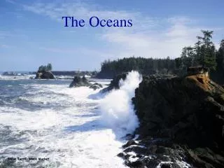
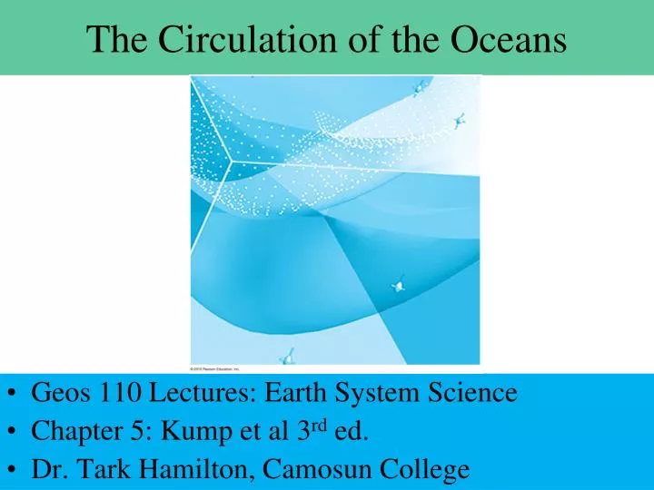
The Circulation of the Oceans. Geos 110 Lectures: Earth System Science Chapter 5: Kump et al 3 rd ed. Dr. Tark Hamilton, Camosun College. Ocean Water is a Special Fluid. Dense & Viscous but variable due to salinity & temperature Density also varies with suspended sediment load

E N D
The Circulation of the Oceans • Geos 110 Lectures: Earth System Science • Chapter 5: Kump et al 3rd ed. • Dr. Tark Hamilton, Camosun College
Ocean Water is a Special Fluid • Dense & Viscous but variable due to salinity & temperature • Density also varies with suspended sediment load • High thermal mass & High heat capacity • While the Ocean is the “burner” under the Troposphere, it is mainly heated from above • 90% of Sunlight/heat is absorbed in the top 100 m • Large insolation changes achieve minor T°C change • The sea is thermally and density stratified, convecting as a 2 layer system • This is very slow at depth ~ several thousand years • Biology matters, especially for ocean chemistry
Winds & Surface Currents: Sea in a Box Continent • Winds have mass, momentum and vector directions • Wind Drift Currents: Friction at the sea surface & excites wave motion & lateral flow causing convection & advection in the sea Easterly Equatorial Trades cause westwards flow in Tropics Continents deflect flow to North and South in Gyres aided by Westerlies at mid latitudes Continent
Winds and Surface Currents: Sea in a Box Warm Iceland/Scotland Cold Labrador Kuroshio Current Gulf Stream Continent Continent Wind Drift Currents confined to upper 50-100m Except big turbulent gyres: Gulf stream, Kuroshio current 1-2 km deep and 100’s of km wide Coriolis force plays a role: Clockwise N, Anti-Clock S
Major Ocean Surface Currents • Westwards Equatorial flow and gyres as predicted • Reality is similar but more complex: warm & cold • Esp. Polar Regions, Northern Indian Ocean, Straits
Current Convergence & Divergence • Water does not generally pile up along the East coast of land in tropics • Mid ocean pile up: wind driven currents, rotation & friction all contribute • Nansen 1890’s noted drift at 20-40° to the right of the wind! • Ekman Spiral: viscous shear, thermal dissipation & coriolis, greater angular deflection with depth but less speed, currents at 100 m depth can reverse! • Eckman Transport: net advection at 90° down wind
The Ekman Transport & Spiral • Wind Friction Currents & Earth’s rotation • The shallow flow drags & shears the water just below it • Heat losses make each deeper layer flow slower • Each layer still feels Coriolis Force
The Ekman Transport & Spiral In Southern Hemisphere, this reverses as Coriolis force and gyres are Widdershins! • W/strong wind, surface current is <45° to wind • Flow slows & reverses by ~100 m depth • Net transport is 90° to wind, into gyre!
Divergence & Convergence • In Equatorial North Atlantic, NE Trades & Ekman Transport to right of wind deflects water North! • This Produces the North Equatorial Current • Conversely, SE Trades in Equatorial South Atlantic & Ekman Transport to left deflects water South! • This Produces the South Equatorial Current • W Mexico & W Africa have significant divergence • Also diverge off W Ecuador & W South Africa
Major Ocean Surface Currents: Divergence D • Westwards Equatorial flow and gyres as predicted • Reality is similar but more complex: warm & cold D D D D D
Upwelling & Downwelling • Where Divergence occurs, the sea thins and sea level drops ~2 m below the GEOID (geopotential surface) • This causes upwelling of cold, micro-nutrient rich deep water: marine biology usually thrives here • Where Convergence occurs, the sea thickens and piles up ~2 m above the GEOID • This causes downwelling of warm, acidic, dust and carbon rich plankton bearing surface waters creating deep sea drifts (linear sediment deposits)
Major Ocean Surface Currents: Convergence C • Westwards Equatorial flow and gyres as predicted • Reality is similar but more complex: warm & cold C C C C C
Divergence & ConvergenceUpwelling & Downwelling
Sea Surface Relief & Geostrophic Flow • Gradients are a few m over 100 to 10,000 km! • Slopes of 1 in 105 - 108 create outwards Pressure▼ • This results in circular geostrophic current ↑‘gyre,↓
Sea Surface Relief & Geostrophic Flow • Northern Hemisphere wind stress currents set up the sub-tropical gyres & geostrophic currents
Sea Surface Relief & Geostrophic Flow • Pressure gradient force opposes Coriolis force for net outwards deflection
Sea Surface Relief & Geostrophic Flow • Pressure gradient force opposes Coriolis force for net outwards deflection tangential & clockwise around the gyre in the Northern Hemisphere
Major Ocean Boundary Current Gyres • Westwards Equatorial flow & Subtropical gyres • Clockwise Northern & Anti-clockwise Southern G G G G G G G
Boundary Currents are Asymmetric - The Gulf Stream is a Fast Western Boundary Current >20°C, 50-70 km wide & 3-10 km/hr Up to 1 km deep G G <10°C, 1000 km wide & <4 km/hr < 500m deep Canary Current G G
Vorticity: The Tendency for Fluid to Rotateunder the influence of Body Forces Planetary vorticity increases towards the poles due to rotation = Coriolis Force Relative vorticity Cyclonic Low P wind shear + AntiCyclonic Hi P -negative Ocean current shear in gradients parallel to coasts • Positive vorticity Counterclockwise (from above) • Negative vorticity Clockwise
Current Shear Producing + or - Vortex • + Positive Vorticity when current increased to Right • - Negative Vorticity when current increases to Left • Whirlpools & Rip Tides tend to take you offshore!
So why are Eastern Boundary Currents Weaker than Western Ones? Speeding • The divergence to the east & Slowing Westerlies • Equator bound Canary Current Slowing
Ocean Circulation & Sea Surface T°C W C C • The Labrador Current - Cold outflow from Arctic • North Atlantic Drift – Warms Iceland & Norway
Ocean Circulation & Sea Surface T°C W • The Cold Humbolt Current – makes the Namib Erg • The Cold Benguela Current – makes the Atacama Humbolt current C Benguela current C
Ocean Circulation & Sea Surface T°C • E-W Circulation in Equatorial Troposphere • Where does Rainfall happen the most? • With respect to the atmospheric circulation? • With respect to sea versus land?
Ocean Surface Layer – Tropical PacificLa Niña every 2-10 years (enhanced normal) • Strong Easterlies make for upwelling in E Pacific • Colder December-February off Ecuador & Peru
ENSO – El Niño Southern OscillationPattern of Easterlies Breaks Down • Reverse of Trades: no upwelling in E Pacific • Warmer December-February off Ecuador & Peru • Rains, high tides, coastal flooding
Which Comes 1st the Chick or the Egg • Positive feedback loop: Easterlies make warm west • Warm west Pacific makes strong Easterlies!
El Niño versus La Niña • Correlated Circulation Events (1997-1998 ENSO) • Sea Surface Temperature Maps (& 1989 La Niña)
ENSO - Atmospheric Circulation • Shift of Warm water to Central Pacific • Loss of Upwelling & micronutrients in E. Pacific • Leads to massive die back of marine life & seabirds • Droughts/Famines in Africa, Australia & Indonesia
Ocean Circulation & Sea Surface T°C Normal E-W Circulation in Equatorial Troposphere Rains in South American jungle not Andes Rains in central Africa Rains in northern Australia
SOI Index – Sea Level Pressures • Negative SOI at Tahiti vs Darwin in warm ENSO • Note extreme ENSO in 1982-83 & 1997-98
Consequences of 82-3, 97-8 ENSO Events • Ecuador & Peru: floods, landslides, 600 dead • crop & property losses > $400M • Guayaquil X 20 normal rainfall • Major erosion, soil loss & sediment transport • Indonesia crop failure & famine • E. Australia worst drought of 100 years • Livestock slaughter • 11,000 tons of dust on Melbourne & worst bushfires • Tahiti got 100 year Typhoon & 6 others in 5 months • Flooding of Mississippi & California landslides
ENSO Anomalies in Rainfall & T°C • Consistent Pattern in Tropics but variable intensity • Highly Variable Mid Latitude Effects Wet 82Dry76
Salinity =g solute per Kg solventi.e. per milSeas 35, 1.035 • Anions: Cl- > SO4-2 > HCO3- > Br- > Boric>F- • Cations: Na+ > Mg+2 > Ca+2 > K+ > Sr+2
The Salt in the Seas • Total salt content is 5 x 10¹⁹ kg • John Joly assumed this accululated since Earth formed and got 80-89 Ma • Salts are removed by submarine weathering, biosedimentation, subduction, uplift and evaporation • The modern flux is 4 x 10¹² kg/day • Our estimate would be: 5 x 10¹⁹ kg / 4 x 10¹² kg/day or 13 x 106 yr This is not “The Age of the Earth” but the residence time for salts in the ocean! ~ 1/400 of Earth’s age!
Thermohaline Structure & CirculationThermal, Salinity & Density Structure Shallow water: warmer, fresher & lighter Deep water is pretty uniformly dense & stable Deep density currents are slow Vertical convection is limited, 2 layer convection
Water is Special & so is Seawater • As per graphs: • density & salinity decrease as T°C increases • Pure H2O max density at 4°C • Above 4° increase in T°C means decrease in density • But density also decreases below 4°C down to 0°C • For saline H2O max density at 2°C for 10 per mil • & at the Freezing point for 24.6 per mil • The freezing point drops as salinity increases, but density decreases somewhat, still defining freezing
Thermohaline Structure & CirculationThermal, Salinity & Density Structure Surface zone/Mixed Layer = low density in upper 60-100 m Maximum interaction with atmosphere: energy, kinetics, friction, evaporation, concentration, dilution Thermal: absorption of solar radiation, emission of long wave IR
Thermohaline Structure & CirculationThermal, Salinity & Density Structure Rapid increase in density with depth ~1 km = pycnocline Transition zone is Pycnocline Zone Where density increase is driven by salinity increase, this is Halocline Most regions the density increase is driven by the temperature decrease thus the Thermocline Either structure stops mixing and is stable despite seasons
Thermohaline Structure & CirculationThermal, Salinity & Density Structure Deep Ocean has only slight increase in salinity with depth while temperature continues to decrease slightly for a net constant salinity Bottom water is the densest & slight lateral salinity gradients drive deep circulation across isopycnals like isobars hi to low in atmosphere Where dense cold or salty water is produced, the deep ocean is fed Polar ice margins -1.9°C dense water + salts excluded by freezing
Thermohaline Structure & Circulation The thermocline is evident in the tropics At high latitude, deep water extends to the surface
Thermohaline Structure & Circulation • The thermocline is evident in the tropics • At high latitude, deep water extends to the surface
Thermohaline Structure & Circulation • Salinity structure is more complex than thermal • Salinity maxima at surface in tropics (Why?) & deep
Thermohaline Structure & Circulation • Salinity structure is more complex than thermal • Salinity maxima at surface in tropics (Why?) & deep • Which ocean has greater salinity layering?
Circumpolar Flow & Weddell Sea • Wintertime Ice Factory – Antarctic Outflow Winds • Ice forms at Shore and disperses to north • Thick ice shelf at Weddell Sea from W. Ant. Cap. • Antarctic Bottom Water forms here & sinks
4000 M Ocean Depth/Configuration • NADW forms off Greenland, higher salinities W AT • AABW forms off Weddell Sea • These dominate flow at 4 km depth
Δ14C Values: Low = young Hi = old The difference value is referenced to modern day ocean surface waters. Off of BC, the reservoir age for modern sea water is 400 years Not just atmospheric CO2 • -40 permil off Greenland NADW young • -140 permil off Weddell Sea Antarctica AABW • -220 permil off Bering Sea – N. Pacific = OLD
Radioactive Decay – 14 C Biota take up Carbon including small amounts of radiocarbon as they live and grow. They stay in equilibrium with their surface reservoir. After they die they become decay clocks • 14N 14C in upper atmosphere by cosmic rays Oxidation to CO2 deposits this in lower atmosphere • 14C 14N by βemission at T1/2 = 5730 years