Download
1 / 28
280 likes | 376 Views
Water vapor partial columns retrieval from Zugspitze plus Garmisch FTIR measurements. Outline Results from AIRS validation campaign 2002 Combination of Zugspitze (mountain) and Garmisch (ground site) FTIR Water vapor columns variability and profile covariance above Zugspitze/Garmisch

E N D
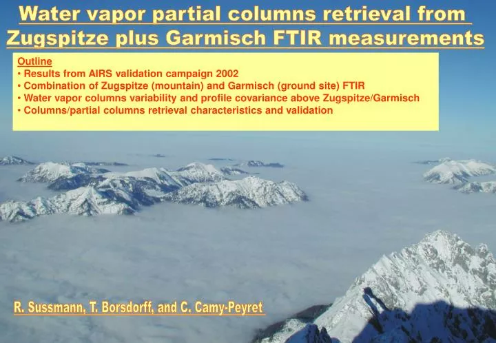
Water vapor partial columns retrieval from Zugspitze plus Garmisch FTIR measurements • Outline • Results from AIRS validation campaign 2002 • Combination of Zugspitze (mountain) and Garmisch (ground site) FTIR • Water vapor columns variability and profile covariance above Zugspitze/Garmisch • Columns/partial columns retrieval characteristics and validation R. Sussmann, T. Borsdorff, and C. Camy-Peyret
Triple NDACC Primary Station: FTIR, Aerosol, UV. Permanent Ground-Truthing Facility Zugspitze/Garmisch according to the WMO requirements. Trace gases IMK-IFU Working Group „Variability and Trends“ Scientists R. Sussmann W. Junkermann H.E. Scheel T. Trickl H. Vogelmann P. Werle Engineers H. Giehl M. Rettinger A. Rockmann PhD students W. Stremme T. Borsdorff FTIR FTIR Aerosols GPS In situ UV IFU Zugspitze, 2964 m MAPS, CRISTA, MOPITT, SAGE, GOME, AIRS, SCIAMACHY, ACE, IASI, CALIPSO, OCO, TCCON, GOSAT, … LIDAR IFU IFU Radio sondes Radiation FTIR LIDAR In situ GPS UV IFU Garmisch, 734 m
Zugspitze/Garmisch instrumentation for water vapor columns/profiles FTIR FTIR GPS In situ IFU Zugspitze, 2964 m LIDAR IFU IFU Radio sondes FTIR In situ GPS IFU Garmisch, 734 m
2002 AIRS validation campaign at Zugspitze/Garmisch: Schedule • Campaign duration: • 3 Months (19 Aug 2002 - 17 Nov 2002) • Validation measurements: • 7 days a week, • 2-hours-period around each overpass delivered, • for 2 EOS-Aqua overpasses per day • Zugspitze FTIR: clear sky operation, typically, 20-min-integration intervals • Radio Sondes (Garmisch): 4 sondes a day (two per overpass) • GPS Garmisch+ Zugspitze, permanent operation, half hourly mean values • In-Situ Met Data (Garmisch + Zugspitze): 1-min-values • Cloud/weather information (Zugspitze: hourly; Garmisch: 1 fish eye image • per overpass) Data delivery: within 12 h for both day- and night-overpasses
2002 AIRS validation campaign at Zugspitze/Garmisch: Radio Sounding Sonde 1 launched 1h before overpass Sonde 2 launched 5 min before overpass Vaisala RS 80-30 G sondes TOTEX-800-g balloons 2 x Digicora III (Marvin 21, SPS220G) TOBIN-Inter-/Extrapolation between both soundings: qTobin(z, top) = qsonde(z, t0) + (dq(z)/dt) (top – t0) Tobin, D., W. Feltz, B. Knuteson, H. Revercomb, “ARM T/q Best Estimate Profiles for AIRS validation”, 1 March 2000
2002 AIRS validation campaign at Zugspitze/Garmisch: Radio Sounding delivered within 12 hours
2002 AIRS validation campaign at Zugspitze/Garmisch: Radio Sounding delivered within 12 hours
Water vapor columns: Zugspitze+Garmisch GPS Garmisch GPS Zugspitze GPS GPS (1.6 / 1.2 GHz) Receivers Collaboration with Geoforschungszentrum Potsdam (Ch. Reigber) GPS Zugspitze, 2964 m IFU GPS Garmisch, 734 m
Water vapor columns: Validation of Garmisch GPS with radio sondes Columns above Garmisch, 734 m 2-h-mean values GPS bias 1-2 mm, precision 1 mm Ralf Sussmann and Claude Camy-Peyret, Ground-Truthing Center Zugspitze, Germany for AIRS/IASI Validation, EUMETSAT Contract No. EUM/CO/01/892/PS, Phase II Report, 28 March 2003 integrated Tobin-profiles
Water vapor columns: Validation of Zugspitze GPS with radio sondes Columns above Zugspitze, 2964 m 2-h-mean values GPS bias 1-2 mm, precision 1 mm Ralf Sussmann and Claude Camy-Peyret, Ground-Truthing Center Zugspitze, Germany for AIRS/IASI Validation, EUMETSAT Contract No. EUM/CO/01/892/PS, Phase II Report, 28 March 2003 integrated Tobin-profiles
Zugspitze operational since 1995 typ. 130 measurement days per year FTIR FTIR H2O columns and profiles IFU Zugspitze2964 m Garmisch operational since 2004 94 measurement days in 2004 147 measurement days in 2005 IFU “Differential FTIR” with Zugspitze: H2O columns and profiles FTIR IFU Garmisch 734 m
Zugspitze solar FTIR retrieval: Micro windows HITRAN96 solar OH 010-010 R10, R14 water lines
Zugspitze solar FTIR retrieval: Micro windows HITRAN2000, solar OH removed 010-010 R10, R14 water lines
Zugspitze solar FTIR retrieval: Micro windows HITRAN96 010-010 R11 water line
Zugspitze solar FTIR retrieval: Micro windows HITRAN2000 010-010 R11 water line
Zugspitze solar FTIR retrieval: Micro windows HITRAN96 010-010 R10, R13, R16 water lines
Zugspitze solar FTIR retrieval: Micro windows HITRAN2000 010-010 R10, R13, R16 water lines
Zugspitze solar FTIR retrieval: Micro windows HITRAN2000 010-010 R10, R13, R16 water lines
Water vapor columns Zugspitze/Garmisch: Validation of solar FTIR with sondes FTIR is probably one of the most accurate techniques to quantify columnar water vapor, with an accuracy around 0.1 mm Columns above Zugspitze, 2964 m 2-h-mean values Ralf Sussmann and Claude Camy-Peyret, Ground-Truthing Center Zugspitze, Germany for AIRS/IASI Validation, EUMETSAT Contract No. EUM/CO/01/892/PS, Phase II Report, 28 March 2003 integrated Tobin-profiles
Zugspitze/Garmisch FTIR profile retrieval: A priori information used (I)
Zugspitze/Garmisch FTIR profile retrieval: A priori information used (II) water vapor variability (stdv) water vapor covariance Unit: covariances of VMR-layer scaling factors VMR
Zugspitze/Garmisch FTIR profile retrieval: Averaging kernels dofs 3 (snr 100) dofs-1-layers: 3 - 4 km 4 - 7 km 7 – 15 km
Zugspitze/Garmisch FTIR profile retrieval: Smoothing error Smoothing error/altitude range does not depend upon absolute column level
Zugspitze FTIR profile retrieval: Retrieved profiles versus sondes
Zugspitze FTIR profile retrieval: Retrieved profiles versus sondes partial column 7 - 15 km partial column 4 - 7 km partial column 3 - 4 km
Zugspitze FTIR profile retrieval: Retrieved profile versus sonde
Summary/Outlook: FTIR water vapor retrievals at Zugspitze + Garmisch • Summary • found interference-free micro-window set • FTIR yields very very high accuracy total columns • Zugspitze – Garmisch „differential FTIR“ • OE with climatological a priori covariance from sondes works fine • dofs 3, i.e., layers 3 - 4 km, 4 - 7 km, 7 – 15 km • smooting error/altitude range does not significantly depend on • absolute water column level • validation against sondes good, given high quality spectra (snr > 120) • Outlook • synergistic combination with Zugspitze water lidar measurements • Zugspitze/Garmisch EPS-MetOp IASI validation campaign in 2007 Partial columns retrieval from Zugspitze and Garmisch FTIR measurements