Download
1 / 34

E N D
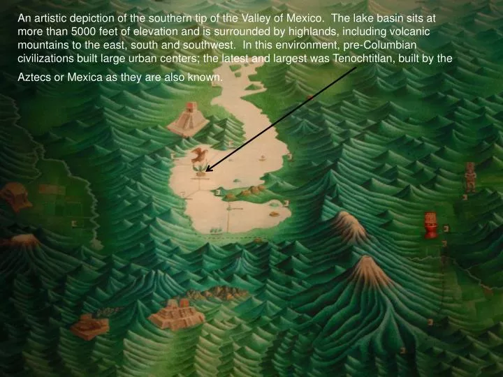
An artistic depiction of the southern tip of the Valley of Mexico. The lake basin sits at more than 5000 feet of elevation and is surrounded by highlands, including volcanic mountains to the east, south and southwest. In this environment, pre-Columbian civilizations built large urban centers; the latest and largest was Tenochtitlan, built by the Aztecs or Mexica as they are also known.
Earliest Spanish map of Tenochtitlan, the Mexica’s island capital.
Our old friend the climograph. ATR stands for annual temperature range which is the difference between the coldest and warmest months. Tropical climates have low ATRs.
Another map of Valley of Mexico. You read about chinampas in the article by West. Some chinampas still exist. However, one aspect of the growth of Mexico City was the draining of the lakes and chinampas.
Black = urban area Dotted = lake area The Gran Canal is critical for draining sewage and storm water out of the valley.
Subsidence means sinking. The map shows that much of the area of Mexico City is sinking. The lowest amount of sinking (4-5 meters) in the central city is near Mexico City’s main plaza, known as the Zocalo.
Floor of the plaza of Tenochtitlan. Another shot from the Zocalo. Bottom of Lake Texcoco in 1881
Subsidence makes drainage incredibly difficult, especially during the wet summer months. Water Drain
Bordo, one of the dumps you read about in the article “Letter from Mexico City”, is closing.
What happens to old dumps? They become upscale shopping and residential developments. You read about Santa Fe in the article mentioned in the previous slide.
Water quality in Mexico City The article reports on a study, by some of the people seated at the table, that found that some areas in the city have high quality water
Recent campaign to increase bicycling in Mexico City as a means to promote alternative transportation.
Cycling on streets blocked off to automobiles in the centro historico, or historic district.
A larger effort to combat automobile emissions. Hoy no circula sabatino is a restriction on Saturday driving in Mexicio City
In a city of more than 20 million inhabitants, there are a lot of taxis drivers, many of whom were not supportive of the driving restrictions.
Stuning images from Avenida de la Reforma. Mexico City’s main commercial thoroughfare.
On La Reforma Mexico’s national monuments compete for space with monuments to international finance.
This is how I begin every morning in Mexico. A visit to the juice shop.