Download
1 / 45
460 likes | 630 Views
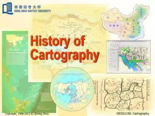
“Seeing is Knowing” The i mpact of technology on visualization techniques used in cartography. Presenter: Jolanta Soltis Class: CIS 679 Professor: Merry Turoff.

E N D
“Seeing is Knowing”The impact of technology on visualization techniques used in cartography Presenter: Jolanta Soltis Class: CIS 679 Professor: Merry Turoff
“The nature of maps and of their use in science and society is in the midst of remarkable change change that is stimulated by a combination of new scientific and societal needs for geo-referenced information and rapidly evolving technologies that can provide that information in innovative ways. A key issue at the heart of this change is the concept of ‘visualization.’” MacEachren (2002)
OUTLINE • Introduction to visualization • Introduction to scientific visualization • The past • Technological advancement in visualization techniques • The role of visualization in cartography in today’s world • Examples • The evolution of GIS and Visualization • Challenges • The future
Introduction to visualization • Visualization allows scientists to: • understand the meaning of millions of pieces of information in a visual form • interpret the meaning of this information • Through the use of multi-dimensional, animated depictions of data, it is possible to extrude previously unvisible information
What is Visualization? • Is visualization an activity carried out by human beings? • Is visualization an activity carried out by computer? • Visualize: • “To form a mental image or vision of …” • “To imagine or remember as if actually seeing.”
The purpose of data visualization • To convey information to people quicker • Visualization is a term with many meanings(MacEachern, 1995). • "Visualization" may mean two things. • Use graphical element to display results • Use 2 or 3dimensional graphics to diaplay data. • More possibilities • Interaction • zooming
Visual Variables • Position • Size • Value • Color • Texture • Orientation • Shape…
Static visual variables • Size (used to show changes in value • Value • Texture/Grain and Color – used as a accent or change in perspective • Orientation • Form
Dynamic visual variables • Moment • Duration (unit of time a frame is displayed) • Frequency (numbers of time forms are displayed) • Order (time sequence) • Rate of change • Synchronization (correspondence of series)
Computer Display Person Interaction Feedback Collaboration
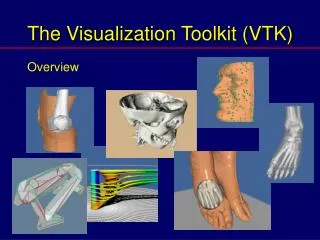
What is scientific visualization? "Visualization, is the process of transforming raw data into a displayable image.” Visvalingam (1994 ) To visualize is “to form a mental image or vision of…” Spence (2001)
Scientific visualization serves two purposes: • Help scientists and engineers solve problems. • Explain and promote a particular science to a wide audience.
Visualization solutions • Mental model – visualization – global translation • Invisible could be seen • Error detection • Interactivity and engaging different audiences • Immersion
A little history… • Development of motion - about 100 years • Mobile sculpture – 20 years • Video art – 20 years • Animated maps – begin in the 1930’s, but were not developed until 1959 • Computer animated maps: 1990’s
Maps from the past The oldest known map:Konya town,6200 BC Anaximader’s Map of the World
Napoleon's 1812 March to Moscow Multi-dimensional map shows size of the army, location, direction of movement, time and temperature.
Dynamic maps… • In 1959 Thrower mention the of audio-visual communication possibilities. • Walter Tobler developed first animation by using 3-D computer generated map
Technological advancement in visualization techniques • Impact of computer • Increased processing power • Internet • High quality graphics • VRML (Virtual Reality Modeling Language) • Animation
Views from an electronic multimedia atlas Examples from Microsoft’s Encarta 2000
The role of visualization in cartography • Communication • Exploration • Processing
Communication • Cartographic visualization relies on the use of maps to communicate cartographic ideas.
Exploration • Our dominate sense - sight allows us to explore data sets. • Use of cognitive process of the mind
GIS • Geographic Information System (GIS) is a combination of operation and tools for exploring and geospatial analysis of data. • It is used to build maps in real time Multicast Backbone Internet traffic using 3D globe to represent data.
Geovisualiztion • Representation of geospatial information • Integration of computational and visual methods • Effective interface designs for geovisualization tools • Usability of geovisualization
Levels of GIS and Visualization • Rudimentary: minimal data sharing • Operational: consistency • Functional: transparent communication • Merged: one environment
Automatic Derivation of Electronic Maps from X3D/VRML Worlds Use of web-base tools like: • VRML (Virtual Reality Modeling Language) • High-end systems: • Mmersive workbenches, CAVEs, Power Walls • 3D “worlds” • Advantages: creating virtual “supper environments”
Factors that contribute to the virtuality of the “supper environments” • Immersion (sensation of being in) • Interactivity (virtual experience) • Information intensity (details) • Intelligence (realism)
Challenges • How to show a mass of data • How to show multiple information • Exploration of data • Cumbersome productions of animation • Data registration • Development of virtual environment that could lead to immersion on a geographic scale • Balancing abstraction and realism • Intelligence of objects • Collaboration
The future • Internet • VRML (Virtual Reality Modeling Language) and GeoVRM: • Animation • Personalized maps Geovisualization is use to solve traffic problems Example of GeoVRML visualization
References • Spencer, R. Information Visualization. , (2001),New York, NY: ACM Press Books • Visvalingam M, (1995), “Visualization in GIS, cartography and ViSC”, Visualization in Geographical Information Systems, Chapt 3, p18