Download
1 / 42
420 likes | 514 Views
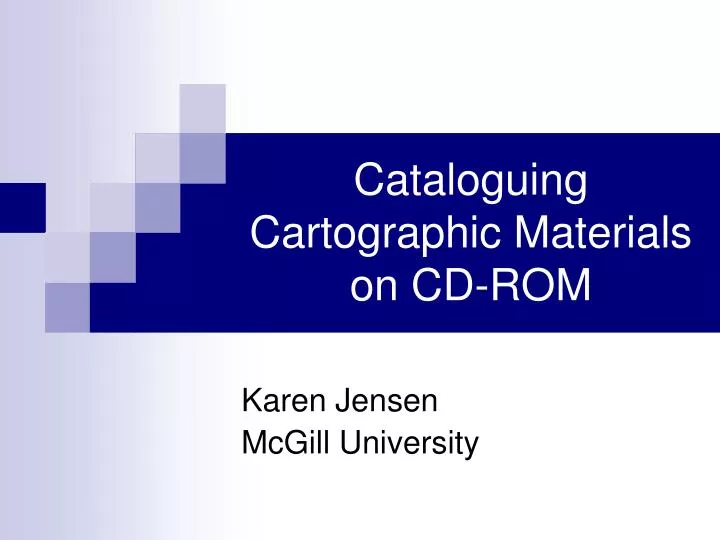
Cataloguing Cartographic Materials on CD-ROM. Karen Jensen McGill University. Highly Recommended.

E N D
Cataloguing Cartographic Materials on CD-ROM Karen Jensen McGill University
Highly Recommended • Cartographic Materials: A Manual of Interpretation for AACR2, 2002 Revision / prepared by the Anglo-American Cataloguing Committee for Cartographic Materials, Elizabeth U. Mangan, editor. 2nd ed. Chicago: American Library Association, 2003. OLAC 2004
Three Types of Cartographic Electronic Resources: • Scanned images of maps • Electronic atlases • Geospatial data OLAC 2004
Scanned Image of a Map • A map is a representation, normally to scale and on a flat medium, of a selection of material or features on the surface of the Earth. • Scanning involves capturing images from hardcopy sources. Maps are usually scanned on large-format colour scanners. OLAC 2004
Scanned Image of a Map Part of: Bowles, Carington. “North America, and the West Indies ...” 1774? American Memory. Map Collections: 1500-2004. [http://memory.loc.gov/ammem/gmdhtml/gmdhome.html] OLAC 2004
Electronic Atlas • An atlas is a systematically arranged collection of maps. It is distinguished from other collections of maps primarily by the publisher’s or compiler’s intent that the work by used like a book and shelved in the form as issued. • An electronic atlas may be the digital counterpart to a traditional paper atlas, or it may be interactive, allowing users to manipulate the data. OLAC 2004
Geospatial Data • “Geospatial data are information about the shape and location of objects on the Earth’s surface that can be manipulated in desktop mapping or in geographic information systems (GIS) programs (e.g., ArcView, ArcInfo, MapInfo, Intergraph) to perform geographic analysis and produce maps.” OLAC 2004
Geospatial Data • Vector data represent geographic features as x, y or x, y, z coordinates. Features are described as points, lines (or arcs), and polygons. • Raster data use a cell- or pixel-based method of representing the Earth’s features, with each cell or pixel having a value. OLAC 2004
Map Created With Vector Data Part of: “Tennessee River and Interconnected Inland Waterway System.” Alabama Maps. Contemporary Map Index. [http://alabamamaps.ua.edu/map_index.html] OLAC 2004
Scanned Map (Raster Data) Part of: Desilver, Charles. “Canada East, Formerly Lower Canada with Inset of Nova Scotia and New Brunswick.” 1856. Alabama Maps. Historical Maps Archive. [http://alabamamaps.ua.edu/historicalmaps/index.html] OLAC 2004
Satellite Image (Raster Data) Part of: “Ohio Flood.” RADARSAT International Image Gallery RADARSAT 1. [http://www.rsi.ca/products/gallery/rs1.asp] OLAC 2004
Raster Data • Raster files store image information, such as scanned paper maps or aerial photographs. • Also used for data captured by satellite and other airborne imaging systems. • GIS Data Formats describes common formats for vector and raster data.http://data.geocomm.com/helpdesk/formats.html OLAC 2004
Published vs. Commercial • “Published” electronic resource = available and/or accessible to the public. • Includes commercially available packages, data, etc., or files that may be downloaded and/or accessed via the Internet. • Non-commercial geospatial data are often distributed on CD-ROMs without any special packaging. OLAC 2004
Non-commercial Publications • 2003 American Library Association Annual Conference covered non-commercial publications. • Electronic-Resource Cartographic Materials - The Basics by Grace Welch (University of Ottawa). • Cataloging Electronic-Resources Cartographic Materials - The Basics by Mary Lynette Larsgaard (University of California, Santa Barbara). • Available at http://magert.whoi.edu:8000/conf/2003/details03.html OLAC 2004
What is a cartographic electronic resource? • Emphasis on cartographic material. • Textual material is secondary and serves mainly to support and explain the cartographic content. • Code the Leader/06 (Type of Record) character position “e” for Cartographic material. OLAC 2004
Guidelines • Guidelines for Distinguishing Cartographic Electronic Resources from other Electronic Resources, January 1998 (Revised December 2001) / Cataloging Policy and Support Office, Network Development and MARC Standards Office, Geography and Map Division, and Special Materials Cataloging Division, Library of Congress. (http://www.loc.gov/marc/cfmap.html) OLAC 2004
Coding the Fixed Fields • LC adds an 008 for maps and an 007 for computer files. • McGill also adds an 006 for computer files and an 007 for maps. • A combination of the fixed fields labels this type of material “Digital Map” in our catalogue. • MARC 21 Concise Format for Bibliographic Data (http://www.loc.gov/marc/bibliographic/) OLAC 2004
008--MAPS • 18-21 - Relief is usually blank for No relief shown. • 22-23 - Projection indicates the projection used in producing the item. • 25 - Type of cartographic material indicates the type described in the bibliographic record. LC uses only “a” - Single map or “b” - Map series. • 28 - Government publication indicates whether the item is published or produced by or for a government agency. OLAC 2004
008--MAPS • 29 - Form of item indicates the form of material for the item. s - Electronic • 31 - Index indicates whether the item or accompanying material includes a location index or gazetteer. 0 - No index 1 - Index present • 33-34 - Special format characteristics indicates the special format characteristics of the map. Usually give as blank. OLAC 2004
006--Computer Files/Electronic Resources • 00 - Form of material is “m” - Computer file/Electronic resource • 09 - Type of computer file is usually “c” for Representational or “m” for Combination. • Representational = pictorial or graphic information that can be manipulated in conjunction with other types of files to produce graphic patterns that can be used to interpret and give meaning to the information. • 11 - Government publication OLAC 2004
007--Electronic Resource • 00 - Category of material is “c” - Electronic resource • 01 - Specific material designation is “o” - Optical disc • 03 - Color is • a - One color • b - Black-and-white • c - Multicolored • 04 - Dimensions is “g” - 4 3/4 in. or 12 cm. • 05 - Sound is • # - No sound (silent) • a - Sound on medium OLAC 2004
007--Map • 00 - Category of material is “a” - Map • 01 - Specific material designation: • d - Atlas • j - Map • r - Remote-sensing image (An image produced by a recording device that is not in physical or intimate contact with the object under study. Remote-sensing devices include cameras, lasers, radiometers, scanners, radar systems, sonar, and scintillation counters used at a distance (as from aircraft, spacecraft, or ship)). OLAC 2004
007--Map • Note that a separate 007 exists specifically for remote-sensing images, but don’t use it for most electronic resources. • 03 - Color • a - One color • c - Multicolored OLAC 2004
007--Map • 04 - Physical medium indicates the material out of which the item is made. • Our policy is to code this with a fill character because digital maps do not exist on a physical medium. • | - No attempt to code OLAC 2004
007--Map • 05 - Type of reproduction indicates whether the item is a facsimile or other type of reproduction. • Do not treat raster images created by scanning as facsimiles. • n - Not applicable OLAC 2004
007--Map • 06 - Production/reproduction details indicates the photographic technique used to produce the item. z - Other • 07 - Positive/negative aspect indicates the positive/negative polarity of the photocopy or film. n - Not applicable OLAC 2004
General Material Designation • GMD for digital maps. • At McGill, we follow LC policy of using [electronic resource], so that the GMD matches the physical description of the record. LC never uses [cartographic material], and we wanted our records to match theirs. OLAC 2004
034--Coded Cartographic Mathematical Data • Coded form of the cartographic mathematical data contained in field 255. • 034:1 :|a a |b 100000 with 255: :|a Scale 1:100,000. • 034:0 :|a a with 255: :|a Scale not given. • 034:1 :|a a |b 253440 |d E0790000 |e E0860000 |f N0200000 |g N0120000 with 255: :|a Scale 1:253,440 |c (E 79°--E 86°/N 20°--N 12°). OLAC 2004
043, 045 • 043--Geographic Area Code is not used for maps. • 045--Time Period of Content is used by LC to represent the date of map situation, the date portrayed by the map. • Date of situation is considered to be of almost equal importance to the geographic and subject content of the map, and is included as part of the item’s call number. OLAC 2004
050--Library of Congress Call Number • LC uses only the maps portion of the LC G Schedule for classification. The main entry cutter always appears after the date in the call number. • Special Instructions and Tables of Subdivisions for Cartographic Materials(http://www.loc.gov/catdir/cpso/class_g.html) OLAC 2004
052--Geographic Classification • A code for the main geographic area and any applicable subareas associated with the item. The code is derived from the LC class G schedule by dropping the letter G. • |b - Geographic classification subarea code. An alphanumeric code, assigned from expanded Cutter lists, that represents a subarea of the geographic area coded in subfield |a. • Cutter numbers for places in the U.S. are published in Geographic Cutters by the Library of Congress. OLAC 2004
255--Cartographic Mathematical Data • Statement of scale, the statement of projection, and the statement of coordinates. • Linear scales are shown on a map as: • 1. representative fractions: 1:50,000; 1:63,360 • 2. verbal scales in the form of phrases stating map distance in relation to Earth distance: 1 inch to 1 mile; 2 cm. to 1 km. • 3. graphic scales, usually a bar scale OLAC 2004
255--Cartographic Mathematical Data • For electronic resources, give the scale if the resource has a scale statement or if the scale is already recorded as part of the title. Otherwise, give Scale not given. • If the main maps in a cartographic item are of more than one scale, give Scales differ. • If all of the main maps in a cartographic item are of two scales, give both scales in separate scale statements. If there are more than two scales, give Scales differ. OLAC 2004
Examples of Graphic or Bar Scales • Often the left end of the bar is subdivided into smaller units to provide more precise estimation of distances. OLAC 2004
255--Cartographic Mathematical Data • Give the statement of projection if it is found on the item, its container, or accompanying printed material. Map projection is “any systematic arrangement of meridians and parallels, portraying the curved surface of the sphere upon a plane.” • Give the statement of coordinates when the information is readily available. OLAC 2004
256--Computer File Characteristics • Type and extent of resource. Characteristics of a computer file, such as the type of file, the number of records or statements. • Add if considered important and not found elsewhere in the description. • No longer seems to be used at LC for electronic cartographic resources. If adding this field, give Electronic data or Electronic data and programs. • 256 relates to 516 (Type of computer file or data note), but neither are commonly used for electronic cartographic materials. OLAC 2004
300--Physical Description • Recommended to give the extent of the cartographic item (number of physical units of atlases or globes, or the number of maps) on the physical carrier. • Use conventional terminology to record the specific format of the physical carrier; use CD-ROM or DVD-ROM. • If the resource has sound, give sd. If it displays in two or more colours, give col. • For CD-ROMs, the dimensions are 4 ¾ in. OLAC 2004
5xx--Notes • Make notes in the order given in AACR2, but give a particular note first if considered of primary importance. • 500 Nature and scope of the item; include date of situation, relief, 538, data quality assessments, metadata descriptions. • 538 System requirements. Make a note of the system requirements of the resource if the information is readily available. • 546 Language. OLAC 2004
5xx--Notes • 500 Source of title proper. This note is required for electronic resources. The chief source of information for cartographic electronic resources is the resource itself. • For commercial publications on CD-ROM, usually give Title from disc label. OLAC 2004
5xx--Notes • 516 Type of computer file or data note. A general descriptor that characterizes a file (e.g., text, computer program, numeric). • Specific information such as the form or genre of textual material (e.g., biography, indexes) also may be included. • Add if the nature of the item is not apparent from the rest of the description. OLAC 2004
5xx--Notes • 530 - Additional Physical Form Available Note. Example: Also available in print version and online via the GLERL home page. • 520 - Summary. Give a summary unless another part of the description provides enough information. • 505 - Contents. OLAC 2004
65x--Subjects • Currently no way to indicate a scanned map is in digital form. LC uses 653 (Index term - uncontrolled) Maps--Digital. • Don’t use |v Databases. • Digital mapping is for works ABOUT digital mapping, not for actual digital maps. • Don’t use 650 Geographic information systems |v Maps. OLAC 2004