Download
1 / 25
250 likes | 376 Views
HIGARUS 08. Solar Disturbance of GPS Satellite Orbits. Merita Halili Orhan Veliu. 06 june 2008. Introduction. HiGarus ’08 -Continuation of previous work Project goal Effect of high solar activity on: GPS satellite orbit positions Ground positions. Sun Activity. 11 year cycle

E N D
HIGARUS 08 Solar Disturbance of GPS Satellite Orbits MeritaHalili Orhan Veliu 06 june 2008
Introduction • HiGarus ’08 -Continuation of previous work • Project goal • Effect of high solar activity on: • GPS satellite orbit positions • Ground positions
Sun Activity • 11 year cycle • Number of sunspots • 24thcycle • Geomagnetic storms • Solar radiation storms • Radio blackouts Solar Storms
Solar activity affects: • Humans in space • Satellite operations • Aircraft operations • Power and communications • Climate change
Selection of solar storms • SWPC archive • Storms(G3 to G5 and S3 to S5) • Calculate and compare • Broadcast and precise satellite orbit positions • Broadcast and precise ground positions
PositionDetermination • Broadcast: • Satellite orbits computed using orbit parameters derived from ephemerides • Satellite clock error parameters • Correct the pseudoranges for satellite clock error • Least Square Adjustment to compute receiver position • Precise: • Precise orbits provided from IGS website • Interpolate to required epochs • Least Square Adjustment to compute receiver position
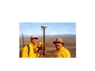
Equipment • GJOV Reference Station Consists of: • Archive with stored 24/7 raw-data, since July of 2000 • GNSS Antenna • Two dual-frequency receivers • Two computers, each connected to a receiver • Appropriate software applications Does: • Tracks the number of and the status of all visible satellites and stores the data transmitted by the satellites. • Displays receiver’s current position and time. • Downloads and stores raw‐data measurements • Transmits the data for “real time” positioning.
Software • Receiver software • Geodetic Base Station Software (GBSS) • PC-CDU • tps2rin • Programming • Microsoft Visual Basic 2005 Express Edition • FreeBasicIDE – Fbide • Other • Word, Excel, Access, Visio, …
Data Formats • Broadcast ephemeris • Binary format • RINEX format (ASCII) • IGS precise orbits • SP3 format (ASCII)
Parameters and Assumptions • Study Analysis Period • Start/end time • 24 hours, after the reported end of storm • Sampling Interval • Five-minute interval • One-minute interval • One-second interval • Satellite antenna phase center offset • WGS84 vs. ITRF
Data Processing Steps Broadcast position • Generate a list of required epochs • Extract visible satellites/observed pseudo-ranges • Extract broadcast ephemeris • Compute broadcast orbit • Compute broadcast receiver position Precise position • Interpolate to epoch of observation • Compute precise orbit • Compute precise receiver position Compare positions • Compare broadcast and precise orbits • Compare broadcast and precise receiver positions Analyze Errors • Analyze orbit errors • Analyze receiver position errors
Written Programs • Visual Basic 2005 and FreeBasic • Short programs • Comment the source code • Document program • dependencies
Difficulties • Non-standard RINEX • Huge amount of data to process • Many parameters in the RINEX - files
Results • Satellite orbit positions • Ground positionsStudyperiods: • Storm day • Day after the storm • Clear day with no solar activity • Short intervals
Storm Day - 30.10.2003 06:00PM -09:00 PM (G4) 09:00 PM -12:00 AM(G5) Satellites position 30.10.2003Difference between broadcast and precise ephemeris on X 5 minutes interval from 01:00AM until 11:00PM , UT
30.10.2003 – 1 minuteinterval Satellites position 30.10.2003Difference between broadcast and precise ephemeris on X 1 minute interval from 01:00AM until 11:00PM , UT
30.10.2003 – 1second interval Satellites position (PRN07)30.10.2003Difference between broadcast and precise ephemeris on X,Y,Z 1 second interval, UT
Storm Day – 08.11.2004 Satellites position 08.11.2004. Difference between broadcast and precise ephemeris on Y 5 minutes interval from 01:00AM until 11:00PM , UT
Day afterthe storm – 09.11.2004 Satellites position 09.11.2004. Difference between broadcast and precise ephemeris on X 5 minutes interval from 01:00AM until 11:00PM , UT
Cleardaywithout storm Satellites position 26.12.2003Difference between broadcast and precise ephemeris on X 1 minute interval from 01:00AM until 11:00PM , UT
Ground position – storm day Ground positions 30.10.2003Difference between broadcast and precise ephemeris on X .Y, Z 1 second interval from 01:00AM until 02:00AM , UT
Conclusions GPS satellite orbits, during the selected study periods, do not tend to be disturbed by geomagnetic or solar radiation storms.
Recommendations • Detailed study of solar storms • Longer study periods • Advanced programming • Advanced analysis tools • Phase pseudo-range measurements • Include also other GNSS
For more information visit: http://hovedprosjekter.hig.no/v2008/iia/geo/higarus-08/