Download
1 / 8
120 likes | 424 Views
Systems for locating points on Earth 1. Latitude and Longitude. A B C D E F. 1 2 3 4 5 6.

E N D
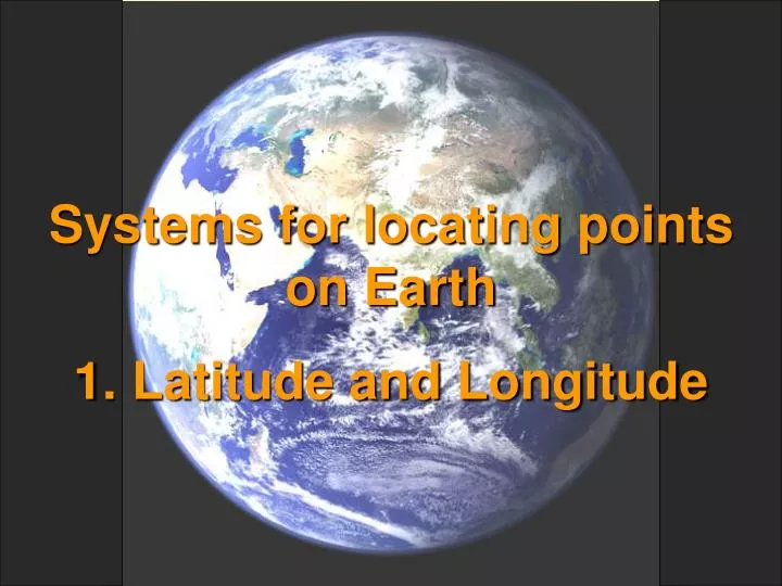
Systems for locating points on Earth 1. Latitude and Longitude
A B C D E F 1 2 3 4 5 6 Roadmaps locate points on a grid by the letter and number of its box , e.g. B4 or E1. This works but is not very accurate. For example, the two points in E1 below share the same locator but are not in the same place.
We use several grid systems to locate points – much more accurately – on the surface of the Earth The two most common grid systems are Latitude and Longitude Universal Transverse Mercator (UTM) The Public Land Survey grid is used in many U.S. states There are many, many local grid systems used for an entire country or parts of a country India Grid A India Grid B Zimbabwe Grid, etc. This help module focuses on Latitude and Longitude
A roadmap grid consists of boxes defined by horizontal and vertical lines The latitude/longitude grid uses horizontal east-west lines called parallels of latitudeand north-south lines that converge at the North and South Poles called meridians of longitude
60° N. Latitude So is this point There are many points 30° N of the Equator. All lie on this line – the 30th parallel of North latitude This point is 30° North of the Equator 30° 30° S. Latitude 60° S. Latitude The Equator is the reference place for Latitude. All latitudes are measured in degrees, minutes, and seconds north or south of the Equator e.g. 47°37’22”N Latitude 90° N. Latitude = North Pole 30° N. Latitude 30° Equator 90° S. Latitude South Pole (Think of the Earth being cut by a horizontal egg slicer)
Prime Meridian 0° E or W Longitude East Longitude West Longitude 60° 90° W. Longitude 90° E. Longitude 75° W. Longitude 60° W. Longitude The reference for longitude is a single meridian passing through Greenwich, England called the PRIME MERIDIAN. Longitudes are measured east or west of the Prime Meridian, e.g. 73°48’55” W. Longitude
Any point on Earth can be located by combining latitude and longitude as in these simple examples. And very accurately, using degrees (°), minutes (’) and seconds (”). There are 60 seconds in one minute, 60 minutes in one degree 34°27’09”N 52°19’52” W 45° N. Lat., 15° E Long. 0° N or S Latitude 0° E or W Longitude 30° S Lat. , 75° W Long.
GLOBE FORMAT FOR LATITUDE AND LONGITUDE The most common format for latitude and longitude was used in the previous slides: degrees, minutes, and seconds e.g. 23°44’19” S Lat., 136°55’33”E Long. To avoid problems with using the base 60, the required GLOBE format uses degrees and decimal fractions of degrees – no minutes or seconds at all – for example, 67.75000° N Latitude. This means the same as 67°45’00” N Latitude because .75 degrees = ¾ of a degree = 45’. Your GPS receiver can report latitude and longitude in several formats. Be sure to set it on degrees and decimal degrees. In the setup screen of the GPS, this will appear as hddd.ddddd°