Download
1 / 48
480 likes | 604 Views
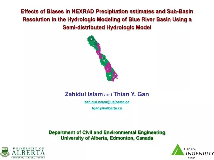
Effects of Biases in NEXRAD Precipitation estimates and Sub-Basin Resolution in the Hydrologic Modeling of Blue River Basin Using a Semi-distributed Hydrologic Model. Zahidul Islam and Thian Y. Gan zahidul.islam@ualberta.ca tgan@ualberta.ca Department of Civil and Environmental Engineering

E N D
Effects of Biases in NEXRAD Precipitation estimates and Sub-Basin Resolution in the Hydrologic Modeling of Blue River Basin Using a Semi-distributed Hydrologic Model Zahidul Islam and Thian Y. Gan zahidul.islam@ualberta.ca tgan@ualberta.ca Department of Civil and Environmental Engineering University of Alberta, Edmonton, Canada
Structure of presentation • Introduction , Platform and Objectives • Semi-distributed Hydrologic Model DPHM-RS • Blue River Basin • Data • Research Methodology • Calibration of DPHM-RS • Discussions of Results • Summary and Conclusions • Recommendations of Future Works
Introduction Fully Distributed Lumped Semi- Distributed DPHM-RS
Platform of the Study DMIP: Distributed Model Inter-comparison Project • Sponsored by The Hydrology Laboratory (HL) of NOAA's National Weather Service (NWS) • Provided a forum to explore the applicability of distributed models using operational quality data ( Smith et al.,2004 ) • Outcomes of the First phase are documented through Journal of Hydrology: DMIP Special Edition, 2004. DMIP 2: Distributed Model Inter-comparison Project Phase II • Launched on February 2006 • Focussed outcomes : Journal of Hydrology: DMIP 2 Special Edition
Objective of the Study Our objectives are to apply DPHM-RS to model the hydrology of BRB using the NEXRAD precipitation and North American Regional Reanalysis (NARR) forcing data to address the following issues: • The effect of sub-basin resolution on hydrologic modeling for long term simulation • Effects of biases of NEXRAD precipitation data on basin-scale hydrologic modeling.
DPHM-RS Semi-Distributed Physically based Hydrologic Model using Remote Sensing • Developed by Getu Fana Biftu and Thian Yew Gan (Biftu and Gan, 2001 & 2004) • In DPHM-RS a basin is subdivided into an adequate number of sub-basins • The model is designed to assimilate remotely sensed data. • DPHM-RS is applied for Paddle River Basin of Central Alberta( Biftu and Gan, 2001 & 2004) • DPHM-RS is also applied for Blue River Basin, Oklahoma, USA for event based simulation( Kalinga and Gan ,2006) • Currently DPHM-RS is applying for Blue River Basin, Oklahoma, USA for continuous simulation DPHM-RS Applications
Model Components of DPHM-RS • Six Components: • Interception • Evapotranspiration(ET) • Soil Moisture • Saturated Subsurface Flow • Surface Flow • Channel Routing Fig.1 : Model Component of DPHM-RS(Biftu and Gan,2004)
Model Components of DPHM-RS • Interception • The Rutter interception model ( Rutter et al.,1971) is used to estimate the rainfall interception Fig.2 : Rutter interception model (source: Biftu and Gan,2004)
Model Components of DPHM-RS • Evapotranspiration(ET) • Two source model of Shuttleworth and Gurney (1990)is used to compute ET • Actual Evaporation from land surface and transpiration from vegetation canopy are computed separately. Fig.3 :Two source model of Shuttleworth and Gurney (1990) (source: Biftu and Gan,2004) • This model calculate the sensible heat flux and latent heat flux and then apply the energy balance for three layer : • Above canopy • Within canopy • Soil
Model Components of DPHM-RS • Evapotranspiration(ET) (..continued) • Energy balance Fig.3 :Two source model of Shuttleworth and Gurney (1990) (source: Biftu and Gan,2004)
Model Components of DPHM-RS • Soil Moisture • Soil Profile of three homogeneous layer is used to model the soil moisture: • Active layer: • unsaturated, 15-30 cm • Simulates rapid changes of soil moisture content. • Transmission layer: • unsaturated • layer between base of the active layer and top of capillary fringe • Simulates seasonal changes of soil moisture • Groundwater Zone: • Saturated Fig.4 Conceptual representation of soil infiltration (source: Biftu and Gan,2004)
Model Components of DPHM-RS • Soil Moisture (..continued) • Apply soil water balance in two layers: • Case I: Z2 >0 • Case II: Z2 =0 Fig.4 Conceptual representation of soil infiltration (source: Biftu and Gan,2004)
Catchments Average value of Local Topographic Soil Index: From DEM of DTED Exponential Decay of Saturated Hydraulic Conductivity Ks Most Important Calibration parameter for Soil Moisture Model Components of DPHM-RS • Saturated Subsurface Flow • The water table equation from Sivapalan et al. (1987) is modified to simulate the average water table for each sub-basin.
Model Components of DPHM-RS • Surface Runoff • The surface runoff from bare soil: • The surface runoff from vegetated soil: • In DPHM-RS the resulting runoff becomes a lateral inflow to the stream channel within the sub-basin • The surface runoff transferred into stream flow using and average response function for each sub basin.
Model Components of DPHM-RS • Surface Runoff • Finding response function: • A reference runoff (e.g. 1 cm ) is made available for one time step for all grid cells within the sub-basin. • Kinematic wave equation is applied for each grid cell and flow is routed from cell to cell based on 8 possible flow direction until the total volume of water corresponding to reference runoff for a sub-basin is completely evacuated. • Finding resultant runoff: • The actual surface runoff for each sub-basin is then computed based on that average response function.
t + C4 j Δt j+1 (Included Lateral Inflow ) x i Δx i+1 Model Components of DPHM-RS • Channel Routing • Muskingum-Cunge Flow routing method is used to route the flow through the drainage network.
Blue River BasinSouth Central Oklahoma, USA • Catchment Type : Non regulated • Terrain: • Flat • elevation ranging from 150 m to 350 m (msl) • Catchment area: 1233 km2 • Major Soil Group: • Silty Clay loam (Sub-basin 1,2,3) • Sandy Clay ( Sub-basin 4) • Clay (Sub-basin 5,6,7) • Dominant Vegetation: • Woody Savanah ( Occupying 80% area )
Input Data to DPHM-RS model (modified from Kaninga and Gan ,2006)
Input Data to DPHM-RS model (modified from Kaninga and Gan ,2006)
Input Data to DPHM-RS model • Data Resolution • DEM : 100 m • Soil Texture : 1 km • Vegetation : 1 km • Precipitation : 4 km • Energy Forcing : 32 km
Basin Sub-Division Methodology • The entire catchment is divided into a number of sub-basins drained by a definite drainage network.
Generating Response Function Methodology
Distribution of Input Variables Methodology
Model Parameterization Methodology • Model parameters of DPHM-RS • Vegetation • Soil • Channel • The vegetation parameters are taken from Kalinga and Gan (2006) • The depth of the active soil layer: 20 cm • Initial moisture content of the active soil layer : 60% • The mean water table depth: 8.0 m.
Calibrating parameters • The exponential decay parameter of saturated hydraulic conductivity (f) • Manning’s roughness coefficient (n) for soil and vegetation • Mean cross sectional top width • n for the channel • Sensitivity • fdirectly affects the depth of the local GWT and the amount of base flow • n for soil and vegetation significantly changes the response function • n for channel and top width affect the shape of the simulated hydrograph. Calibration
Calibrations Steps • f was manually adjusted by a trial and error approach so as to simulate adequate base flows with respect to the observed • Calibrated f values: 1.0 m-1 for silty clay loam, 0.7 m-1 for sandy clay and 0.4 m-1 for clay. • The response functions for the seven sub-basins were further calibrated by manually adjusting Manning’s n values for forest and bare soil, with the objective of matching the simulated with the observed hydrographs, especially the peak flows. • The Manning’s n derived were 0.08 for forest, 0.07 for bare soil and 0.015 for the channel • Based on the Muskingum-Cunge method for channel routing we did not find the need to adjust the mean top width of the channel reaches (Biftu and Gan, 2001) and we ended up using the cross-sectional measurements provided by DMIP 2 Calibration
Monthly Mean Flow Results
Comparison with Other studies Discussion on Results
Biases of NEXRAD Precipitation Data Discussion on Results
Biases of NEXRAD Precipitation Data Discussion on Results
Biases of NEXRAD Precipitation Data Discussion on Results
Biases of NEXRAD Precipitation Data Discussion on Results
Biases of NEXRAD Precipitation Data Discussion on Results
Effects of Grid Resolution Discussion on Results
Effects of Grid Resolution Discussion on Results
Effects of Grid Resolution Discussion on Results • Increasing the number of sub-basin causes higher simulated runoff in both high and low flow seasons for the same total precipitation input which causes generally leads to an increase in the correlation during high flow and a decrease in the correlation during low flow.
Effects of Grid Resolution Discussion on Results • With smaller sub-basin areas water has to travel a shorter distance via interflow to the saturated areas compared to larger sub-basin areas. • So increasing the number of sub-basins causes a quicker drainage of water because of the shorter travel distance than for larger sub-basin areas • Higher moisture content at larger sub-basin areas give rise to higher actual evaporation, thus lowering the effective precipitation (the difference between actual precipitation and evaporation) and so the net outflow from the entire basin decreased as number of sub-basins decrease
Even as a semi-distributed, physically based hydrologic model and using 7 sub-basins, DPHM-RS performed comparably at the calibration stage with three other hydrologic models that are either TIN-based (Ivanov et al. 2004; Bandaragoda et al., 2004), or with 21 sub-basins (Carpenter and Georgakakos, 2004), and marginally better in the validation stage; • Considering there could be other sources of errors, the degradation of model performance at the validation stage for DPHM-RS can partly be attributed to biases associated with NEXRAD precipitation even though it is already merged with rain gauge data, as evident in some cases where high precipitation based on NEXRAD data under reasonable antecedent moisture content resulted in minimal observed runoff; Summary and Conclusions
By adjusting NEXRAD precipitation data with rainfall measurements from 3 selected Mesonet stations, DPHM-RS’s performance improve marginally in the calibration stage and significantly in the validation stage, which supports our suspicion on the biases associated with NEXRAD data. Therefore we suggest that whenever possible, NEXRAD precipitation data should first be compared and adjusted to local conditions (e.g., rain gauge data) before applying the data to simulate basin hydrology. • For a given climatic regime and river basin characteristics (topography, vegetation and geology), there might be an optimum level of discretization in modeling basin hydrology and for BRB it turned out to be 7 sub-basins (170 km2 per sub-basin), which is still the same as that of Kalinga and Gan (2006) even though we used long-term instead of event based simulations. Summary and Conclusions (Contd..)
With respect to the Mesonet’s soil moisture estimates, it seems that DPHM-RS simulated realistic soil moisture, which together with realistic simulated runoff hydrograph, demonstrate the physical basis of the semi-distributed model, which should be subjected to more extensive testing to confirm this observation. Summary and Conclusions( Contd..)
Recommendations for Future Studies • The uncertainties of NEXRAD precipitation should be further examined • The current development of satellite based precipitation estimates e.g., CMOPRPH (Climate Prediction Center morphing method), TMPA (TRMM Multi-satellite Precipitation Analysis), SCaMPR (Self-Calibrating Multivariate Precipitation Retrieval) can be a future alternative of radar precipitation data.
The first author is supported by FS Chia PhD Scholarship of the University of Alberta and Alberta Ingenuity PhD Graduate Student Scholarship. • The data used in this study were downloaded through the links provided in the website of DMIP2 (http://www.weather.gov/oh/hrl/dmip/2/data_link.html ), of the US National Weather Services (NWS) and Office of Hydrologic Development (OHD). • In addition, Oklahoma Mesonet data were provided by the Oklahoma Mesonet, a cooperative venture between Oklahoma State University and The University of Oklahoma and supported by the taxpayers of Oklahoma • The research support group of Academic Information and Communication Technologies (AICT), University of Alberta for significant amount of technical support in data decoding. Acknowledgement
Thank You Comments & Questions ?