Download
1 / 14
140 likes | 325 Views
1997 Red River of the North Flood 10 Years Later. 4th International Symposium on Flood Defence Toronto, Canada May 6, 2008. PRESENTATION SUMMARY. Introduction Overview ( Mike Ryan ) Geography Living with the Red ( M. Clamen ) Conclusions and Recommendations Accomplishment's

E N D
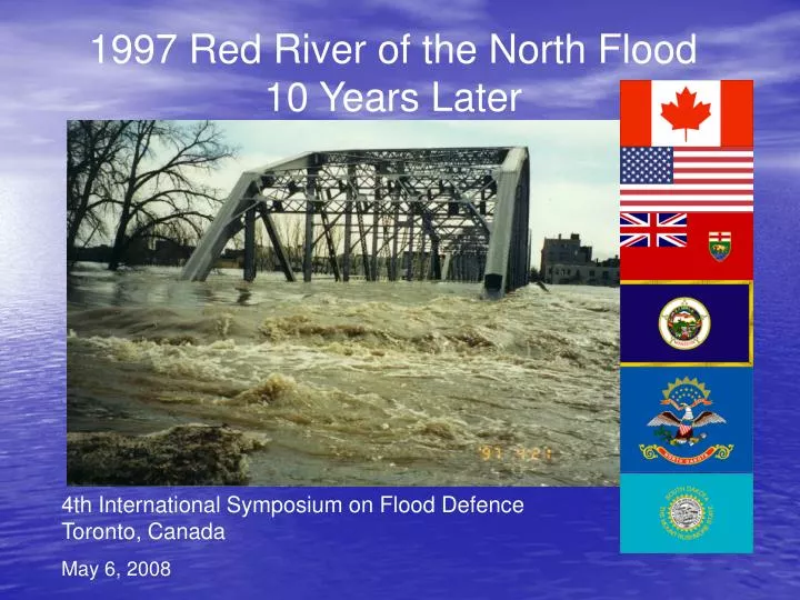
1997 Red River of the North Flood 10 Years Later 4th International Symposium on Flood Defence Toronto, Canada May 6, 2008
PRESENTATION SUMMARY • Introduction • Overview (Mike Ryan) • Geography • Living with the Red (M. Clamen) • Conclusions and Recommendations • Accomplishment's • Improvements in Flood Forecasting (D. Luna) • Mitigation (Structural/non-structural/Policy/Legislation changes) • North of the Border • Manitoba (D. McNeil) • South of the Border • US Federal (J. DeHarnais) • US State (D. Frink) • Summary • What’s next? (M. Ryan) • Questions Introduction - Overview
WHERE IS THE RED RIVER OF THE NORTH? LAKE WINNIPEG WINNIPEG EMERSON GRANDFORKS EAST GRAND FORKS FARGO/MOORHEAD Introduction - Overview
Red River Basin Characteristics • Formed by glacial Lake Agassiz • Basin is characterized as glaciated plain with moraines, lakes, wetlands, and lake plains • Covers 45,000 mi2 (116,500 km2) • About 90% of area in US (40,000 mi2 or 103,600 km2) • River meanders northward for 551 mi (887 km) • The river path is nearly double the straight-line distance • Red River Floodplain • 60 mi wide (100 km) at the widest point Introduction - Overview
Red River Basin Characteristics • Basin remarkably flat • Drops 229 ft (69 m) over length • Average of 0.4 ft/mi (0.08 m/km) Introduction - Overview
Red River Flow Characteristics Daily flows • Maximum: 133,000 ft3/s (3,770 m3/s) April 26, 1997 • Mean: 4,050 ft3/s (155 m3/s) • Minimum: 0.9 ft3/s (0.0255 m3/s) February 2, 1937 Introduction - Overview
Red River Flooding in 1997 Introduction - Overview
Red River Flooding in 1997 Annual Maximum Peak Streamflow for Red River of the North at Grand Forks, ND Introduction - Overview
Red River Flooding in 1997What caused the flooding? • Substantial precipitation in fall of 1996 • Early freezing of saturated ground in fall of 1996 • Snowfall 300% or more of normal • Fargo…..117 in (297 cm) • Grand Forks…..98 in (249 cm) • Winnipeg…..90 in (228 cm) • Melt of Snow pack and thawing of ice began in late March • Melt inhibited by late-spring blizzard on April 5-6, 1997 • Wind-driven rain and sleet • Severe drop in temperatures • Winds to 70 mph (133 kph) • Up to 2 ft (0.6 m) of snow • Wind and ice toppled trees and power lines – no power for days Introduction - Overview
Red River Flooding in 1997Economic damages • Physical Damage/Costs • Estimates of 2 to 3 Billion Dollars Introduction - Overview
Red River Flooding in 1997Farms and Agricultural Lands Flooded • Inundated Land • US • 7,040 mi2 (18,200 km2) • Canada • 1,700 mi2 (4,400 km2) • Almost of 20% of basin inundated at some point Introduction - Overview
Red River Flooding in 1997 Transportation – Disrupted BRIDGES UNDERWATER STREETS AND ROADS FLOODED ROADS WASHED OUT Introduction - Overview
Red River Flooding in 1997Grand Forks flooded • Psychological Damage/Costs • There are damages resulting from major floods for which a monetary value cannot be determined • Often the psychological damages following a major flood are the most difficult to overcome and may remain long after the clean up and replacement effort Introduction - Overview
Red River Flooding in 1997Moving Forward • IJC recognizing that flooding will continue to impact the Red River basin • IJC recognizing the social/economic costs associated with flooding will continue to increase • Developed “Living with the Red” • 7 Conclusions • 28 Recommendations Introduction - Overview