Download
1 / 21
210 likes | 388 Views
An Application in GIS for a Sanitary Sewer Overflow Emergency Response Program. Mike Pritchard Penn State MGIS Capstone Project Advisor: Jan Oliver Wallgrun. Key Points of Discussion. Project background Proposed goals Project needs Literature review Proposed methodology

E N D
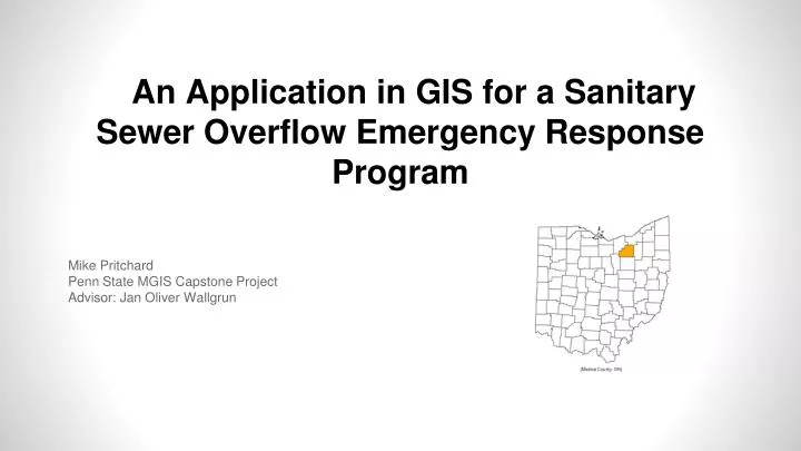
An Application in GIS for a Sanitary Sewer Overflow Emergency Response Program Mike Pritchard Penn State MGIS Capstone Project Advisor: Jan Oliver Wallgrun
Key Points of Discussion • Project background • Proposed goals • Project needs • Literature review • Proposed methodology • Deliverables and timeline
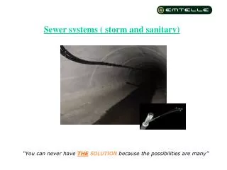
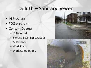
Medina County Sanitary Engineer (MCSE) Sanitary Sewer System Project Background
Motivation for Project MCSE Response Plan • Developed GIS • Sanitary trunk sewer collapse in 2009 • Response plan to Sanitary Sewer Overflow (SSO) • How to best utilize GIS in emergency situations
Proposed Goals Application in GIS to use with existing web based GIS
GIS Generated Report • Easy to understand • All pertinent info • Printer friendly
GIS Tool to Generate Report • Potential geoprocessing service • Python and model builder • Accompanying map of incident area
MCSE Needs • Sanitary network info related to location of SSO • Repair options • Customers concerns • Necessary/unusual equipment Source: http://wgcl.images.worldnow.com/images/22175327_BG1.jpg Source: http://www.contractortalk.com/attachments/f62/99515d1379174520-re-how-long-does-take-dig-track_hoe.jpg
MCSE Needs Continued • Environmental risks • Emergency Contacts • Regulatory Agencies • Government and Community Leaders Source: http://farm8.static.flickr.com/7258/7004128015_d559f76af3_b.jpg
Literature Review • What is an SSO • A discharge of untreated sanitary sewage from the result of a broken pipe, equipment failure, or overload on the system [1] • Why Have an effective emergency response plan • Define how to respond, control, report and mitigate the event • Enhance the protection of public health and the environment • Provide compliance with regulations and permits • Maintain trust with the public, the regulatory agencies and the non-governmental organizations • Minimize the wastewater agency’s exposure and liability from claims, enforcement, or litigation
Involved Organizations • EPA SSO Toolbox • Important information to include in plan • SSO identification protocols • Hydraulic modeling to understand effects of SSO
Case studies of effective plans related to SSO’s Greenwood County, SC [5]: Comprehensive Management, Operations, and Maintenance Plan DeKalb County, GA [6]: SSO Contingency and Emergency Response Plan City of Delmar, CA [4]: Sanitary Management Plan
Approach & Methodolgy • Design SSO report to be generated from GIS • Build GIS to run report as a service through ArcGIS Server (python and model builder) • Simulate SSO with potential users
Organized based on response plan categories • Static and dynamic data • Overview map to provide general location • One page (may change in design) Sketch of Potential Generated Report
User Testing • Flexible based on project timeline • Simulate an SSO event • Actual user testing • Feedback Report
Project Deliverables • GIS generated report with simulated data from SSO • Geoprocessing script with accompanying screenshots (or video) of simulated SSO • Presentation of paper
Timeline • January – February (~6 Weeks) • Design SSO report • February – March (~6 Weeks) • Build GIS tool to generate report and accompanying maps • April (~4 Weeks) • User testing • May – September • Finalize report and presentation
Potential Conferences • Water Infrastructure Conference (AWWA) • 10/26/2014 in Atlanta, GA • URISA GIS-PRO Conference • 9/8/2014 in New Orleans, LA • Ohio GIS Conference • September in Columbus, OH • Pennsylvania GIS Conference • 5/5/2014 in State College, PA
References [1] EPA (2001). Managing Sewer Overflows. Retrieved on October 22, 2013 from http://www.epa.gov/safewater/sourcewater/pubs/fs_swpp_ssocso.pdf [2] EPA (2001). Why Control Sewer Overflows. Retrieved on October 29, 2013 from http://www.epa.gov/npdes/pubs/sso_casestudy_control.pdf [3] APWA (2010). SSO Response Plan. Retrieved on October 22, 2013 from http://www2.apwa.net/documents/resourcecenter/Final%20Core%20Attributes%20July%202010.pdf [4] Delmar, CA (2010). Sanitary Sewer Management Plan: City of Delmar, CA. Retrieved on October 26, 2013 from http://www.delmar.ca.us/Government/dept/Documents/SSMP_Final2010.pdf [5] EPA (ND). CMOM Case Study: Greenwood, SC. Retrieved on October 26, 2013 from http://www.epa.gov/npdes/pubs/sso_casestudy_greenwood.pdf [6] Dekalb County, Georgia (ND). Sanitary Sewer Overflow Contingency and Emergency Response Program. Retrieved on October 22, 2013 from http://www.dekalbwatershed.com/PDF/prog_updates_sanitary_sewer_overflow_contingency_&_emergency_response_plan.pdf [7] American Society of Civil Engineers (Under Cooperative Agreement with EPA, Project No. CP-828955-01-0) (2004). Solutions for Sanitary Sewer Overflows. Retrieved on November 6, 2013 from http://epa.ohio.gov/portals/35/permits/sso%20solutions%20asce%20epa%20guidance%202004.pdf [8] American Society of Civil Engineers (Under Cooperative Agreement with EPA) (2000) Protocols for Identifying Sanitary Sewer Overflows (SSOs). Retrieved on November 6, 2013 from http://scap1.org/Collection%20Reference%20Library/Folder%20contains%20Misc%20EPA%20files%20for%20Collection%20Systems/Protocols%20Identifying%20SSO.pdf [9] Sier, D., & Lansey, K. (2005). Monitoring sewage networks for sanitary sewer overflows. Civil Engineering & Environmental Systems, 22(2), 123-132. Retrieved on November 7, 2013 from http://ezaccess.libraries.psu.edu/login?url=http://search.ebscohost.com/login.aspx?direct=true&db=a9h&AN=17473374&site=ehost-live