Download
1 / 34
340 likes | 428 Views
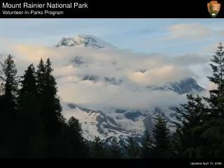
Sources of Haze - North Cascades and Mt. Rainier National Parks. Keith Rose EPA, Region 10 WRAP IWG Meeting August 30, 2006. Introduction.

E N D
Sources of Haze - North Cascades and Mt. Rainier National Parks Keith Rose EPA, Region 10 WRAP IWG Meeting August 30, 2006
Introduction • Objective - Identify sources within geographic areas responsible for the worst visibility days in the North Cascades and Mt. Rainier National Parks in 2003 • Used VIEWS reconstructed species (SO4, NO3, OCM, and EC) Bext to determine species contribution to haze for 20% worst visibility days • Used VIEWS back trajectories to determine sources of air parcels on worst visibility days
Sources • SO4 – Point, area, and mobile sources in Portland and along the I-5 corridor in western OR • Total Bext = 45 Mm-1 (20% worst > 41 Mm-1)
Sources • NO3 – Centralia Power Plan • SO4 – Offshore marine vessels • OCM – Biogenic emissions and/or fires in BC (OC/EC = 5.8) • Total Bext = 57 Mm-1
Sources • SO4 – Point, area, and mobile sources in Portland area, and offshore marine vessels • Total Bext = 41 Mm-1
Sources • SO4 – Point, area, and mobile sources in Portland and along the I-5 corridor in western OR • OCM – Point, area, and mobile sources in Portland and along the I-5 corridor in western OR • Total Bext = 56 Mm-1
Sources • SO4 – Point, area, and mobile sources in Puget Sound and Vancouver area • OCM – Wildfires in northern WA and BC (OC/EC = 3.5) • Total Bext = 72 Mm-1
Sources • SO4 – Point, area, and mobile sources in the Columbia Gorge and Portland area • OCM – Agricultural burning in eastern WA and OR? • Total Bext = 32 Mm-1 (20% worst > 28 Mm-1)
Sources • SO4 – Point, area, and mobile sources in Puget Sound, and offshore marine vessels • OCM – Point, area and mobile sources in Puget Sound • Total Bext = 31 Mm-1
Sources • SO4 – Point, area, and mobile sources in Vancouver area, and offshore marine vessels • Total Bext – 43 Mm-1
Sources • OCM – Wildfires in BC (OC/EC = 7.3) • Total Bext = 334 Mm-1
Sources • High OCM – Wildfires in BC and Alberta (OC/EC = 6.6) • Total Bext = 137 Mm-1
Summary – Mt. Rainier • Visibility impacted primarily by: • SO4 from point, area, and mobile sources in Puget Sound and western OR (April-Oct) • SO4 from marine vessels (April-Oct) • OCM from wildfires in northern WA and BC (Aug-Oct)
Summary – North Cascades • Visibility impacted primarily by: • SO4 from point, area, and mobile sources in Puget Sound and Vancouver area (April-July) • SO4 from marine vessels (April-July) • OCM from wildfires in BC (Aug-Oct)