Download
1 / 8
80 likes | 180 Views
The Triangle Trade. 17 th Century To 18 th Century. Imperialism. During the Age of Discovery in the 15 th and 16 th centuries, Portugal and Spain pioneered European exploration of the globe, and in the process established large overseas empires.

E N D
The Triangle Trade 17th Century To 18th Century
Imperialism During the Age of Discovery in the 15th and 16th centuries, Portugal and Spain pioneered European exploration of the globe, and in the process established large overseas empires. Envious of the great wealth these empires bestowed, England, France and the Netherlands began to establish colonies and trade networks of their own in the Americas and Asia.
Imperialism Cont. A series of wars in the 17th and 18th centuries with the Netherlands and France left England (Britain after the 1707 Act of Union with Scotland) the dominant colonial power in North America and India.
Why do you think it was said that the sun never sets on The British Empire?Explain in one paragraph.
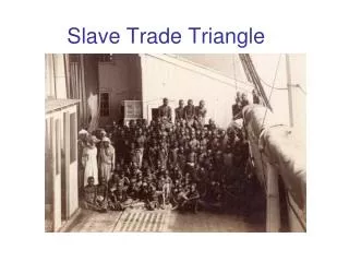
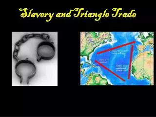
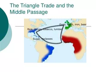
Growth During the Industrial Revolution During the 1600s and 1700s, people who lived on the continents of Europe, Africa, and North America all had products that the others needed. A small example of the countries and their goods are: Europeans produced furniture and tools, while colonists in North America had fish and lumber. Many ships crossed the Atlantic Ocean carrying these and other goods to trade between the continents. The three continents formed the points of large triangles, giving the trade routes their name.
Three Continents http://www.eduplace.com/kids/socsci/books/applications/imaps/maps/g5s_u3/index.html#top Write down all the countries and the goods that they traded (imported-brought in to their country, exported-sent out of their country).
CreateChart it Make a chart showing the goods that were produced in each place. Label the columns of your chart with these headings: From Thirteen Colonies, From England and Europe, From Africa,and From West Indies. Then use the information on the map to fill in your chart.
Mapping In your work Book, draw or stick in a blank map of the area we have been looking at. Name the continents and the countries and then draw in the trade routs. You will need to annotate your map, stating what goods were carried by whom and to where.