Download
1 / 20
200 likes | 369 Views
2006 Comprehensive Plan Update An Overview of the Comprehensive Plan’s Role in our Community March, 2005. THE COMPREHENSIVE PLAN Is a 20-Year Strategy for the Community. Influences:. Private Sector Actions (Regulations) e.g., Zoning Laws Zoning Maps Subdivision Regulations

E N D
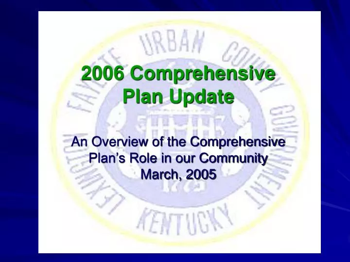
2006 Comprehensive Plan Update An Overview of the Comprehensive Plan’s Role in our CommunityMarch, 2005
THE COMPREHENSIVE PLAN Is a 20-Year Strategy for the Community Influences: • Private Sector Actions • (Regulations) • e.g., • Zoning Laws • Zoning Maps • Subdivision Regulations • Administrative Actions • Public Sector Actions • (Capital Projects) • e.g., • Transportation • Waste Disposal • Parks/Greenways • Schools
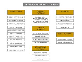
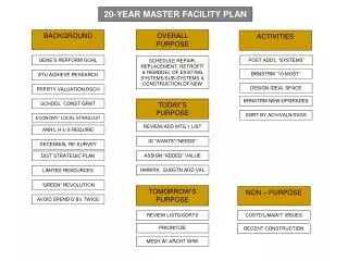
KRS 100.187: Contents of the • 2006 Comprehensive Plan • Goals and Objectives • Land Use Plan • Transportation Plan • Community Facilities Plan • Provisions to accommodate all military installations greater than 300 acres • Optional elements such as community renewal, housing, and historic preservation
Urban/Rural Service AreasThe Cornerstone of Our Community Planning Program since 1958Urban = 85 Square Miles (30% of County)Rural = 200 Square Miles (70% of County)
1996 Urban Service Area Expansion - 5400 Acres At average density, will result in over 13,000 dwellings
2001 Comprehensive Plan Update Future Land Use Map Click this link to view an online version that can be viewed in detail and/or downloaded http://www.lfucg.com/AdminSvcs/Planning/2001CompPlan_Update_Map.pdf
Newtown Pike Extension Plan: An Amendment to the 2001 Comprehensive Plan Update Click this link to go to the Newtown Pike Extension Website for up to date info. http://www.newtownextension.com/
What is the catalyst that causes us to change the way we designate uses for the Land in Fayette County? It is our people… They need a place to live, a place to work, a place to learn, a place to worship, a place to get medical attention, a place to play, a place to shop...
Between 1990 - 2000: • Fayette County grew by 35,146 persons • Adjoining counties grew by 38,116 persons
Regional Population Growth 1990-2000
Changes in the Population by Age Groups From 1990 to 2000 • For Birth through 19 years, there was a 9.8% increase. • In the 20 to 64 years old age range, there was about a 17.7% increase. • For the 65 to 84 years old range, there was approximately a 15.2% increase. • The 85 years old and up group has increased by about 35.8%.
Projections by Age Fayette County Population Kentucky State Data Center’s Population Projections to 2030 2000 Population From U. S. Census Bureau
LEXINGTON IN THE YEAR 2030: • We will have 1,200+ more infants and preschool children. • Hospital nurseries, daycares, pediatricians, etc? • We will have 4,000+ more children between the ages 5 and 19 years of age. • School space, recreation programs, sports, pediatricians, etc? • We will have 600+ more people in the 20 to 39 age range. • Employment, homes, cars, retail, restaurants, recreation, etc? • We will have 29,000+ more people aged 40 to 64. • Employment, homes, cars, retail, restaurants, hospital space, medical, recreation, etc? • We will have 33,000+ more senior citizens aged 65 to 84. • Senior citizen centers, assisted living facilities, entertainment, hospitals, medical, transportation, home help, etc? • We will have 1,800+ more senior citizens aged 85 and older. • Assisted living facilities, nursing homes, hospitals, medical, special services, transportation, etc?
New Residential Units Between July 2000 And September 2004
Purchase of Development Rights (PDR) Program PDR Protected Farms and Conservation Easements As Of 5/25/04 Click this link to go to an online up to date version of this map ftp://ftp.lfucg.com/AdminSvcs/PDR/councilpres2.pdf
While PDR Protects Some Of Our Rural Land, Our Urbanized Area Is Constantly Changing And Developing New Residential Units On South Broadway Reynolds Road Improvement Project
Central Library 2/7/05 Northside Library 2/2/05 Public Participation Eagle Creek Library 2/22/05 Tates Creek Library 2/10/05 Beaumont Library 2/15/05
For More Information Contact: LFUCG Division of Planning 200 East Main Street Lexington, KY 40507 (859) 258-3160 Thank You!