Download
1 / 61
610 likes | 761 Views
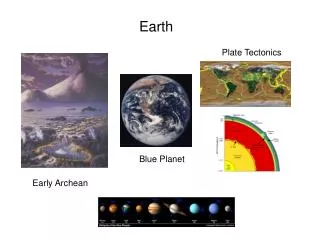
EARTH. A DYNAMIC PLANET. Geography 1000A. ‘SIDE VIEW’. 100,000 ly. ‘TOP VIEW’ Solar System on outside of Orion Arm (25,000 light years from centre). Solar system formation. Nebular hypothesis

E N D
EARTH A DYNAMIC PLANET Geography 1000A
‘SIDE VIEW’ 100,000 ly ‘TOP VIEW’ Solar System on outside of Orion Arm (25,000 light years from centre)
Solar system formation • Nebular hypothesis • Important theorists: Emanuel Swedenborg (1734), Immanuel Kant (1755), Pierre-Simon Laplace (1796), Victor Safronov (1972) – Solar nebular disk model (SNDM) • Evidence: observations systems at varying stages • Nebula: Giant Molecular Cloud (GMC) results from collision(s) or explosion of dying star • 3. H and He condense into Sun • 4. Disk of matter (many elements) around sun • 5. Disk slowly accretes into clumps (planetesimals) that also contain heavier elements • planetesimalsplanetoids • planets and satellites Hubble Space Telescope view of a new solar system 1500 l-y away in the Orion Nebula
GEOLOGIC TIME SCALE Eons, Eras, Periods and Epochs Superposition: youngest rocks superimposed on older rocks “Relative time” Dating by radioactive isotopes Half-life: time for ½ of unstable isotopes to decay “Absolute time” Uniformitarianism: “The same physical processes active in the environment today have been operating throughout geologic time”Hutton (1795), Lyell (1830)
Red ovals indicate major extinction events: when extinction rate greatly exceeds speciation rate Source: University of Calgary
The Earth in cross-section
Upper mantle and lithosphere
ISOSTASY Elevation of tectonic plates determined by density/thickness Mountain masses displace mantle material Isostatic adjustment due to loss of mass by erosion Deformation from sediment load
THE ROCK CYCLE Mineral A natural, inorganic compound with a specific chemical formula and a crystalline structure Examples silicates (quartz, feldspar, clay minerals), oxides (eg., hematite) carbonates (eg., calcite)
Rock An assemblage of minerals bound together • Igneous (solidify & crystallize from molten magma/lava) • Sedimentary • (settling & cementation) • Metamorphic • (altered under pressure)
Igneous Rock Formation • from magma (molten rock beneath the surface) • intrusive or extrusive (from lava)
Igneous Structures Laccolith Sill plutons Dike Batholith
Sedimentary Rock Existing rock or organic material is digested by weathering, picked up by erosion, moved by transportation, and deposited at river, beach and ocean sites. Lithification follows (cementation, compaction and hardening) Laid down in horizontally-layered beds
Defined by clastic origin Conglomerate largest clasts Sandstone sand cemented together Siltstone derived from silt Shale mud/clay compacted into rock Limestone calcium carbonate, bones and shells cemented or precipitated in ocean waters Coal ancient plant remains compacted into rock or by chemical / organic origin
note the shells
Metamorphic Rock Any type of rock is transformed, under pressure and increased temperature • Harder and resistant to weathering • Produced from any rock type by: • Compressional forces due to plate collisions • Regional and contact metamorphism
Original rock Metamorphic rock Shale Slate Granite Gneiss Basalt Schist Limestone, dolomite Marble Sandstone Quartzite
Crustal Movements
CONTINENTAL DRIFT • Continents are adrift due to • convection currents in the • asthenosphere • Mantle movements result in plate • migration • 225 M BP: Pangaea
PROOF OF CONTINENTAL DRIFT Fossil Record (plant and animal) Distribution of marsupials vs. placentals Age of mid-oceanic ridge magnetic stripes Age and thickness of oceanic crust Subduction zones “Ring of fire”
Mid-oceanic ridge magnetic stripes
PLATE BOUNDARIES Divergent Boundaries (constructional) Convergent Boundaries (destructional) Transform Fault Boundaries
HOT SPOTS Source: USGS
The technique of _____ involves the measurement of decaying elements and stable end products. radiometric dating relative dating superposition punctuated equilibrium uniform dating
The technique of _____ involves the measurement of decaying elements and stable end products. radiometric dating relative dating superposition punctuated equilibrium uniform dating
Place the major concentric layers of Earth in order from outermost to innermost. mantle > outer core > inner core > crust inner core > outer core > mantle > crust outer core > crust > inner core > mantle crust > outer core > inner core > mantle crust > mantle > outer core > inner core
Place the major concentric layers of Earth in order from outermost to innermost. mantle > outer core > inner core > crust inner core > outer core > mantle > crust outer core > crust > inner core > mantle crust > outer core > inner core > mantle crust > mantle > outer core > inner core
The process of cementation, compaction, and hardening of sediments into sedimentary rock is called _____. carbonation geomagnetic reversal lithification isostasy metamorphism
The process of cementation, compaction, and hardening of sediments into sedimentary rock is called _____. carbonation geomagnetic reversal lithification isostasy metamorphism
The most common extrusive igneous rock is _____. sandstone basalt granite gneiss limestone
The most common extrusive igneous rock is _____. sandstone basalt granite gneiss limestone
Pangaea is the name given to the part of California west of the San Andreas fault that is moving into the Pacific Ocean. the period of geologic history that predates modern life forms. a rift valley in east Africa where a new ocean is forming. the name of a previous supercontinent thought to have broken into several plates. the larger feature that makes up the Hawaiian Islands via hotspot volcanism.
Pangaea is the name given to the part of California west of the San Andreas fault that is moving into the Pacific Ocean. the period of geologic history that predates modern life forms. a rift valley in east Africa where a new ocean is forming. the name of a previous supercontinent thought to have broken into several plates. the larger feature that makes up the Hawaiian Islands via hotspot volcanism.
The interconnected mountain chain on the ocean floor is built by upwelling flows of magma in a process called _____. trench widening metamorphism sea-floor spreading isostasy subduction