Download
1 / 11
110 likes | 263 Views
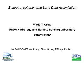
SMAP and Agricultural Productivity Applications Wade T. Crow USDA Hydrology and Remote Sensing Laboratory, Beltsville, MD Thanks: John Bolten (NASA GSFC), Xiwu Zhan (NOAA NESDIS) and Curt Reynolds (USDA FAS IPAD) ISDWG SMAP Applications Workshop March 3, 2011

E N D
SMAP and Agricultural Productivity Applications Wade T. Crow USDA Hydrology and Remote Sensing Laboratory, Beltsville, MD Thanks: John Bolten (NASA GSFC), Xiwu Zhan (NOAA NESDIS) and Curt Reynolds (USDA FAS IPAD) ISDWG SMAP Applications Workshop March 3, 2011 Funded by the NASA Applied Sciences Program (joint with NASA HSB, NESDIS STAR, USDA ARS, and USDA FAS, PI: Wade Crow, Program Manager: Brad Doorn)
SMAP Mission Concept • L-band unfocused SAR and radiometer system with offset-fed 6-m light-weight deployable mesh reflector rotating about nadir axis (14.6 rpm) • Single feed (dual-pol radar and polarimetric radiometer) • Conical scan, fixed incidence angle across swath • Contiguous 1000 km swath • Radar resolution: 1-3 km (degrades over center 30%) • Radiometer resolution: 40 km • Sun-synchronous dawn/dusk orbit • Mission Ops duration 3 years
The USDA Foreign Agricultural Service (FAS) International Production Assessment Division (IPAD): • Monthly global production estimates for commodity crops. • Vital for economic competitiveness, national security and food security applications. • Utilizes a wide-range of satellite data sources, input databases, climate data, crop models, and data extraction routines to arrive at yield and areaestimates. • Analyst-based decision support system. • Characterizing the extent and impact of agricultural drought (i.e. root-zone soil moisture limitations) is critical for monitoring variations in agricultural productivity.
Past USDA FAS/IPAD Treatment of Soil Moisture • Time/space attributes: • 12-km resolution. • Global coverage within agriculturally relevant areas. • Monthly reporting cycle (< weekly latency). 2-Layer Soil Moisture Model Analysts Global Rain and Met Forcing Data Crop Stress (Alarm) Models Crop Models
Current USDA IPAD Treatment of Soil Moisture Funded by the NASA Applied Sciences Program (joint with NASA HSB, NESDIS STAR, USDA ARS, and USDA FAS, W.T. Crow PI, Brad Doorn, program manager) Remotely-Sensed Soil Moisture Data Assimilation 2-Layer Soil Moisture Model Analysts Global Rain and Met Forcing Data Crop Stress (Alarm) Models Crop Models
What is the added value of integrating remotely-sensed soil moisture information? Remotely-Sensed Soil Moisture Data Assimilation 2-Layer Soil Moisture Model Analysts Global Rain and Met Forcing Data Crop Stress (Alarm) Models Crop Models
Example Time Series Results Can the poor-precipitation open loop case be corrected to resemble the good-precipitation benchmark case through the assimilation of remotely-sensed soil moisture (EnKF case)?
Bolten, J.D., W.T. Crow, T.J. Jackson, X. Zhan and C.A. Reynolds, IEEE Journal of Selected Topics in Applied Earth Observations and Remote Sensing, 3, 57-66, 10.1109/JSTARS.2009.2037163, 2010. Improvement in Root-Zone RMSE Fit to Benchmark
Improvement in Lagged Correlation with EVI Preliminary 2002 to 2008 results in United States Southern Great Plains
Summary: • X-band AMSR-E soil moisture retrievals can add value to both global-scale root-zone soil moisture monitoring and vegetation status forecasting activities. • Added skill will be enhanced by improved L-band SMAP retrieval accuracy (versus existing X-band AMSR-E). • Evaluate added skill all the way to agricultural yield and production statistics (the central goal of USDA FAS IPAD). • Thank you….questions?