Download
1 / 11
110 likes | 296 Views
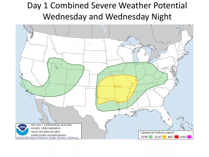
Day 1 Combined Severe Weather Potential Wednesday and Wednesday Night Tornado, Wind, and Hail. Tornado Potential Wednesday and Wednesday Night. Wind Potential Wednesday and Wednesday Night. Hail Potential Wednesday and Wednesday Night. Increased risk of large hail 2 inches or larger.

E N D
Day 1 Combined Severe Weather PotentialWednesday and Wednesday NightTornado, Wind, and Hail
Hail PotentialWednesday and Wednesday Night Increased risk of large hail 2 inches or larger
Day 2 Combined Severe Weather Potential Thursday Tornado, Wind, and Hail
Combined Severe Weather PotentialThursday Increased risk of EF2 + tornadoes, 75mph + wind, and 2 inch + hail
THURSDAY/THURSDAY NIGHT • Main threat…strong tornadoes (EF2+) possible • Timing…from early afternoon Central and Western MO moving eastward into Eastern MO through the evening • Large hail (2 inches or larger) and damaging wind threat continues until at least 3 am in Eastern MO