Download
1 / 2
30 likes | 114 Views
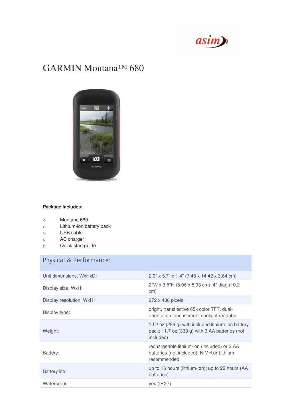
Montana 680 features a dual-orientation, color touchscreen that’s glove friendly and includes a 1-year BirdsEye Satellite Imagery subscription. The digital camera provides high-quality images, excellent resolution and automatically geotags photos with coordinates. Handheld includes 3-axis tilt-compensated compass, barometric altimeter and access to both GPS and GLONASS satellites for improved positioning and typically faster fixes. For More Information visit : http://www.asimcommunication.com/garmin-montana-680/

E N D
GARMIN Montana™ 680 Package Includes: o o o o o Montana 680 Lithium-ion battery pack USB cable AC charger Quick start guide Physical & Performance: Unit dimensions, WxHxD: 2.9" x 5.7" x 1.4" (7.48 x 14.42 x 3.64 cm) 2"W x 3.5"H (5.06 x 8.93 cm); 4" diag (10.2 cm) Display size, WxH: Display resolution, WxH: 272 x 480 pixels bright, transflective 65k color TFT, dual- orientation touchscreen; sunlight readable Display type: 10.2 oz (289 g) with included lithium-ion battery pack; 11.7 oz (333 g) with 3 AA batteries (not included) Weight: rechargeable lithium-ion (included) or 3 AA batteries (not included); NiMH or Lithium recommended Battery: up to 16 hours (lithium-ion); up to 22 hours (AA batteries) Battery life: Waterproof: yes (IPX7)
Floats: no High-sensitivity receiver: yes Interface: Maps & Memory: high-speed USB and NMEA 0183 compatible Basemap: yes Ability to add maps: yes Built-in memory: 3.0 GB Accepts data cards: microSD™ card (not included) Waypoints/favorites/locations: 4000 Routes: 200 Track log: Features: 10,000 points, 200 saved tracks Automatic routing (turn by turn routing on roads): yes (with optional mapping for detailed roads) Electronic compass: yes (tilt-compensated, 3-axis) Touchscreen: yes Barometric altimeter: yes yes (8 megapixel with autofocus; automatic geo-tagging) Camera: Geocaching-friendly: yes (paperless) Custom maps compatible: yes Photo navigation (navigate to geotagged photos): yes Outdoor GPS games: no Hunt/fish calendar: yes Sun and moon information: yes Tide tables: yes Area calculation: yes Custom POIs (ability to add additional points of interest): yes Unit-to-unit transfer (shares data wirelessly with similar units): yes Picture viewer: yes Garmin Connect™ compatible (online community where you analyze, categorize and share data): yes Address: 306, Agarwal Arcade, Plot No. 6, Sector 12, Aashirwad Chowk, Dwarka, New Delhi-110075 Ph:011-28034223/24