Download
1 / 14
150 likes | 291 Views
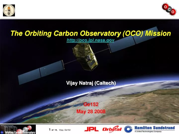
The Orbiting Carbon Observatory (OCO) Mission http://oco.jpl.nasa.gov. Vijay Natraj (Caltech) Ge152 May 28 2008. Introduction: Carbon Sinks?. Atmospheric Carbon dioxide (CO 2 ) Primary man-made greenhouse gas Mixing ratios increased by ~25% since 1860

E N D
The Orbiting Carbon Observatory(OCO) Missionhttp://oco.jpl.nasa.gov Vijay Natraj (Caltech) Ge152 May 28 2008
Introduction: Carbon Sinks? • Atmospheric Carbon dioxide (CO2) • Primary man-made greenhouse gas • Mixing ratios increased by ~25% since 1860 • Only half of the CO2 from fossil fuel emissions in atmosphere • Outstanding Issues • Where are the CO2 sinks? • Why does atmospheric buildup vary with uniform emission rates? • How will CO2 sinks respond to climate change?
1.2 Flux Residuals (Gt/yr/zone) 0.6 0.0 1.2 0.6 Flux Residuals (Gt/yr/zone) 0.0 Why Measure CO2 from Space? • Studies from GV-CO2 stations • Flux residuals exceed 1 GtC/yr in some zones • Network is too sparse • Inversion tests • Global XCO2 pseudo-data with 1 ppm accuracy • Flux errors reduced to < 0.5 GtC/yr/zone for all zones • Global flux error reduced by a factor of ~3 Courtesy:Rayner and O’Brien, 2001
90 90 364 364 0 0 Latitude Latitude 360 360 -90 -90 356 356 Precise CO2 Measurements Needed • Space-based XCO2 estimates will improve constraints on CO2 fluxes • Near global coverage on monthly intervals • Precisions of 1–2 ppm (0.3–0.5%) on regional scales • No spatially coherent biases > 1–2 ppm (0.3 to 0.5%) on regional scales CO2 Mixing Ratio (ppm)
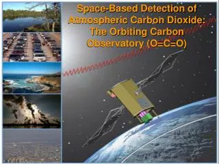
The Orbiting Carbon Observatory (OCO) • Spectra of CO2 and O2 absorption in reflected sunlight used to estimate XCO2 • Random errors and biases no larger than 1 - 2 ppm (0.3 - 0.5%) on regional scales at monthly intervals OCO will make the first space-based measurements with the precision and resolutions needed to quantify CO2 sources and sinks and monitor their variability.
OCO Fills a Critical Measurement Gap 6 NOAA TOVS 5 Aqua AIRS 4 ENVISAT SCIAMACHY 3 CO2 Error (ppm) 2 Aircraft 1 Flask Site Globalview Network OCO Flux Tower 0 1000 10000 1 100 10 Spatial Scale (km) OCO will make precise global measurements of XCO2 needed to monitor CO2 fluxes on regional to continental scales.
O2 A-band CO2 2.06 m CO2 1.61m Spectroscopy • Column-integrated CO2 abundance • Maximum contribution from surface • Why high spectral resolution? • Enhances sensitivity, minimizes biases Clouds/Aerosols, Surface Pressure Column CO2 Clouds/Aerosols, H2O, Temperature
Coordinated Observations GLORY 1:34 1:26 OCO Will Fly in the A-Train OCO files at the head of the A-Train, 4 minutes ahead of the Aqua platform
Nadir Observations • Observatory points instrument at local nadir • Collects science data over sunlit hemisphere at solar zenith angles < 85 • Advantages + Small footprint (< 3 km2) isolates cloud-free scenes and reduces biases from spatial inhomogeneities over land + Simplifies operations • Liabilities Low Signal/Noise over dark ocean
R I Glint Spot Ground Track Glint Observations • Glint Observations: views “glint” spot • Angle of reflection equals angle of incidence of sunlight at surface: R = I • Advantages + Improves Signal/Noise over oceans • Disadvantages More interference from clouds Operations more complicated Local Nadir
Target Observations • Tracks a stationary surface target (calibration site) to collect large numbers of soundings • Uplooking ground-based FTS data acquired simultaneously through same slant column • Acquire Target data over 1 surface validation site each day 447-m WLEF Tower Geolocation Accuracy Spatial Direction Along Slit Scan Direction
Validation Program • Ground-based in-situ measurements • NOAA CMDL Flask Network + Tower Data • TAO/Taurus Buoy Array • Uplooking FTS measurements of XCO2 • 3 funded by OCO • 4 upgraded NDSC • Aircraft measurements of CO2 profile Buoy Network CMDL
Acknowledgments • Yuk Yung • David Crisp, Charles Miller • Retrieval Algorithm: Denis O’Brien, Geoff Toon, Bhaswar Sen, Hartmut Boesch, Rob Spurr, Hari Nair, James McDuffie, Mick Christi • Validation: Paul Wennberg, Ross Salawitch, Brian Connor • Calibration: Carol Bruegge • OCO Science Team