Download
1 / 30
310 likes | 500 Views
Southeast Climate Consortium. Southeast Climate Consortium. Members. SECC : Funding Support. National Oceanic-Atmospheric Administration. USDA Risk Management Agency. USDA Cooperative State Research, Extension and Education Service. Southeast Climate Consortium.

E N D
Southeast Climate Consortium Members
SECC : Funding Support National Oceanic-Atmospheric Administration USDA Risk Management Agency USDA Cooperative State Research, Extension and Education Service
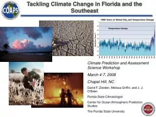
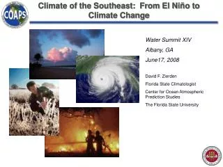
Southeast Climate Consortium • Mission:To use advances in climate sciences, including improved capabilities to forecast seasonal climate, to provide scientifically sound information and decision support tools for agriculture, forestry, and water resources management in the Southeastern USA.
University of Georgia • Gerrit Hoogenboom • David Stooksbury • Joel Paz • Carla Roncoli • Pam Knox • Axel Garcia y Garcia • Pierre Marchant • Rabiu Olatinwo • Tomas Persson
UGA Activities • Climate • Extension and Impact Assessment • Crop modeling • Decision support tools • Water resources • Pests and diseases • Corn ethanol net energy value
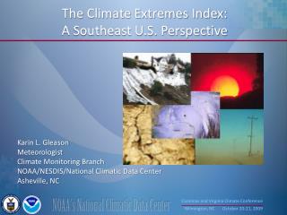
2-3 months Inter-annual Decadal Climate Variability Several decades 50+ years Centuries Climate Change
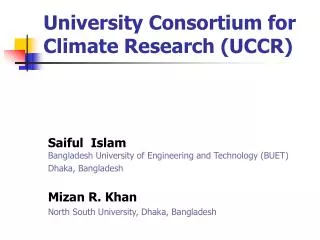
Changing Ocean Temperature Impacts our climate here in the U.S. and across the globe Image courtesy of NOAA Earth Science Laboratory
El Niño-Southern Oscillation (ENSO) • El Niño is one phase of an oscillation in ocean temperatures and atmospheric pressure in the eastern Pacific Ocean that can steer weather systems in the southeastern US and elsewhere. • El Niño is considered the warm phase of the oscillation. • La Niña (sometimes known as El Viejo) is the opposite atmospheric pattern from El Niño.
El Niño-Southern Oscillation (ENSO) • El Niño is one phase of an oscillation in ocean temperatures and atmospheric pressure in the eastern Pacific Ocean that can steer weather systems in the southeastern US and elsewhere. • El Niño is considered the warm phase of the oscillation. • La Niña (sometimes known as El Viejo) is the opposite atmospheric pattern from El Niño.
Sea Surface Temperatures: Equatorial Pacific Ocean Normal conditions El Niño La Niña Source: Climate Research Unit
ENSO Impacts in the Southeast • EL Niño • Very wet winter and spring • Greatly reduces Atlantic • hurricanes • Decreases tornadoes in • the tornado alley • La Niña • Dry Fall, Winter, and Spring • Greatly increases Atlantic • hurricanes • Increases tornadoes in • the deep south • Greatly increases wildfire • risks Neutral ENSO phase increases the risk of severe freezes by 3:1 odds.
Management Decisions • Variety selection • Planting dates • Acreage allocation • Amount and type of crop insurance • Marketing • Purchase inputs
Analysis of HistoricalWeather Data Year: 1 2 3 4 5 6 7 8 9 10 11 12 13 14 15 16 …
Analysis of HistoricalWeather Data Year: 1 2 3 4 5 6 7 8 9 10 11 12 13 14 15 16 … Neutral El Niño La Niña
El Niño La Niña El Niño Neutral La Niña Location Shift
AgClimate Tools Yield based on climate forecast, planting date, and soil type.
Simulated Crop Yield Irrigated
Simulated Crop Yield Rainfed
Simulated Crop Yield La Niña Select 2 or more planting dates
Simulated Crop Yield El Niño
Simulated Crop Yield Tattnall County • Select 1 planting date • Compare ENSO phases
County Yield Database Use National Ag. Statistics Service (NASS) Crop Yields
AgClimate Website http://www.agclimate.org