Download
1 / 29
290 likes | 503 Views
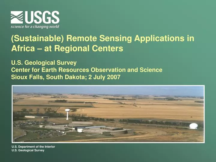
(Sustainable) Remote Sensing Applications in Africa – at Regional Centers U.S. Geological Survey Center for Earth Resources Observation and Science Sioux Falls, South Dakota; 2 July 2007. (Sustainable) Remote Sensing Applications in Africa – at Regional Centers. Overview:

E N D
(Sustainable) Remote Sensing Applications in Africa – at Regional CentersU.S. Geological Survey Center for Earth Resources Observation and Science Sioux Falls, South Dakota; 2 July 2007
(Sustainable) Remote Sensing Applications in Africa – at Regional Centers • Overview: • Remote Sensing applications at Regional Centers • who, why, what, where • Landsat Data Distribution and Applications at Regional Centers • EROS activities and collaboration with Regional Centers • Recommendations to USAID (and/or other donors) • supporting (sustainable) RS applications in Africa • supporting RS applications at Regional Centers • SERVIR implementation and/or replication for Africa? • geospatial data/information/DSS portals at Regional Centers
(Sustainable) Remote Sensing Applications in Africa – at Regional Centers • Prepared by: • James Rowland and Eric Wood, SAIC at USGS EROS • Larry L. Tieszen, USGS EROS • Contributors: • Kate Lance, Editor SDI-Africa Newsletter • Erick Khamala, RCMRD (Kenya) • Blessing Siwela, SADC RRSU (Botswana) • Alkhalil Adoum, FEWS NET at AGRHYMET (Niger) • Molly Brown, SSAI at NASA GSFC • Objective: • To recommend to USAID a feasible and most appropriate approach to support sustainable remote sensing applications at African Regional Remote Sensing Centers
(Sustainable) Remote Sensing Applications in Africa – at Regional Centers • Background: • USAID requested USGS EROS to assess current and potential capabilities at regional RS centers in Africa to use RS applications for societal benefit • USAID also requested an evaluation of the utility of a web-based data, information, and DSS portal such as SERVIR for Africa (currently implemented for Mesoamerica) • “Remote Sensing Applications” refers to: • the acquisition, maintenance and archiving, dissemination and distribution, and analysis and interpretation of RS data, as well as the integration of interpreted data with other spatial data and models, to address various needs, and includes training in all aspects of the above.
Landsat 2000 Regional Remote Sensing Centers – Africa Partners Regional Centre for Mapping of Resources for Development Landsat 1990s AGRHYMET Regional Centre GeoCover (1970s, 1980s, 2000) + Landsat archive (EROS) + MODIS/ ASTER/ SRTM data Internet 2 Internet 2 SADC Regional RS Unit Landsat (1970s/90s, 2000); MODIS NDVI • EROS Support to Regional Remote Sensing Centers • Collection/dissemination of RS data • Landsat, SRTM, MODIS, ASTER • Training in applications of RS data Supported by USAID, USGS-LRS, EROS
Regional Remote Sensing Centers – Africa Partners AGRHYMET Regional Centre (CILSS) Regional Centre for Mapping of Resources for Development SADC Regional Remote Sensing Unit Contracting members Non-Contracting member
AGRHYMET Regional Center • Landsat data for 1972, 1986, and 2000 distributed to: • CILSS countries: Non-CILSS countries: • Niger: Inst Géo du Niger (IGN) Benin: Centre Nat de Télé (CENATEL) Unité Tech d’Appui (UTA) Dir des Forêts et Res Naturelles • Burkina: PNGIM Ghana: RS & GIS Lab (U of Ghana Geog) Inst Géo du Burkina (IGB) Environmental Protection Agency • Chad: Laboratoire de Farcha Guinee Conakry: Dir Nat de la Météo (DNM) • Gambia: Nat Environ Agency (NEA) Service Nat des Sol (SENASOL) • Mali: Laboratoire de l’IER Nigeria: RECTAS (Reg Ctr for Training) • Mauritania: CNARDA Nat Center for RS • Sénégal:Centre de Suivi Eco (CSE) Togo: Dir Nat de la Météo (DNM) • Projects/universities: specific images Inst Togolais de Recherche Agricole Côte d’Ivoire: Ctr Nat de Télé et d’Info Géog (CNTIG)
Southern African Development Community (SADC) Regional Remote Sensing Unit (RRSU) Landsat distributed Oct 2004 – Oct 2005 • Formal request for data via e-mail or hardcopy forms • Cost recovery for media (DVD/CD) and delivery service – no charge for labor ETM: 6 recipients, 394 scenes TM: 5 recipients, 142 scenes MSS: 3 recipients, 187 scenes
Applications AGRHYMET Center • Case studies of LU/LC change: • Western Gambia; Kolokani, Mali; Mare aux Hippos, Burkina; Mahayi, Niger • SRTM images from USGS for West Africa countries: • DEMs used in many applications at AGRHYMET Center • DEMs will be distributed to all Sahel countries Regional Remote Sensing Unit (RRSU) • Geology maps • Ground water surveys • Change detection, map updating, biodiversity conservation mapping • Management of game reserves • Input to state of the environment reports
Workshop for interpretation of Landsat data at AGRHYMET Regional Center, Niamey, Niger
RCMRD Gums and Resins of the GHA Mau Forest Cover Change Loita Forest Cover Change Landsat data interpretation: Regional Centre for Mapping of Resources for Development, Nairobi, Kenya
[ Template - Presentation Title] [Template - Presenter] Integration of multiple donors and projects in a training workshop initiated by the US-Italy-FAO to integrate land cover projects with the UNEP/FAO-GLCN. Applications of Coarse to High Resolution Satellite Imagery for Land Productivity Assessment & Management Bamako , Mali 6 - 17 February, 2006
Activities with Regional Centers (cont.) Applications of High to Coarse Resolution Satellite Imagery for Land Productivity Bamako, Mali; February 6-17, 2006 • The West Africa Land Cover Applications Program (WALCAP) and Bamako outcome and recommendations (February 17, 2006) • Set up thematic national multi-disciplinary teams that address various applications of RS (e.g LU /LC, Change and Applications) • Identify and deploy sustainable means of servicing requests to the USG and specialized agencies (USAID, USGS, DOS, NASA, etc) to provide assistance in enabling regional and sub-regional centers in Africa (e.g., CGIARs, Regional RS Centers) to develop distribution systems to disseminate Corona, Landsat, and other satellite data • Identify and deploy appropriate means to service requests to the USG and specialized agencies (USAID, USGS, DOS, NASA, etc) to provide recent satellite data (2005/06/07), including Landsat, ASTER, and SRTM 30-m derived products for Africa in the framework of the ongoing/emerging initiatives for biodiversity, conservation, food security and economic development, and NRM purposes, as important component of sustainable development • Need for all relevant players (donors, African Governments, RS scientists in Africa, etc.) to build strong synergies for designing and implementing RS activities in West Africa and Africa in general
(Sustainable) Remote Sensing Applications in Africa at Regional Centers • Funded by USAID, UNEP, USGS • Assessing remote sensing data / applications • Acquisition; maintenance and archiving; distribution • Interpretation and analysis (applications) • Working with • Erick Khamala, RCMRD (Nairobi, Kenya) – working at EROS UNEP • Blessing Siwela, SADC RRSU (Gaborone, Botswana) – working at EROS UNEP • Alkhalil Adoum, FEWS NET at AGRHYMET Regional Center (Niamey, Niger) • Kate Lance (ITC); Molly Brown (NASA GSFC); Dan Irwin (NASA MSFC) • Needs Assessment • Regional Center ICT infrastructure • Needs of constituent countries • Training needs • Site visit to southern Africa • RRSU; Botswana Meteorological and Agricultural Services; Botswana Universities • CSIR (Meraka); SAC; EIS-Africa; Space Science & Technology (SAAO), SunSpace • Online questionnaire (EIS-Africa, GSDI-Africa; Regional Centers; contacts)
(Sustainable) Remote Sensing Applications in Africa at Regional Centers Recommendations • Secure (or nurture) government buy-in, such that African governments provide national budgets for geo-information • Institutionalize capacity building to support proficiency in the development of RS applications and awareness of new applications • Improve data availability, access, and distribution (i.e., inexpensive or no-cost) • Expand and extend data and information portals • Develop/enhance RS capacity and RS curricula at universities and other tertiary institutions in Africa • Improve access to regional and international RS communities • Improve infrastructure for data access, analyses, and distribution – information technology, hardware, software • Strengthen regional coordination • Plan for future activities
(Sustainable) Remote Sensing Applications in Africa at Regional Centers 1. Secure (or nurture) government buy-in, such that African governments provide national budgets for geo-information • Develop products & conduct workshops to convince Decision-Makers & Policy-Makers of the importance, relevance, & appropriateness of RS technology for specified applications • Expansion of the role that EROS has played in the development & implementation of workshops conducted jointly with the RCs • Specialization of workshops for each region as appropriate • Develop products & workshops targeting specific applications (e.g., RCMRD joint workshop with UNEP/NBO to support national-scale UNEP State of the Environ. Reports) • Expansion of the role that EROS has played in supporting RCs to define specific applications, develop training material and datasets, and conduct workshops • Expand FEWS NET training on use of RS products for monitoring the growing season for EW of food insecurity and/or vulnerability • Information workshops on emergency response and the International Charter “Space and Major Disasters” • Support participation in Conferences such as CODI-V and CODI-Geo, which address Africa-wide development (and subsequently support) of NSDI
(Sustainable) Remote Sensing Applications in Africa at Regional Centers – Recommendations 2. Institutionalize capacity building to support proficiency in the development of RS applications and awareness of new applications • Support projects that result in building hands-on RS capacity in government institutions (via collaboration among RCs, U.S. institutions, and national governments), based upon competitive proposals to USAID • Fund competitive proposals from RCs, regional institutions, and/or government institutions which apply RS technology for societal benefit (in collaboration with USGS and NASA, as appropriate) • Support national collaborators in significant research and development (R&D) projects (e.g., NASA and SAFNet, NASA/UMD/USDA/WRI/etc and CARPE [Central African Regional Program for the Environment]) • Support refresher courses, and/or specific application courses, via RCs, universities, and partners (e.g., USGS EROS, ITC, etc) • Support training on the International Charter “Space and Major Disasters” for emergency/disaster response
(Sustainable) Remote Sensing Applications in Africa at Regional Centers – Recommendations 2. Institutionalize capacity building to support proficiency in the development of RS applications and awareness of new applications (cont.) • Support RCs in conducting in-country training workshops for member States (as opposed to training at RCs) • More cost-effective, more nationals benefit from the training (as opposed to bringing 1 or 2 nationals to the RCs for training) • Support exchange between universities in the region and RCs (e.g., for hands-on applications via internships) • Already implemented in some cases with universities in the same city as the RC (e.g., Nairobi universities with RCMRD), but should be implemented for other universities in the region • Explore/support distance learning and video conferencing • video conferencing capacity for RCs and country partners • capacity for RCs and partners to access training opportunities in the U.S. (USGS EROS, universities) • capacity for country partners to access training at RCs
(Sustainable) Remote Sensing Applications in Africa at Regional Centers – Recommendations 3. Improve data availability, access, and distribution (i.e., inexpensive or no-cost) • U.S. institutions provide no-cost data • USGS provide mid-decadal Landsat data (to extend GeoCover Landsat coverage for c.2005) and MODIS products (e.g., FEWS NET processed NDVI) • NASA provide ASTER data and MODIS products (e.g., real-time fire incidence, fire scar, land cover, red tide, as appropriate for the region) • NOAA provide climate data (e.g., 7-day Global Forecast System (GFS) data, FEWS NET processed daily rainfall estimates) • Develop database management capacity/capability at RCs • See recommendation 7 (“Improve Infrastructure…” – 3rd bullet)
(Sustainable) Remote Sensing Applications in Africa at Regional Centers – Recommendations 4. Expand and extend data and information portals • Based on this report, and previous surveys and analyses, RCs finalize data and information needs for their respective regions • Support the RCs to convene meetings with key partners (e.g., USGS EROS, FAO [GeoNetwork], NASA [“SERVIR”, etc.], ESA [GMFS, GeoNetcast]) to define web portal implementation (including roles of each institution) • Technical implementation of regional data / information portal (i.e., address minimum hardware, software, bandwidth needs) • Develop web portal user interface and structure • Populate web portal with regionally relevant data and information (and maintain updated data/information) • Existing regional data and information • Development of regional and national baseline datasets • Development of additional international/regional datasets that will feed the RCs’ websites.
(Sustainable) Remote Sensing Applications in Africa at Regional Centers – Recommendations 4. Expand and extend data and information portals (cont.) • Emphasize decision support system / information (DSS) • Existing (food security) products (e.g., FEWS NET products: Executive Overview Briefs, regional bulletins, weekly weather hazards assessments, Food Security Outlooks, etc) • Development of specific regional and national-scale DSS products (using locally-implemented tools such as FEWS NET’s GeoWRSI, NOAA CPC’s Rainfall Estimation algorithm and USGS Improved Rainfall Estimation, Climate Outlook Forum Forecast Interpretation Tool, etc.) • Involvement in, or development of, Africa-wide and regional newsletters (e.g., SDI-Africa, etc.) • Build capacity at the RCs in development & maintenance of portal data and information • Support awareness creation and capacity building in the RCs member States in the use and maintenance (e.g., updating) of the regional portals • Develop (or link to) introductory & web-based resources on use of RS for different applications • Support website promotion/publicity via workshops in major fora in Africa (e.g., CODI, AfricaGIS 07, AARSE 08, etc.).
(Sustainable) Remote Sensing Applications in Africa at Regional Centers – Recommendations 5. Develop/enhance RS capacity and RS curricula at universities and other tertiary institutions in Africa • Establish agreements with software vendors for the provision and maintenance of GIS, RS and image processing software for universities • Increase access to e-libraries • Strengthen R&D at African universities, based on USAID priorities • Support scholarship programs for post-graduate students for studies at African universities (e.g., at RS programs in Africa) • Support U.S.-based scientists on sabbatical to African universities (e.g., 1 to 3 months) • Explore/support distance learning • video conferencing capacity for African universities (with collaborating U.S. universities) • Strengthen collaborations with outside institutions (e.g., with other universities, RCs, USGS EROS, NASA, ITC)
(Sustainable) Remote Sensing Applications in Africa at Regional Centers – Recommendations 6. Improve access to regional and international RS communities • Support participation in regional/international meetings (RCs and universities) • Support participation/membership in professional organizations • Involvement in CEOS (Committee on Earth Observation Satellites)? 7. Improve infrastructure for data access, analyses, and distribution – information technology, hardware, software • Establish agreements with software vendors for the provision and maintenance of RS and image processing software • Support increased bandwidth (e.g., paying for more service, installation of VSAT capacity, support efforts for trunk line [i.e., Internet 2]) • Improve servers and storage capacity (e.g., purchase, maintenance, and systems and data administration capacity)
(Sustainable) Remote Sensing Applications in Africa at Regional Centers – Recommendations 8. Strengthen regional coordination • RCs to regional institutions (e.g., better linkages to universities, institutions, and partners in the region) so that RCs are informed on all RS applications/needs in the regions • RCs should be knowledgeable of, and understand, current and potential RS applications at all institutions in their respective regions, in order to coordinate appropriate workshops and training to share RS knowledge/applications, and meet training needs • Strengthen/encourage collaboration among RCs; formalize network among RCs in Africa • Support workshops in major fora in Africa (e.g., CODI, AfricaGIS 07, AARSE 08) 9. Plan for future activities • Implement monitoring and evaluation of RS programs/applications • Conduct further evaluation on: • RS business models • Sustainability • Role of other regional institutions, associations, partnerships (e.g., CGIARs, UNEP, EIS-Africa, NEPAD, etc.) • Develop an implementation plan with 5- to 10-year goals and milestones
Special Considerations for AfricanRegional Centers • The continent is large with numerous constituent countries & languages • There is no continental or even regional responsibility for standards • Internet and other communications are difficult or slow • Can we expedite or ensure Internet 2 access? • Funding for centers is not secure • Centers and scientists are only poorly networked professionally • Infrastructure needs to be developed • How do we address the needs of 3 (4 or 5) centers? • Can donors integrate the regional centers and network them effectively? • Impoverishment, climate change, AIDS, expanding populations, and political instability exacerbate development challenges • Sustainability is the issue, not technology nor even understanding
(Sustainable) Remote Sensing Applications in Africa at Regional Centers – SERVIR portal? • SERVIR replication / implementation? • Existing websites at each of the RCs • http://www.rcmrd.org • http://www.agrhymet.ne • http://www.sadc.int/fanr/aims/rrsu • Existing clearinghouses at RCs (GeoNetwork, built on USAID- funded, USGS-implemented, EMIS clearinghouse) – strengthen existing portals • http://41.206.33.118/geonetwork/srv/en/main.home • http://www.sadc.int/geonetwork • Much data and information exist for Africa environmental monitoring – coordinate with data providers (ADDS, NOAA, FAO, NASA, EU, etc.) • https://earlywarning.usgs.gov/adds • https://www.fews.net • http://www.fews.net/execbrief • http://www.pecad.fas.usda.gov/glam.cfm • http://www.pecad.fas.usda.gov/cropexplorer • EUMETCast GEONETCast
(Sustainable) Remote Sensing Applications in Africa at Regional Centers – SERVIR portal? • SERVIR replication / implementation? • Recognize limitations (and variations) in ICT policies and infrastructure in Africa (and within regions) • Bandwidth to Africa, and within Africa, is major constraint to RS data distribution – needs to be enhanced • Lack of LAN and WAN (many government ministries with none at all) • RCs take lead, and coordinate with other institutions (e.g., USGS, FAO, NASA, etc.) • Current Regional Center websites should be focal nodes through which other data/portals accessed • Levels of regional/institutional network functionality vary greatly (e.g., CILSS, SADC, RCMRD / ICPAC) • Varying levels of government buy-in • Significant resources required to support portals for large regions • Vast spatial extent, with environmental diversity (climate, agriculture, etc.) • Great diversity of cultures (language, religion, etc.) within regions
(Sustainable) Remote Sensing Applications in Africa at Regional Centers – SERVIR portal? • SERVIR replication / implementation? • Currently government ministries/etc often sell data to generate income for institutional sustainability • Re-design web-based portal along income-generation strategy rather than expecting free data through centralized (or distributed) portal • Develop/strengthen data & information portals for each major region of sub-Saharan Africa, in conjunction with ARGHYMET, RCMRD, RRSU • If resources limited, begin with support at RCMRD • Propose real, useful, currently implementable realizations of RS applications for decision-makers / policy-makers • Recognize need, and potential, for SADC regional support from S.Africa • S.Africa skills and expertise • Need for ownership of projects and results • Consider greater involvement of, and reliance upon, CGIAR consortium
(Sustainable) Remote Sensing Applications in Africa at Regional Centers – Recall • Impoverishment, climate change, AIDS, expanding populations, and political instability exacerbate development challenges • Sustainability is the issue, not technology nor even understanding