Download
1 / 25
250 likes | 381 Views
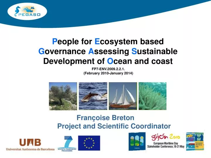
P eople for E cosystem based G overnance A ssessing S ustainable Development of O cean and coast. FP7-ENV.2009.2.2.1. (February 2010-January 2014). Françoise Breton Project and Scientific Coordinator. Main goal of PEGASO.

E N D
People for Ecosystem basedGovernance Assessing Sustainable Development of Ocean and coast FP7-ENV.2009.2.2.1.(February 2010-January 2014) Françoise Breton Project and Scientific Coordinator
Main goal of PEGASO • Support to ICZM Protocol for the Mediterranean • Supporting similar developments for the Black Sea
Support to ICZM Protocol ICZM Protocol adresses : • Land and sea ecosystems, • coastal and maritime planning including tourism, energy, etc., • impacts of Climate change and adaptation, • in a multi sectoral /holistic approach
Objectives of PEGASO • Bridging science, stakeholders and decision makers • Establishing co-working process, building and sharing common knowledge • Support Southern capacity for addressing by themselves the implementation of the Protocole • Building onexisting capacities to develop common novel approaches and practices for coastal, marine and maritime realms
Policy driven • Consistent with the frameworks of the Barcelona and Bucharest Conventions • Continuing ICZM efforts • Supporting new Marine Strategy Directive Framework • Supporting maritime policy • Links with Directive habitat, CC and adaptation etc, • In phase with H2020
Partners The foundation and strength of PEGASO is that it is built upon the long-term work of a number of key national and international institutions dedicated to regional assessment of the Mediterranean and Black Sea basins in recent decades 24 partners : MAP/PAP-RAC/Plan Bleu, IUCN, PSCBS, MEDCOAST, UNEP-GRID, IOC-UNESCO Univ and Instituts: JRC, UK, BE, FR, SP, IT, GR, MA, AL, LE, EG, TR, RO, UKR
ICZM Governance Platform • The core of the project is the development of an ICZM Governance Platform that : • will enable the science and end user communities to share data and information, explicit their needs • test sustainability tools developped in PEGASO in case studies, • build a common understanding on priority issues and institutional perspectives affecting the coastal zones and the sea of the two regional seas.
ICZM Governance Platform The ICZM Governance platform includes all the PEGASO partners (scientists and decision makers), the Stakeholders of the CASES and the end-user Committee. Establishment of the ICZM Med and BS Strategic Panel , to reinforce ICZM platform future
The SDI The ICZM Platform will be supported by the development and implementation of a spatial data infrastructure (SDI) for the Mediterranean and Black Seas. PEGASO will Construct/support a network of local geonodes coordinated together around a common interactive web portal
Why a SDI? The Spatial Data Infrastructure willshare spatial data in an interactive way: • To advance in the concept and implementation of an interactive atlas of the Mediterranean and Black Seaswork with ICAN and Envirogrid (FP7) • Sharing capacity: • South-south/ • north-North and • South-North
A tool box for assessment PEGASO will refine and further develop efficient and easy to use tools for making sustainability assessments in the coastal zone. • Spatial Indicators (expressing statistics into space) • Accounting tools/LEAC development for the Mediterranean and Black Sea coasts and sea (as far as possible) • Making of simple scenarios with participatory methods for decision making • Developing basis for a Med and BS Atlas • Coastal and maritime spatial planning guidelines
Previous experiences • DEDUCE Indicator fact sheet (as a tool) Area of build up land www.deduce.org
Wetlands LEAC: Urban sprawl in the province of Venice, 1990-2000, cells of 1 km x 1 km – wetlands in the background Despite possible threats from sea level rise and the permanent ecological problems of the lagoon due to agriculture eutrophicating surpluses, urban and infrastructures development has continued in the province of Venice.
Tools built in PEGASO validated by the ICZM Governance platform and CASES Tourism is so important that it needs to be analysed together with ICZM: -Tourism in islands: mobility and accessibility - -Climate change, vulnerability and adaptation Fisheries and aquaculture as ecosystem services Harbors and navigation routes Habitats and Biodiversity loss (AMP, Wetlands…)
1st challenge: Make the shared ICZM Governance Platform work • Expressing needs and testing tools, • Co-working: identifying priorities, support data gathering, revising outputs for assessment , etc • Discussing consensuated responses Work on progress since Venise KO (12-14 April): -Building Platform ToR with our 24 stakeholders -Participative discussions (at KO, on the PEGASO web portal) -Preparing the stocktake for ICZM Protocol (how countries are equipped for) with the platform next meeting 24 September: Slovenia, Coast day, meeting of all NFPs of Protocole 1st CASE meeting in the Nile Delta, in October 2010 (working guidance)
Identification of wetlands not declared at Ramsar 2d challenge:Extending assessment to the whole Mediterranean and Black Sea: from CLC to GlobCorine • Agreement between ESA and EEA to produce a CORINE like product from –GlobCoverGlobCorine (Desembre 2009) • Coastal mapping of coastal areas of both seas will be done using GlobCorine • Agreement EEA/ESA to make a mapping of South Med wetlands and LEAC with GlobWetland Sources: GlobCover2005 – courtesy European Space Agency Ramsar database – courtesy Wetlands International
3rd challenge: Produce a sea bottom maps and test LEAC at sea • IBCM (above) & partner data: currently being harmonised • Sediment data for other basins from EMODNET
Work in progress • Data inventory • Data gathering at bassin scale • Planned meeting with JRC, EEA and ESA on available data for the Med and BS, ToR to be prepared • ToR in preparation with ENVIROGRID, SPICOSA, MESH, etc to access and exchange data • Preparation of the geonode implementation
4th challenge: Mapping coast-sea uses for maritime activities developping Planning guidances • Mapping shipping routes, the anchorage areas, the nature protection areas (Natura 2000, RAMSAR sites and World heritage), the gas and oil exploitations & connecting pipelines, the fishing areas and telecom cables. • Shipping intensity in the Northern Adriatic in 2005 • (DAMAC project, Marche Regione, Italy 2007) • From SIGLA • links river-coast-sea, identifying how uses impact ecosystems and sea scape • From PlanCoast project
PEGASO Diffusion PEGASO has been already presented at: -EU Maritime Day 2009 in Rome (19-20 May 2009)(Joe Borg interested in having a follow up) -PAP-RAC, INFO RAC and Blue Plan meeting (25-29 May 2009) in Zagreb -MEDSTAT Course at UAB (24-26 June 2009), BCN with Marroco, Algeria, Tunez and Israel -NFP meeting of MAP in Athens (6-9 July 2009) (Lybia, Albania, Algeria, Slovenia, Italy, Spain, Israel have demonstrated interest) -ICZM EU Expert Group meeting in Brussels, 7 september 2009 PEGASO flyer v.1
Towards a Mediterranean Cluster • Links with Union Pour la Mediterranée (UpM • Presentation of PEGASO to the EU Maritime Day, May 2010 in Gijon, Spain • Links with H2020 and EEA • UAB and the Spanish government are planning to fund a coastal, marine and maritime ICZM cluster in the Mediterranean and Black Sea with enlargement to Africa. PEGASO is the first step. • Ensuring maintenance of PEGASO network, practices and products after the porject ends
Gracies Muchas gracias Moltes gràcies Eskerrik Asko Moitas gracias DziekujeMerci beaucoup Mного БлагодаряObrigado Paldies ΕυχαριστώTack Thank you very much Dank u Hvala Köszönöm Dekuj Multumesc Dakujem Danke Takk Aitäh Grazzi Kiitos GrazieDêkuji Cпаси́бо Tesekkur ederim شُكْرًاDieuredieuf for additional information please contact: francoise.breton@uab.cat