Download
1 / 29
290 likes | 419 Views
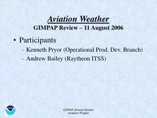
GIMPAP Annual Review. GSD Progress and Plans Dan Birkenheuer, Yuanfu Xi, Seth Gutman 11 August 2006. Main Goals. Better understand GOES-12 -10 and now GOES-11 error, improve data GSI Gradient assimilation, coordinate with JCSDA and GOES RRR No JCSDA funding this year. TAC Guidance.

E N D
GIMPAP Annual Review GSD Progress and Plans Dan Birkenheuer, Yuanfu Xi, Seth Gutman 11 August 2006
Main Goals • Better understand GOES-12 -10 and now GOES-11 error, improve data • GSI Gradient assimilation, coordinate with JCSDA and GOES RRR No JCSDA funding this year
TAC Guidance • Continue research to utilize gradient information • Continue evaluation of sounder products using GPS moisture information • Coordinate with ORA-STAR and CIMSS on sounder product evaluations • Try to resolve GOES-10 versus GOES-12 GOES PW moisture biases
Outline – Major Accomplishments • Outliers • Calibration and validation (cal-val) • Why is TX so moist? • AIRS data into the GPS comparison system • GOES 10/11 switchover – it could have been done better • RAOB problems
Outliers • Wrote paper on GOES moist bias and RMS (8, 11, and IHOP 2002) • Tim Schmit recommended we look at specific outliers to glean insight as to why problems occur • Identified numerous outliers some shown here for illustration.
Not always does a high bias indicate a bias. Here is a high bias that shows a slight Mis-match in data time can have a drastic affect on statistics. Perceived bias
The cloud problem seems most difficult for this station. Several stations along this cloud boundary have moist problems but the one highlighted had the worst problems.
This is the associated time series of the above station. It was tracking pretty well up until things went out of control, then they came back into control.
Here is the time series over Platteville CO with the Denver RAOB data, the arrows point out the outliers in both GOES 12 and 10, and 12 is much greater. Note this is a very dry situation so the relative differences are quite large. 12 10 RAOB & GPS
Cal-Val using GPS moisture • Moisture check is easy and cheap (ground based system) • Moisture is a trace gas in the retrieval algorithm • If the trace gas is not correctly represented, the thermal retrieval could be poor.
Cal-Val continued • As will be shown, GPS comparisons have rendered a number of useful facts relevant to GOES operations • Outliers (already shown) • Regional problem areas • Early detection of satellite change • Raob problems (affects GOES 2 ways) • GPS is being terminated
Why is TX so moist? • Identified by Jaime Daniels • Identified by us • Loop
RAOB Problems • RAOBs are used in models therefore they affect the GOES retrieval first guess • The new GPS sondes have been shown to have difficult to characterize problems. • RAOBS are often used to assess GOES moisture products, if they are “wrong” how can we get a good assessment?
GPS-TPW detecting a sudden degradation in the new GPS-RAOBs that started launching around 4/24.
GPS is in jeopardy • Not funded for the next 2 FY (07 & 08) • Tracks microwave radiometer very well as demonstrated at the ARM cart site. It might be a few fractions of mm dry. • Over 100 stations in the US alone and more world wide. • Can be used for GEOS calibration of various satellite data systems.
GOES 10 and 11 • GOES 11 went into service 20 June • Detected bias and RMS increases by 7 July • By late July errors exceeded GOES 12 • Did resolve one issue, that dry meteorology in the west has been responsible for the good performance of GOES 10
A definite moist trend is observed in GOES W after the switch to GOES 11
AIRS data into the GPS Comparison System • Studies with “ideal” AIRS data and GPS have already been performed (reference) • We need to look at “operational” AIRS products to see if day in and day out generation are of same high quality • Obtaining data from Walter Wolf • Converting from HDF4 to netCDF for input to our web-based comparison system
THE VALIDATION OF AIRS RETRIEVALS OF INTEGRATED PRECIPITABLE WATER VAPOUR USING MEASUREMENTS FROM A NETWORK OF GROUND BASED GPS RECEIVERS OVER CONTIGUOUS UNITED STATES M. K. Rama Varma Raja, Seth I. Gutman, James G. Yoe, Larry M. McMillin, And Jiang Zhao
Publications/Travel • BIRKENHEUER, D., 2006: Direct use of satellite horizontal gradients in variational analysis. Invited poster, CIRA Spring Science Symposium, 16-17 May 2006, Ft. Collins, CO. • Gutman S. I., D.L.BIRKENHEUER, C. Barnet, J. Daniels, M.K. Rama Varma Raja, T. J. Schmit, and J. G. Yoe 2006: Validation of GOES-R Total Precipitable Water Products Using GPS derived TPW, Invited Poster, GOES_R Users Conference, Broomfield, CO May 1-3, 2006. • BIRKENHEUER, D., 2006: The Initial Formulation of a Technique to Employ Gradient Information in a Simple Variational Minimization Scheme, OAR-GSD Tech Memo - 32, 22pp. • BIRKENHEUER, D., 2006: Direct use of satellite horizontal gradients in variational analysis. 14thConference on Satellite Meteorology and Oceanography, Amer. Meteor. Soc., Atlanta, GA, 8pp. • Hiemstra, C.A., G.E. Liston, R.A. Pielke, Sr., D.L. BIRKENHEUER, S.C. Albers 2006: Comparing Local analysis and prediction system (LAPS) assimilations with independent observations. (Accepted for publication in Weather and Forecasting, April 2006) • BIRKENHEUER, D., and S. Gutman, 2005: A comparison of the GOES moisture-derived product and GPS-IPW during IHOP. J. Atmos. Oceanic Tech. 22, 1840-1847.http://laps.noaa.gov/cgi/birk.pubs.cgi
?Future? • If GPS remains, continue with AIRS comparisons • Regardless of GPS, continue to utilize gradient information in analysis. • If no GPS, look to A-train and for improved cloud information to tune GSD cloud analyses for better overall data assimilation especially from satellites.