Download
1 / 20
200 likes | 318 Views
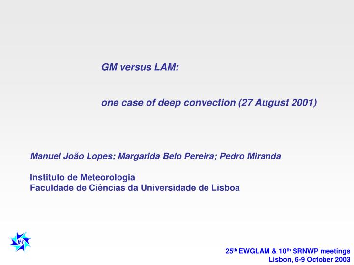
GM versus LAM: one case of deep convection (27 August 2001) Manuel João Lopes; Margarida Belo Pereira; Pedro Miranda Instituto de Meteorologia Faculdade de Ciências da Universidade de Lisboa. 25 th EWGLAM & 10 th SRNWP meetings Lisbon, 6-9 October 2003. Motivation:

E N D
GM versus LAM: one case of deep convection (27 August 2001) Manuel João Lopes; Margarida Belo Pereira; Pedro Miranda Instituto de Meteorologia Faculdade de Ciências da Universidade de Lisboa 25th EWGLAM & 10th SRNWP meetings Lisbon, 6-9 October 2003
Motivation: • 1. Comparison of ECMWF and ALADIN/Portugal precipitation forecasts in deep • convection situations • 2. Verification of the usefulness of some of the diagnostic tools once calculated • from the analysis and from forecast of each model • 3. Determination of thresholds of stability indices for deep convection • 4. Application of the diagnostic tools on weather forecast Centre of Instituto de • Meteorologia
Three important physical mechanisms for convection: • - Convective Instability • - Orography • Humidity convergence in low troposphere Stability Indices Convective Instability Index= 0.5(e2m + e925 ) - e500 (possible threshold for deep convection : 10ºC) Jefferson Index= 1.6sw850 – 0.5 (T700 – Td700) – T500 - 8 (possible threshold for deep convection: 32ºC) This thresholds of indices were determined by Belo Pereira in her first study of deep convection.
Radar image at 1520UTC: reflectivity (dBZ) regions with stronger convective activity Observed lightening strikes for the period 00-23UTC of 27 Aug 2001 (Information from site http://www.wetterzentrale.de/topkarten/) regions with weaker convective activity The precipitation was associated to MCS that developed in the North of Portugal and to smaller scale convective cells located in the western part of Central region of Portugal. Most of the convective precipitation occurred in 1 hour interval.
Forecasted precipitation on the 12UTC run of 26 August - ECMWF and ALADIN Step H+30 -> Accumulated precipitation in 6 h : 12-18UTC (contour interval is 1 mm) ECMWF model ALADIN model Observations 24 32 10 9 13 7 2 1 • (Note: The contour of Peninsula Iberia shows a displacement to NE of 0.25º (approximately) due to a software problem ! ) • Both models underestimate the precipitation but ALADIN forecasts a larger area of precipitation extended to the southeast of Spain. According to the convective developments observed on NOAA satellite images, this appears to be realistic. • Neither ECMWF or ALADIN forecasts the precipitation associated to the convective cells that actually developed in some regions of the Centre of Portugal (Estremadura, Ribatejo and Beira Litoral) during this period.
1 2 26 Forecasted precipitation on 12UTC run of 26 August - ECMWF and ALADIN Step H+36 -> Accumulated precipitation in 6h : 18-24UTC (contour interval is 1 mm) ECMWF model ALADIN model Observations • ECMWF forecasts no rain in Portugal !!! • But ALADIN forecasts more than 10mm in the area of northeast border of Portugal warning forecasters to the possibility of heavy showers in this region . The reflectivity pattern in MAX(Z) reveals the presence of reflectivity cores with reflectivity levels above 54 dBZ which may indicates strong convective activity. • However, ALADIN underestimates the occurred precipitation (for instance, forecasts only 3mm in Vila Real area, where it was recorded 26mm/1h at 19UTC).
Forecasted precipitation on 00UTC run of 27 August - ECMWF and ALADIN Step H+18 -> Accumulated precipitation in 6h : 12-18UTC (contour interval is 1 mm) ECMWF model ALADIN model Observations 24 32 10 9 13 7 2 1 • The ALADIN forecast from 00UTC is better than the one of 12UTC (from the day before), because the area and the amount of forecasted precipitation is more in accordance with the observations. For instance, in the region of Serra da Estrela it forecasts 11.5mm in this period alerting to the possibility of heavy showers. • On the contrary, ECMWF forecast from 00UTC is worse than the one of 12UTC (from the day before), because the amount of forecasted precipitation is more underestimated in the North of Portugal. • Again, both models forecast no rain in the western part of Central region of Portugal ( Beira Litoral, Estremadura and Ribatejo).
Forecasted precipitation on 00UTC run of 27 August - ECMWF and ALADIN Step H+24 -> Accumulated precipitation in 6h : 18-24UTC (contour interval is 1 mm) ECMWF model ALADIN model Observations 1 2 26 • ECMWF forecasts no rain over Portugal, during this period. • For this period, the ALADIN forecast from 00UTC is also better than the one of 12UTC (from the day before), because the area and the amount of forecasted precipitation is more in accordance with the observations.
Physical mechanisms to convection in ECMWF analyses at 12UTC Vertical vel. () at 700hPa (contour interval is 0,2 Pa s-1) 700 < 0 700 > 0 700 < 0 Dif. Vorticity advec.(1000-500hPa): contour interval is 0,310-11s-2Pa-1 Temperature advec.(850hPa): contour interval is 0,3ºC/h Radar image at 12UTC: reflectivity (dBZ) According with the surface analysis of ECMWF the situation is determined by an high pressure located in Ireland and a low (1013hPa) located southwest of Portugal. The differential vorticity advection contributes for upward motion in the areas of convection, except in the region of river Tejo Valley. The warm advection (WA) contributes for upward motion in the areas of convection except in the Northwest of Portugal. WA
Physical mechanisms to convection in ECMWF analyses compared with ALADIN analyses : 12UTC -> Humidity convergence ALADIN model ECMWF model Radar image at 12UTC: reflectivity (dBZ) Specific humidity converg. at 850hPa (contour interval is 210-4g kg-1s-1) • The analysis of ALADIN are consistent with ECMWF analysis but there are some important differences in terms of humidity and stability: • In the areas with convection, the analysis of humidity convergence (at 850hPa) of ECMWF indicates convergence in the North and the South of Portugal but indicates divergence in the Central part of Portugal. • The analysis of humidity convergence of ALADIN indicates convergence in the areas with convection over Portugal and indicates divergence in Alentejo, where there was no convection at this time.
Physical mechanisms to convection in ECMWF analyses compared with ALADIN analyses : 12UTC -> Instability Radar image at 12UTC: reflectivity (dBZ) ECMWF model ALADIN model Convective Instability Index (contour interval is 1ºC) • Considering threshold of 10ºC for convective instability index and comparing with observations (precipitation + radar), analysis of ECMWF and ALADIN are reasonable in the northern regions where was already convection. • None of the analysis indicates conditions for deep convection in the region of river Tejo Valley and in the western part of the South regions where convection also occurred. • ECMWF analysis indicates also conditions for deep convection in the area of the Atlantic Ocean adjacent to the northwest of Portugal, where convection occurred only after 15UTC. • In both models, the forecast for 12UTC are not significantly different from the analysis of 12UTC. However, humidity convergence forecasts are much worse. For instance, in the areas with convection, ECMWF forecasts divergence for southern regions while, in the areas with no convection, ALADIN forecasts convergence for the region of Serra da Estrela.
Physical mechanisms to convection in ECMWF forecast compared with ALADIN forecast : H+15 Forcing to upward motion Radar image at 15UTC: reflectivity (dBZ) ECMWF model ALADIN model Vertical velocity () at 700hPa (contour interval is 0,2 Pa s-1) • ECMWF forecasts upward vertical motion (at 700hPa) in the whole country. • In the regions with convection, ALADIN forecasts upward vertical motion except in the western part of the Central region of Portugal.
Physical mechanisms to convection in ECMWF forecast compared with ALADIN forecast : H+15 -> Humidity Convergence Radar image at 15UTC: reflectivity (dBZ) ECMWF model ALADIN model Specific humidity converg. at 850hPa (contour interval is 210-4g kg-1s-1) • In the regions with convection, ECMWF forecasts humidity convergence (at 850hPa) in a part of the northern region and divergence in the western part of the Central region. • ALADIN forecast indicates humidity convergence in the regions where convection occurred.
Physical mechanisms to convection in ECMWF forecast compared with ALADIN forecast : H+15 Observed lightening strikes for the period 00-23UTC of 27 Aug 2001 -> Instability ECMWF model ALADIN model Radar image at 15UTC: reflectivity (dBZ) Convective Instability Index (contour interval is 1ºC) • Both models forecasts convective instability in the northern region where MCS developed. • ECMWF also forecasts convective instability in the area of the Atlantic ocean adjacent to the northwest of Portugal, where convection occurred after 15UTC. • ECMWF forecast indicates conditions for deep convection (e.g., the presence of upward vertical motion, humidity convergence and instability) in a part of the northern region where convection developed. • ALADIN forecast indicates conditions for deep convection except in the western part of Central region of Portugal
Physical mechanisms to convection in ECMWF forecast compared with ALADIN forecast : H+15 -> Instability Radar image at 15UTC: reflectivity (dBZ) ECMWF model ALADIN model Jefferson Index (contour interval is 1ºC) In both models, the forecasted of Jefferson index leads to the same results as the forecast of convective instability index (e.g., the forecasted area with conditions for deep convection is identical).
Physical mechanisms to convection in ECMWF forecast compared with ALADIN forecast : H+18 Forcing to upward motion Radar image at 18UTC: reflectivity (dBZ) ECMWF model ALADIN model Vertical velocity () at 700hPa (contour interval is 0,2 Pa s-1) • In the regions with convection, ECMWF only forecasts vertical upward motion in the area of the northeast border of Portugal. • ALADIN forecasts upward vertical motion in whole area with convection.
Physical mechanisms to convection in ECMWF forecast compared with ALADIN forecast : H+18 -> Humidity Convergence ECMWF model ALADIN model Radar image at 1750UTC: reflectivity (dBZ) Specific humidity converg. at 850hPa (contour interval is 210-4g kg-1s-1) Specific humidity convergence at 850hPa (isoline of 210-4g kg-1s-1) • ECMWF only forecasts humidity convergence in the area of the northeast border of Portugal. • ALADIN forecasts humidity convergence in the regions with convection, except in a small area of the northeast regions.
Physical mechanisms to convection in ECMWF forecast compared with ALADIN forecast : H+18 -> Instability ECMWF model ALADIN model Radar image at 1750UTC: reflectivity (dBZ) Convective Instability Index (contour interval is 1ºC) • Both models forecasts convective instability in the northern regions where MCS developed. • While ECMWF forecasts only indicates conditions for deep convection (e.g., the presence of the three mechanisms to convection) in the area of the northeast border of Portugal, ALADIN forecast indicates the same conditions in the regions with convection except in a small area of the northeast regions.
Physical mechanisms to convection in ECMWF forecast compared with ALADIN forecast : H+18 -> Instability ECMWF model ALADIN model Radar image at 1750UTC: reflectivity (dBZ) Jefferson Index (contour interval is 1ºC) • In the regions with deep convection, ECMWF forecast of Jefferson index doesn’t indicates instability in the area of Serra da Estrela. • ALADIN forecast for this index includes the whole region with deep convection. • Again, in both models the forecasted of Jefferson index leads to the same results as the forecast of convective instability index (e.g., the forecasted area with conditions for deep convection is identical).
Conclusions: • Both models underestimate precipitation but ALADIN forecasts more than 10mm/6h in the periods 12-18UTC and 18-24UTC, which in convective situations can mean heavy showers due the concentration of precipitation in very short periods. • Opposite to ECMWF, ALADIN improves its performance from 12UTC run of 26 August to 00UTC run of 27 August increasing the amount and the area of precipitation in agreement with the highest instability region (e.g., the region with heavy showers and thunderstorm). • Nevertheless, none of the models forecasts precipitation associated to convective cells which actually developed in some areas of the Central and Southern regions of Portugal. This may be possible for instance if the LSM and LAM underestimate the instability in these regions or if the convective phenomena were completely filtrated due to their scale. • In this situation, the use of diagnostic tools was very important to indicate conditions of deep convection, specially in the case of ECMWF where the forecast of rain didn’t give an alert. • We hope that with the validation of diagnostic tools and the adjustment of the indices thresholds the regions with deep convection can be better defined.