Download
1 / 14
140 likes | 253 Views
Comparison of Sediment Loading and Non-Point Source Pollution in the Mission and Aransas Rivers. Jena R. Campbell Department of Marine Sciences November 29, 2007. Mission-Aransas NERR. 30 miles NE of Corpus Christi 27 th Reserve Designated May 3, 2006 Only one in Western Gulf of Mexico

E N D
Comparison of Sediment Loading and Non-Point Source Pollution in the Mission and Aransas Rivers Jena R. Campbell Department of Marine Sciences November 29, 2007
Mission-Aransas NERR • 30 miles NE of Corpus Christi • 27th Reserve • Designated May 3, 2006 • Only one in Western Gulf of Mexico • Area for research in a natural setting • UTMSI lead State Agency • Mission River • Mission Bay • Aransas River • Copano Bay http://www.utmsi.utexas.edu/nerr/index.htm
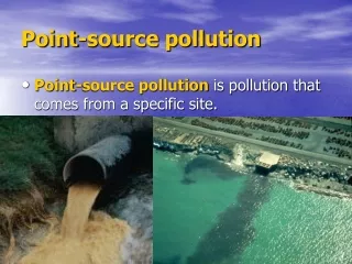
Purpose • Original idea – too ambitious • Compare between Mission and Aransas Rivers • Land Cover • Sediment Loading • Nitrogen • Phosphorus • Lead • Zinc • Pollution & Sediment accumulation downstream
Data Sources • Exercise 5 • NHDPlus • Catchments • Flowlines • National Land Cover Data Set • Hydroseek
High Intensity Development Aransas Catchments Mission Catchments
Row Crops Aransas Catchments Mission Catchments
Deciduous Forests Aransas Catchments Mission Catchments
Grassland Aransas Catchments Mission Catchments
Predictions • Aransas River • More Nitrogen • More Sediment • Reason – land cover (agriculture, high intensity) • Mission River • Less Pollutants • Less Sediment • Reason – land cover (forests, grassland)
Future Work • Add lead, zinc, and phosphorus measurements to the map • Sediment and pollutant accumulation farthest downstream • Make concentration grid based on the run-off in each catchment • Exercise from 2005 • Compare actual measurements to acceptable thresholds