Download
1 / 13
130 likes | 237 Views
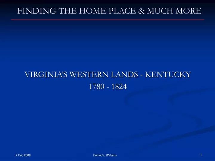
FINDING THE HOME PLACE & MUCH MORE. VIRGINIA’S WESTERN LANDS - KENTUCKY 1780 - 1824. 2 Feb 2008. Donald L Williams. FOUR QUESTIONS I WILL TRY TO ANSWER. WHAT EVENTS IN VIRGINIA-KENTUCKY AFFECTED LAND RECORDS? WHAT CAN YOU ACCOMPLISH BY SEARCHING LAND RECORDS?

E N D
FINDING THE HOME PLACE & MUCH MORE VIRGINIA’S WESTERN LANDS - KENTUCKY 1780 - 1824 2 Feb 2008 Donald L Williams
FOUR QUESTIONS I WILL TRY TO ANSWER • WHAT EVENTS IN VIRGINIA-KENTUCKY AFFECTED LAND RECORDS? • WHAT CAN YOU ACCOMPLISH BY SEARCHING LAND RECORDS? • WHAT TYPES OF LAND RECORDS CAN BE FOUND AND HOW DO THEY RELATE? • HOW CAN COMPARING LAND RECORDS WITH CENSUS, DEEDS AND FAMILY EVENTS BREAK THROUGH WALLS? 2 Feb 2008 Donald L Williams
THE CONTEXTA BRIEF HISTORY OF KENTUCKY & LAND • VIRGINIA’S WESTERN LANDS (1669 – 1772) • SETTLING THE WESTERN LANDS (1773 – 1792) • KENTUCKY AFTER STATEHOOD – (1792 – 1824) See handout for recommended Readings 2 Feb 2008 Donald L Williams
Fm Neal Hammond’s, Virginia’s Western War VIRGINIA’S WESTERN LANDS (1669 – 1772) 1669 - French explorer Rene-Robert Cavalier on the Ohio River 1750 - Christopher Gist, commissioned by the Ohio Land Co. preceded Dr. Thomas Walker’s expedition into Kentucky via the Gap he named Cumberland Pass; Walker entered Virginia’s western lands as agent for The Loyal Land Company; these men led the beginning of what was to become the U.S. western movement that lasted well into the early 1900s 1752 – Virginia’s western lands from Washington’s 1752 Journal Donald L Williams
VIRGINIA’S WESTERN LANDS (1669 – 1772) 1756 – After many skirmishes and English defeats, French & Indian War officially begins - ends 1763 1763 – Proclamation by England forbids their colonists from settling beyond the Appalachians eliminating prior land grants (Ohio Land Co & The Loyal Land Co); Elisha Walden led group of Long Hunters into southeastern “Kentucky” area 1765 – 1770 The Boones hunt Virginia’s western lands along with other Long Hunters 1771 – James Donelson’s surveying expedition; Earl of Dunmore arrives in Williamsburg as new governor of Virginia, began encouraging land speculators 1772 – Fincastle County, Virginia formed (included eastern Kentucky); George Rogers Clark surveys in Kentucky for the Grand Ohio Company which had proposed a colony to be named Vandalia ranging as far west as the Kentucky River, it failed to materialize Donald L Williams
SETTLING THE WESTERN LANDS (1773 – 1792) 1773 - Attempts to settle the western lands (Kentucky) begin; Thomas Bullitt, from Fauquier Co, VA, leads surveying expedition to Falls of Ohio area, finds salt lick that became Bullitt’s Lick, nearby river named Salt; James Harrod, Isaac Hite & McAfee brothers were part of expedition; McAfee brothers, William, Robert & Samuel hire Hancock Taylor to make surveys along upper Salt River (Town Fork); Boone brings families to attempt first settlement, son, James Boone killed, turns back; crisis year for settlers south of Ohio River as Shawnees & others attack 1775 - Revolutionary War begins; Colony of Transylvania purchases large area of Virginia’s western lands (Kentucky), from Cherokees, threatening many prior claims; Virginia voided it in 1778; Boone party blazes Wilderness Road (about 200 miles); Boonesborough founded; Isaac Cox’s party at future site of Cox’s Station; Fincastle Co. surveys of about 40,000acs, at Falls of the Ohio completed, including the future site of Louisville, Kentucky; Kentucky County created next year 1777 - One of bloodiest years in Virginia’s frontier history; only 121 fighting men in central Kentucky; ammunition, powder & salt in short supply; Virginia legislature allows legitimate settlers 400acs & later required payment of two pounds sterling plus fees for title Fm Neal Hammond’s, Virginia’s Western War Fm Neal Hammond’s, Virginia’s Western War Donald L Williams
SETTLING THE WESTERN LANDS (1773 – 1792) 1778 - Virginia grants the right of preemption of 400acs to all who settled in KY before 1 Jan 1778 & an additional 1,000acs if improvements had been made, also tracts could be acquired by military bounties & by treasury warrants 1779 - Virginia Land Commissioners arrive in Kentucky area to try to sort out conflicting claims 1780 - Many old pioneers with earlier land claims return to them; a long, bitterly cold “Hard Winter;” Wilderness Trail route took ten to twenty days in addition to the one or two weeks to reach the beginning point at the Block House in Virginia and further time to more distant points at destination; the Ohio River route took one to two weeks to reach Redstone on the Monongahela, then to Limestone (Maysville) took one week to five weeks depending on conditions (longer to the Falls) with an additional one to four weeks overland to interior, central Kentucky; Jefferson, Fayette & Lincoln Counties, Virginia formed from Kentucky County; Baird’s town (Bardstown) settled; Virginia sold treasury warrants redeemable for 1,925,796 acres of Kentucky area lands in one year; in spring 300 boatloads of settlers arrive at Falls of Ohio Fm Ellen Eslinger’s, Running Mad for Kentucky Fm Neal Hammond’s, Virginia’s Western War Donald L Williams
SETTLING THE WESTERN LANDS (1773 – 1792) 1782 - Indian attacks peak but will continue another decade or more 1784 - Virginia ceded the Northwest Territory (Ohio, Indiana, Illinois, Michigan, Wisconsin, Minnesota) to the Congress of the United Colonies; Nelson County formed 1785 - Tens of thousands of men, women & children pouring into Kentucky; buffaloes disappeared from central Kentucky because of over-hunting; the towering canebrakes that covered much of central Kentucky slashed & burned for farm land 1786 - Virginia made last effort to get northern Indians to seek peace, it failed & the U.S. took control of the campaign against the Indians 1787 - The Northwest Territory created by the U.S. Congress 1790 - U.S. Census: Virginia counties in what became Kentucky 73,677 population is 10% of VA; Jefferson Co. 4,765, Nelson Co. 11,315 John Filson’s, 1783 Map (first with name Kentucky) Donald L Williams
FILSON’S 1783-1784 MAP OF CENTRAL KENTUCKY Famous because “first map naming Kentucky” Limestone (Maysville) primary Ohio River route entry to central Kentucky At least 11 maps, 1752-1782, of area preceded Filson Kentucky River next most common River entry to central Kentucky Falls of the Ohio (Louisville) third entry point Boonesborough Salt River Harrods Town Coxs Station Bards Town Cumberland Gap primary overland route entry to central Kentucky Donald L Williams
KENTUCKY AFTER STATEHOOD (1792 – 1820) 1792 - Kentucky becomes 15th State; Isaac Shelby first Governor 1794 - American military victories against Shawnees accelerated migration into Kentucky, Tennessee & Ohio 1795 - Landed gentry of Virginia and their attorneys’ land activities led the Kentucky Legislature to overhaul the court system, creating Circuit Courts and mandating that two of the three judges riding each circuit be unschooled in the law; Green River settlement act opened vast area south of the river offering 200ac preemptions; Bullitt County formed following year 1797 - Surveyor General of Kentucky told Legislature, “that land grants for approximately 24 million acres had been issued however the state contains only half that acreage” (Kentucky was actually much larger); the threat of backcountry folks’ loss of homesteads forces Legislature to pass additional land reforms 1798 - Kentucky funded improvements to complete the conversion of the Wilderness Trail to a road 1799 - Travel by the Ohio River continues to be the route of choice for a majority moving west; Kentucky population 221,000 in 1800c Donald L Williams
FINDING HOME PLACE – A CIRCULAR PROCESS • KENTUCKY TAX LISTS • VIRGINIA & KENTUCKY LAND GRANTS • KENTUCKY DEEDS • PLOTTING METES & BOUNDS SURVEYS – A Primer 2 Feb 2008 Donald L Williams
FINDING THE HOME PLACE: A CIRCULAR PROCESS KENTUCKY TAX LISTS • The Lists were for an annual State Revenue Tax, beginning 1792 • Paid Commissioners were appointed in each County to record all the property & prepare four copies – Commissioner, County Clerk, Sheriff & State Auditor – thus, one was sent out of the county VIRGINIA-KENTUCKY LAND GRANTS (PATENTS) • Virginia land grant process evolved from 1614 to the formation of the Land Office in 1779 • Virginia and Kentucky Land Patents (patent is the colonial word for grant) represent the conveyance, from the two Commonwealths to individuals or groups; first individual grant was for service in the French & Indian War • The Grant Surveys were in Metes & Bounds and typically referred to adjoining Land Grants Donald L Williams
FINDING THE HOME PLACE: A CIRCULAR PROCESS KENTUCKY DEEDS • Virginia-Kentucky Deeds date from the first conveyances of Land Granted tracts to the second generation owners – late 1770s • The Deed’s Surveys were in Metes & Bounds and quite often referred to the original land grant as well as adjoining land grants and may later help you finalize the Land Grant location WHY CIRCULAR ? • The Census will indicate the county in which to start search • The annual Tax Lists will indicate how long in a county, when to look for deeds, watercourses and who held the original Land Grant • The Land Grants can be plotted to provide the location or approximate location if it was only a portion of the Land Grant • The Deed may confirm the original Land Grantee and common corners and lines and where person lived when sold which can lead you to another county to restart the process Donald L Williams