Download
1 / 1
10 likes | 147 Views
Digital Elevation Model (DEM) Resolution and Stream Extraction Using Terrain Openness Josh Page and Dr. Wei Luo, Northern Illinois University, Department of Geography, 2010. Introduction

E N D
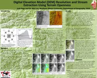
Digital Elevation Model (DEM) Resolution and Stream Extraction Using Terrain Openness Josh Page and Dr. Wei Luo, Northern Illinois University, Department of Geography, 2010 Introduction In the past, traditional flow direction-based methods for extracting streams from DEM data often fell short of accurately representing the spatial variation of the degree of surface dissection. Newer morphology-based algorithms use appropriate terrain attributes to capture these variations by extracting stream systems as the parts of the surface which contain concave upward morphology. The purpose of this study is to examine one such attribute (terrain openness) for stream extraction and the effect of DEM resolution. Results DEM data ranged from coarse resolution(1km) to finer resolution(37m). The radial limits(L in number of cells) for different resolution DEM(R in meters) were set so that L×R is the about same for easy comparison. E.g., for 1km resolution DEM, L is 5 cells (L×R =5000m) and for 37 m resolution DEM, L is 135 cells (L×R=4995m). Initially, the threshold for openness was set as various multiples of the standard deviation above the mean for the entire study area. This resulted in an unrealistic increase in the amount of streams that were extracted for finer resolution DEMs[Figure 4]. To correct this, the threshold was set as multiples of standard deviation above the mean for only the area with openness > 90⁰. In other words, the mean and standard deviation were obtained after a conditional procedure was used to mask out openness values ≤ 90⁰. With this correction, more accurate and realistic results of streams were extracted[Figure 5]. All these new extractions are very similar due to the radial limits being multiples of each other. Process Using Geographic Information Systems software, the DEM maps of the different resolutions were used as the basis for the openness calculations. This raster data was exported as an ASCII text file of unique coordinates and values. This ASCII file was then put through a FORTRAN program that calculated the resulting openness. Figure 3a shows a computed openness image of the DEM of the study area[Figure 3b]. Note in Figure 3a, the light values represents valleys with angles ≥ 90⁰ whereas the darker parts are ridges. The openness greater than a threshold value, along with surface flow direction, can then be used to extract stream systems. Multiple openness calculations were conducted with different resolutions and radial limits to examine their effects on the final product of the extracted streams. When the radial limit is lowered to a few meters for the finer resolutions, the data is flooded with noise. Figure 6a shows the difference between a large radial limit and a shorter one. This important fact shows that as the radial limits increase in length, the detail in the streams is quickly lost. Figure 6b shows the four different resolutions (yellow-coarse, purple-fine) at the radial limit of a multiple of 5 cells. This shows a good representation of how similar the detail of the extracted streams can be with the right type of parameters. Openness Terrain Openness is defined as the average of zenith angles along the eight cardinal directions within a specified neighborhood[Figure 1]. The size of the neighborhood provides a natural built-in length scale, as the number of cells, denoted as the radial limit ‘L’ and once the maximum azimuth angle ‘D’ is chosen then the positive openness can be determined at point ‘A’[Figure 2]. Because positive openness, or ‘above ground’ openness, at a certain grid point is confined by its surrounding topography, it thus in essence represents the terrain curvature at that point. All of the calculated data is constrained to the radial limit ‘L’, which tends to emphasize topography differently. Smaller features are highlighted more with small radial limits, and larger features are shown more easily when larger radial limits are used. SummaryIn general, finer resolution DEMs will generate more detailed streams. However, the coarser DEM data can be partially compensated by using smaller radial limits in calculating the openness. Also, the finer DEMs’ streams can get overbearing and create noise which can be compensated by using larger radial limits. References Mary Brandel (July 6, 1999). 1963: The Debut of ASCII: CNN. Accessed 2010-12-04 Moore, J.G., and R.K. Mark (1992) Morphology of the island of Hawaii, GSA Today, 2(12):257-259 and 262. Ryuzo Yokoyama, MlchloShlrasawa, and Richard J. Pike (2002) American Society for Photogrammetry and Remote Sensing, Vol. 68, No. 3, March 2002, W. Luo and T.F. Stepinski (2008) Identification of Geologic Contrast from Landscape Dissection Pattern: An Application to the Cascade Range, Oregon, USA. Geomorphology, 90, p90-98


