Download
1 / 21
210 likes | 216 Views
Updates on the West Coast IOOS partners, including SCCOOS, CeNCOOS, NANOOS, and the West Coast Ocean Data Network Meeting in Costa Mesa, CA.

E N D
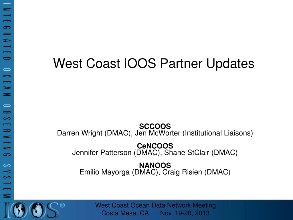
West Coast IOOS Partner Updates SCCOOS Darren Wright (DMAC), Jen McWorter (Institutional Liaisons) CeNCOOS Jennifer Patterson (DMAC), Shane StClair (DMAC) NANOOS Emilio Mayorga (DMAC), Craig Risien (DMAC) West Coast Ocean Data Network Meeting Costa Mesa, CA Nov. 19-20, 2013
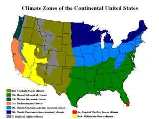
West Coast IOOS Three RAs span continental U.S. West Coast: NANOOS NW Association of Networked Ocean Observing Systems Oregon and Washington CeNCOOS Central and Northern CA Ocean Observing System Point Conception north to Oregon border SCCOOS Southern California Coastal Ocean Observing System Point Conception south to Mexico border
West Coast IOOS Data Continuous Real-Time Data Surface Currents Ocean Buoys Glider Profiles Coastal Monitoring Ocean Forecasts And more…
West Coast Connections • SCCOOS + CeNCOOS + NANOOS MOU • MOU September 2011 • Not isolated regions (CCLME) • Connected by oceanographic applications, policy and data systems WCGA and WC OOS MOU Credit: Lubchenko / Menge, OSU
OOS Participation in WCODP Activities • Representatives on WCODP Action Coordination Team • NANOOS: Jan Newton, CeNCOOS: Jennifer Patterson • West Coast IOOS and WCGA Fellowship • Mentored by Todd Hallenbeck (WCODN) and Emilio Mayorga (NANOOS), hosted by SCCOOS. Supported by staff and scientists from all 3 RA's. Data services by CeNCOOS and NANOOS. • Fellowship Products • Transforming our data into tertiary products and formats that meet the needs of the WCODP user community of policy and decision-makers • Integrate data from SCCOOS, CeNCOOS and NANOOS into West Coast wide maps • Data currently available in the WCODP catalog and data viewer
West Coast IOOS Data Accomplishments /Projects Collaborative Accomplishments IOOS Catalog Registration West Coast Ocean Acidification - Data Collection, Display and Services
Collaborative IOOS Work - Services registered in IOOS Catalog SCCOOS, NANOOS and CeNCOOS datasets registered in new national IOOS catalog Coastal Data Information Program 677 Directional Wave buoy datasets Registered via THREDDS Data Service. 7
Ocean Acidification: IPACOA Application http://www.ipacoa.org
NANOOS: Climatology data, NVS App • Highlights: • New monitoring sites and data products • More robust geospatial web services via GeoServer; can support partners • Metadata (WAF) hosting • Other data services • New NVS user apps Includes several new data products spanning the West Coast http://nvs.nanoos.org/Climatology
NANOOS: Climatology data, NVS App Tides, currents, weather, forecasts, etc http://nvs.nanoos.org/Boaters
West Coast Collaboration Example Ocean Acidification Instrument Installed Carlsbad Aquafarm “Burkalator” installed Installed and in testing Data Dissemination: Soon Other Burkalators installed in CeNCOOS and NANOOS regions as part of West Coast program 11
SCCOOS - Areas of Biological Significance (ASBS) Explorer 13
CeNCOOS Data Accomplishments /Projects • Data Portal Interface • Integrated map viewer • Catalog search • Data services / Download • directly downloadable in csv format • Adv. download interface for netcdf, matlab, R, GIS, and more More Datasets California Harmful Algal Bloom Forecasts Additional sensor data, model forecasts, satellite data, MPAs, habitat maps Continued UI development, subsurface data visualization, moving platform data (gliders, ships), and more Website Development – Updated site released by Dec. data.cencoos.org
CORDC Surface Currents – Monthly Averages data.cencoos.org
CeNCOOS Use of WCODP Provide CeNCOOS Data to WCODP Harvesting Setup pathways allowing data records to be harvested by WCODP Metadata Adding and reformatting metadata records for automated harvesting Integration with WCODP catalog and viewer
IOOS take on the value in the WCODN View WCODP as a platform for ‘advertising’ our data to user groups with a policy and decision-making focus on a West Coast scale Introduce people to our data and encourage data discovery and integration Network is a way to engage with these user communities to help determine their needs for future data product development Potential data discovery tool, points us to data sets that we’d like to add to our own portal/integrated products
Thank You IOOS www.ioos.noaa.gov NANOOS www.nanoos.org CeNCOOS www.cencoos.org SCCOOS www.sccoos.org 13