Download
1 / 33
330 likes | 470 Views
Overview. Importing data from generic raster files Creating surfaces from point samples Mapping contours Calculating summary attributes for polygon features using a grid theme Cross tabulating areas Querying across multiple grid themes Calculating neighborhood statistics

E N D
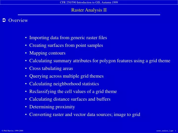
Overview Importing data from generic raster files Creating surfaces from point samples Mapping contours Calculating summary attributes for polygon features using a grid theme Cross tabulating areas Querying across multiple grid themes Calculating neighborhood statistics Reclassifying the cell values of a grid theme Calculating distance surfaces and buffers Determining proximity Converting raster and vector data sources; image to grid
Importing data from generic raster files ArcView can import several different generic raster data formats ASCII raster file format binary raster file format USGS Digital Elevation Model (DEM) raster file format US DMA DTED raster file format very common format free data source
input drive and directory file type input file name • Importing data from generic raster files
output gridname output drive &directory • Importing data from generic raster files
Creating surfaces from point samples generation of a complete surface from incomplete point samples interpolation between and beyond individual sample points better estimation of surface value in locations near sample points several different interpolation methods available assumption of gradual change of value across landscape “GIGO:” Garbage In, Garbage Out
continuous surface discrete sample points • Creating surfaces from point samples
Creating surfaces from point samples spline inverse distance weighting (IDW)
Mapping contours finds adjacent cells of the same value converts linear arrangement of raster cells to vector lines creation of individual contours as simple graphics, or creation of shapefile of contours for entire grid theme user control of base contour and contour interval valuable due to low amount of digitized contour lines for remote areas
Mapping contours individual contour added as graphic
Mapping contours group of contours created as shapefile
Calculating summary attributes for polygon features using a grid theme(Summarize zones) defines a zone of cells based on a single polygon or group of polygons of similar value. creates statistical summary of zone summary table summary chart
select grid theme containing variable to summarize select polygon field to define zones of cells • Calculating summary attributes for polygon features using a grid theme(Summarize zones)
chart created displaying statistic from input grid based on polygonal zones select statistic (from input grid) to chart • Calculating summary attributes for polygon features using a grid theme(Summarize zones)
Cross tabulating areas creates a “zonal intersection” of grid or polygon themes output is a table 1st input theme creates records (1 record for each unique value) 2nd input theme creates fields (1 field for each unique value) table values are area measurements of combinations of zones valuable technique for change detection
record theme spatial extent field theme cell size input theme setup • Cross tabulating areas
Cross tabulating areas record theme (stands) field theme (soils)
Querying across multiple grid themes the Map Query is rapid and easy results may be as good as vector overlay multiple grids can be simultaneously queried(whereas only 2 vector themes can be compared)
standard GUI query builder interface result is a new temporary grid • Querying across multiple grid themes
Calculating neighborhood statistics • “focal” statistical functions • moving focus window calculates statistics for all cells within focus • output value is written to central cell in output grid • statistical functions: Minimum Maximum Mean Median Sum Range Standard Deviation Majority Minority Variety
Reclassifying the cell values of a grid theme “mapping” of input and output data values increase or decrease the number of classes (zones) reclassification (one-to-one relationship of input and output; categorical data) slice (“lumping” into classes; continuous data) change classification type (e.g., nominal to ordinal)
nominal ordinal • Reclassifying the cell values of a grid theme: reclassification
Reclassifying the cell values of a grid theme: slice site index, reclassified with slice into equal-interval classes
Calculating distance surfaces and buffers similar to buffering with vector data creates a continuous distance surfacerather than a discrete bounded polygonal area distance measured from input theme featuresor grid cells
group of selected cellsas source theme each output cell’s value is the distance to the closest input cell • Calculating distance surfaces
source theme can be point, line, or polygon each output cell’s value is the distance to the closest input vector feature • Calculating distance surfaces
Creating buffer surfaces a combination of distance calculation and map calculation . . .
Creating buffer surfaces . . . reclassification, . . .
Creating buffer surfaces . . . analysis masking, and map calculation.
output cells have the value of the closest input feature (raster or vector) output value is selected from input theme table • Assigning proximity good for asking “what is the closest feature to another feature?”
Converting raster and vector data sources it is possible to convert raster vector always a loss or generalization of shape support for line, polygon grid in ArcView
select output name & directory • Converting raster and vector data sources: grid to polygon
select theme table attribute for output grid cell value • Converting raster and vector data sources: polygon to grid