Download
1 / 23
230 likes | 388 Views
GONDWANA BASINS-POTENTIAL STORAGE SITE FOR CO 2. By G. Mukhopadhyay Geological Survey of India. CARBON SEQUESTRATION. CAPTURE. TRANSPORTATION. INJECTION OF CO 2 INTO FAVORABLE SITES. POST INJECTION MONITORING. Produced oil or gas. Overview of Geological Storage Options. Injected CO 2.

E N D
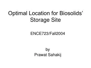
GONDWANA BASINS-POTENTIAL STORAGE SITE FOR CO2 By G. Mukhopadhyay Geological Survey of India
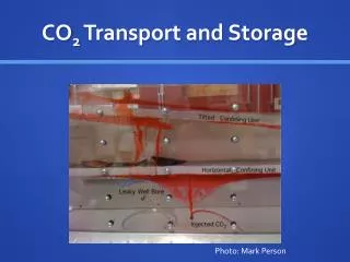
CARBON SEQUESTRATION CAPTURE TRANSPORTATION INJECTION OF CO2 INTO FAVORABLE SITES POST INJECTION MONITORING
Produced oil or gas Overview of Geological Storage Options Injected CO2 Stored CO2 Basalt Deep seated coal seam as a a sink of CO2 with enhanced CBM recovery Depleted oil and gas reservoirs Deep saline aquifers- onshore Enhanced oil and gas recovery Deep saline aquifers- offshore
FIELD EXPERIENCE- US • Allison CO2-ECBM Pilot • Location- San Juan basin • Producer well—16 • Injector well—4 • Average depth to top coal - 3100 feet • Permeability 100md • Initial pressure – 1650 psi • Temp. – 160oF OBSERVATION • CO2 injection improved methane recovery from 77% to 95% of OGPI • Ratio of injected CO2 to produced CH4-3:1
FIELD EXPERIENCE- CANADA • Alberta Research Council • Location- Fenn BIG Valley, Alberta Province • Producer well—1 • Injector well—1 OBSERVATION • injectivity improves with continued CO2 injection and methane production
FIELD EXPERIENCE- JAPAN • Operated by JCOAL • Location- Yubari site, Ishikari Coalfield • Producer well—1 • Injector well—1 OBSERVATION • Gradual increase of injection rate –may be due to decrease in effective stress near injection well area. • 90% of injected CO2 stored in coal seams • Gas production increase with CO2 injection, and dropped after injection was stopped- indicating ECBM effect
Tertiary coalfields Bangladesh Barapukuria Dighipara Lower Gondwana Coalfields Jamalganj
Coal Resource base Proved Indicated Inferred 99.06 b.t 120.18 b.t 38.14 b.t 257b. t. (up to 1200m depth) Proved Indicated Power grade coal: 155.8 b. t. (60%) (up to 1200m depth) Inferred Quality-wise break-up of Non-coking coal (87%) (12.6%)
156.6 67.6 18.9 14.2 0 – 300m 0 – 600m 300m – 600m 600m – 1200m Indian coal resource is expressed in terms of : Depth Range from surface (in billion tonnes) Jharia CF only Resource up to 1200m depth considered for National Inventory.
COALFIELDS OF INDIA RAJMAHAL – BIRBHUM MASTER BASIN Important geological locales for storage 1. large aerial extent. 2. Coal seams ( > 50m) occur beyond 1.0 Km depth. 3. Thick Cap rock. 4. Close proximity with the thermal power stations and other industrial activities. RANIGANJ BASIN WARDHA –PRANHITA – GODAVARI BASIN CBM blocks are allotted in these coalfields.
LITHOSTRATIGRAPHY OF SOME GONDWANA BASINS OF INDIA Godavari 0.0 Km Deccan Trap Damodar Rajmahal Chikiala Supra-Panchet Kota Rajmahal Trap Dubrajpur Panchet Up. Kamthi Panchet Raniganj 2.0 Km Maleri Raniganj Barren Measures Md. Kamthi Barren Measures Lr. Kamthi Barakar Barren Measures Barakar Barakar Talchir Talchir Talchir 4.0 Km SEAL ROCK COAL SEAM
A RCM-9 888.83 Salanpur-A Seam(61.97m) 967.75m B
GEOLOGICAL SECTION ALONG A - B Chalbalpur-Mahismura RCM-9 PROJECTED BOREHOLE RCM -9 Barakar coal occur beyond 1200m 888.83 61.97 m 967.75m 2500m
A RCM-9 Area having Coal seams below 1200m B Prognosticated coal resource below 1200m depth – 30BT (Area700sq km;Av. Coal thicness – 30m)
GENERALISED STRATIGRAPHIC SUCCESSION OF DEEPER PART OF RANIGANJ BASIN ( A CASE HISTORY OF MULTI-LAYER TRAP AND RESERVOIR ROCKS) 0 Km SUPRAPANCHET (coarse clastic) 600m PANCHET (Intercalated shale-sandstone) 600m RANIGANJ (coal bearing sand-dominated) upto 1100m 1 Km Barren Measures (shale dominated -upto 90%) 800m Barakar (coal bearing sand-dominated) upto 800m 2.5 Km CAP ROCK CO2 storage capacity – 600 MT RESERVOIR ROCK COAL SEAMS TALCHIR FORMATION
GEOLOGICAL MAP OF RAJMAHAL- BIRBHUM COALFIELDS G E O L O G I C A L M A P O F R A J M A H A L A N D B I R B H U M C O A L F I E L D S J H A R K H A N D A N D W E S T B E N G A L 8 7 ° 0 0 ' 8 7 ° 1 0 ' 8 7 ° 2 0 ' 8 7 ° 3 0 ' 8 7 ° 4 0 ' 8 7 ° 5 0 ' 8 8 ° 0 0 ' 1 0 0 1 0 k m 2 5 ° 2 0 ' 2 5 ° 2 0 ' P i r p a i n t i R S . S a h i b g a n j K a h a l g a o n B a r a 2 5 ° 1 0 ' 2 5 ° 1 0 ' R a j m a h a l R S . M a h a g a m a P h u l b e r i a 2 5 ° 0 0 ' 2 5 ° 0 0 ' S i m r a B e r h a i t B a r h a r w a H a n s d i h a 2 4 ° 5 0 ' 2 4 ° 5 0 ' P a k u r 2 4 ° 4 0 ' 2 4 ° 4 0 ' U R M A - P A H A R I T O L A A m r a p a r a 2 4 ° 3 0 ' 2 4 ° 3 0 ' G o p i k a n d a r C H A U D H A R - G A R I A P A N I K a t i k u n d O n g o i n g b l o c k s S a l d a h a C o m p l e t e d b l o c k s P r o p o s e d b l o c k 2 4 ° 2 0 ' 2 4 ° 2 0 ' D u m k a S A H A R P U R - J A M A R P A N I L E G E N D A l l u v i u m R a m p u r h a t K U L K U L I D A N G A L - R a j m a h a l F o r m a t i o n S I T A S A L B O R T A L A - M A T H U R A P U R U p p e r G o n d w a n a s 2 4 ° 1 0 ' 2 4 ° 1 0 ' F a t e h p u r L o w e r G o n d w a n a s R A M P U R - M A L L A R P U R K h a r g r a m M e t a m o r p h i c s 8 7 ° 0 0 ' 8 7 ° 1 0 ' 8 7 ° 2 0 ' 8 7 ° 3 0 ' 8 7 ° 4 0 ' 8 7 ° 5 0 ' 8 8 ° 0 0 ' Pachami DPD-2 HURA 755.10 64.04 m Trap thickness increases generally towards east Maximum Trap thickness recorded –370m in southeastern part of the basin 940.45m
Purnia Kathar Raiganj TECTONIC MAP OF RAJMAHAL BASIN ( EASTERN PART ) 88° 26° CDN-40 Y Dinajpur 1500m Munger – Ridge Marginal Fault Sahibganj Malda – Kishanganj Fault INDEX 25° Rajmahal Fault Alluvium X HURA Rajmahal Trap Lower Gondwana JangipurFault Metamorphics Borehole Murshidabad 88°
GEOLOGICAL SECTION ALONG X – Y IN RAJMAHAL BASIN X Y Malda – Kishanganj Fault CDN - 40 Tertiary 25m Dubrajpur 50m Panchet 653m 755.10 64.04 m 1220m Reservoir Area 3000sq km (appx) Av. Coal thickness 30m Prognosticated Resources – 135 BT CO2 storage capacity 5000 MT 1 Km 940.45m Raniganj Barren Measures Barakar 2 Km Talchir 150 Km 0 Km 3 Km
0 Km 2 Km 4 Km GENERALISED STRATIGRAPHIC SUCCESSION OF GODAVARI BASIN ( A CASE HISTORY OF DOUBLE-LAYER TRAP AND RESERVOIR ROCKS) DECCAN TRAP- upto 250m GANGARAMPUR / CHIKIALA –sand dominated- 150m KOTA –mostly sand dominated- 500m UPPER KAMTHI coarse clastic dominated- 600m MALERI / MIDDLE KAMTHI –mud dominated - upto 700m LOWER KAMTHI – sand dominated BARREN MEASURES-intercalated sand-mud-upto 500m 3 Barakar (coal bearing sand-dominated) upto 350m 2 BARAKAR - Sand dominated 350m TALCHIR –sand-mud intercalation- upto 500m Area 300sq km Av. Coal thickness 5m Prog. Resource 20 BT CO2 storage capacity 800MT CAP ROCK RESERVOIR ROCK BARAKAR COAL SEAMS TALCHIR FORMATION
Coal basin Reservoir Av. Coal Resource Capacity area(sq km) (m) (BT) (MT) Raniganj 700 30 30 600 Rajmahal 3000 30 135 5000 Godavari 3000 5 20 800 Total 6700 185 6400
COAL WING OF GSI WITH ITS RICH AND ROBUST GEOSCIENTIFIC DATABASE ( SURFACE AND SUBSURFACE) ON ALL COAL BASINS OF INDIA AND HAVING ADEQUATE EXPERTISE IN FIELD AND LABORATORY STUDIES IS CAPABLE TO DELINEATE THE SUITABLE SITES FOR CO2 STORAGE IN DEEP SEATED UNMINABLE COAL SEAMS AND ASSOCIATED PERMEABLE AND IMPERMEABLE ROCKS CONSIDERING ALLGEOLOGICAL FACTORS
Collaborative work to be performed by coal wing, GSI; CMFRI and Foreign Agencies/Institutions NATURE OF WORKS • DELINEATION OF BASIN WISE AREAS WITH COAL • RESOURCE OCCURING BELOW 1200m DEPTH • DETAILED STUDY OF FAULT AND FRACTURE • PATTERN • COAL PETROGRAPHY INCLUDING DETAILED • STUDY OF CLEAT PATTERN • PHYSICOCHEMICAL CHARACTER OF ROCKS • PHYSICO-MECHANICAL PROPERTIES OF COAL • DESORPTION OF CH4 AND SORPTION OF CO2 CHARACTER OF COAL