Download
1 / 25
250 likes | 375 Views
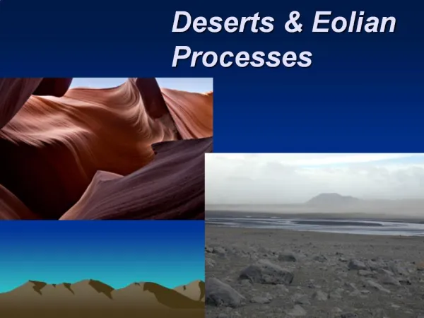
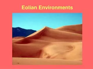
Eolian Mapping Models. Objectives. Consider the mapping models of two different major eolian deposits: Nebraska Sand Hills Peoria loess in Missouri Discuss the factors to consider when conducting soil surveys in eolian deposits. Mapping the Dunes. Grant County Nebraska Sand Hills.

E N D
Objectives • Consider the mapping models of two different major eolian deposits: • Nebraska Sand Hills • Peoria loess in Missouri • Discuss the factors to consider when conducting soil surveys in eolian deposits.
Mapping the Dunes Grant County Nebraska Sand Hills Reviewed by & with comments added from Roger Hammer, NRCS Soil Scientist (now retired), North Platte, NE
Where did all that sand come from? MLRA 65 Sand Hills Grant Co Nebraska Why might this be of interest to soil survey models?
Scotts Bluff, W of Sand Hills Source of sands?
Tertiary alluvium Soft sandstones, mudstones
N Platte R Scottsbluff
Sand Hills: formed “in place” from the Ogallala formation? Miocene Pliocene
Soils and Landforms in Grant Co General Toposequence • Dunes landform • Typic Ustipsamments • Valentine series • Interdunes landforms • Dunes on Interdunes* • Psamments, sandy Haplustolls • Valentine, Dailey; 3-9% slopes • Hummocks on Interdunes • Typic, Oxyaquic & Aquic Psamments; Oxyaquic Haplustolls (sandy); Halaquepts (sandy) • Valentine, Ipage, Els, Nenzel, Wildhorse; 0-3% slopes • Swales on Interdunes • Psammaquents, Endoaquolls (sandy), Calciaquolls (co-l); partial list • Tryon, Loup, Gannett, Elsmere, Crowther, Cullison, etc.; 0-3% slopes • Depressions on Interdunes • Mollic Psammaquents • Marlake series * “Dunes on Interdunes” nested landforms no longer used; R. Hammer
Interdune Landform Definitions* • Hummocks • A “best-fit” term, not optimal. Small, low-lying, nearly level (0-3%) areas that are not swales. • Swales • Concave areas w surface drainage; open depressions. • Depressions • Closed, concave areas w no surface outlet; deeper ponding for longer duration than swales. * Definitions from R. Hammer
Interdune Landform Definitions* • Hummocks • A “best-fit” term, not optimal. Small, low-lying, nearly level (0-3%) areas that are not swales. • Swales • Concave areas w surface drainage; open depressions. • Depressions • Closed, concave areas w no surface outlet; deeper ponding for longer duration than swales. * Definitions from R. Hammer
Draft Block Diagram from Cherry Co., NE Valent = Valentine Note Interdune pattern: Hummock, Swale, Depression Courtesy of R. Hammer
Slope model and Dunes soil mapping model Rolling Rolling and Hilly Hilly
Interdune lake (depression) with alkali rim Vegetation includes inland saltgrass (Distichlisspicata ) Photo courtesy of R. Hammer
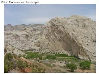
Loess mapping in Missouri Loess source(s)? Loess characteristics?
Missouri River Floodplain Uplands: Pre-Illinoian till draped with thick Peoria loess. Missouri River Floodplain Pedons: Geographic pattern? Trend?
Missouri River Floodplain Gradient: Co-si Udorthents, calc. Fi-si Eutrochrepts Fi-si Hapludolls (sil) Fi-si Hapludolls (sicl) F Argiudolls Missouri River Floodplain
V Deep Loess woodland/forest soils in Missouri Loess source(s)? Any testable hypotheses here? Menfro: fi-siTypicHapludalfs Winfield: fi-siOxyaquicHapludalfs Weller: f AquicHapludalfs