Download
1 / 19
190 likes | 277 Views
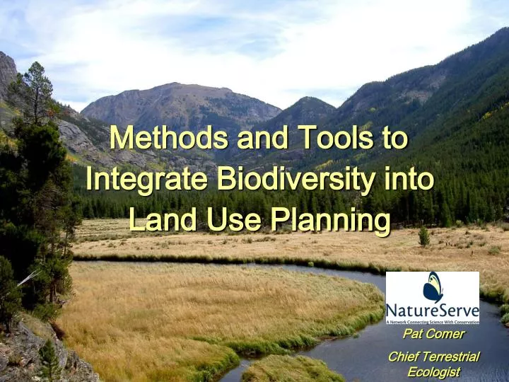
Methods and Tools to Integrate Biodiversity into Land Use Planning. Pat Comer Chief Terrestrial Ecologist. Greater Yellowstone Area. Local Partner : Bridger-Teton National Forest Objective : Support forest plan revision and implementation. Landscape Diversity. At-Risk Species.

E N D
Methods and Tools to Integrate Biodiversity into Land Use Planning Pat Comer Chief Terrestrial Ecologist
Greater Yellowstone Area • Local Partner: Bridger-Teton National Forest • Objective: Support forest plan revision and implementation
Landscape Diversity At-Risk Species Community Diversity Desirable Species Indicators Condition Trend Policy Response Condition Trend Policy Response Condition Trend Policy Response Condition Trend Policy Response Sustainability Vision Economic Ecological Social Clean Water Biodiversity Clean Air Adapted from Hagan & Whitman (2006) Biodiversity Indicators for Sustainable Forestry. Journal of Forestry, June 2006
Social Sustainability Economic Sustainability Ecological Sustainability Criteria and Indicatorsfor Sustainability B-T NF Indicators (35) Recreational Opportunities (road access and roadless areas) Scenic Integrity Educational Opportunities Indicators (11) Forest Productivity Carbon Sequestration Livestock Grazing Energy Production Commercial Recreation Water Development Indicators (100+) Ecosystem Diversity Species Diversity Invasive Species Fuel Load, Pests, Disease Watershed Integrity (stream channel function, soil productivity, water quality, etc.)
Common Steps in Planning • WHAT IS THE PLANNING AREA? • WHICH INDICATORS REQUIRE CONSIDERATION? • WHERE ARE THEY? • WHAT ARE REFERENCECONDITIONS? • WHAT ARE CURRENTCONDITIONS? • WHAT ARE THE TRENDS AMONG THOSE CONDITIONS? • WHAT ARE DESIRED CONDITIONS? • WHAT STRATEGIES WILL MOVE US TOWARD DESIRED CONDITIONS? • WHAT ARE EXPECTED OUTCOMES FROM IMPLEMENTING STRATEGIES? • HOW WILL WE MONITOR AND EVALUATE OUR IMPLEMENTATION?
Conservation ElementsFocus for Ecological Sustainability • Species Diversity Species of Concern • ESA proposed, candidates, petitioned • G1-G3 (T1-T3) NatureServe status • May include distinct populations Species of Interest • S1-S2 NatureServe status • Other T/E not captured above • UAFWS birds of concern • Regional/local concern • Other public interest requiring plan components • Ecosystem Diversity Representative ecosystem types Vegetation types and structural stages
Ecological System and Structural Stage Nested Dominance Types Ecological System Type Building Element Information
Modeling LandscapeCondition • Combines land use, road type, built infrastructure, etc. • Model weights effects, adds distance effect • Specified to element-groups Greater Yellowstone Area
Land Use Scenarios 1) Land Use Type 2) Special Designations 3) Regulation 4) Zoning/ Policy Type
Land Use Conflict Map Scenario Evaluation • Red areas indicate elements with incompatible land use intent. • Darker shades indicate richness of elements in conflict
Vista Modules & Interoperability Economic Analysis & Reporting Conservation Scenario Optimization Tools: MARXAN, SPOT Visualization Tools (e.g., Community Viz) Vista Framework Decision Support System Predictive Range Mapping; e.g., MAXEnt, GARP Agency Regulatory Monitoring Tools Land-use System Tools: Transportation Sylviculture Agriculture Ecological Dynamic Simulation Tools: e.g., Vegetation Dynamics Development Tool (VDDT) Knowledge Engine Tools: EMDS
Stating Desired Conditions • Establish measurable goals for representation • Users may define multiple, potentially competing goal sets representing different values, or uncertainty • A single land-use scenario can be evaluated against multiple goal sets • Goals based on % of total area, % of occurrences, absolute amount of habitat, or absolute # of occurrences
Analysis at Multiple Spatial Scales • Regional-scale (e.g., Representation throughout the Greater Yellowstone area) • National Forest Plan (e.g., Relative emphasis within the Bridger-Teton N.F.) • Project Implementation(e.g., multiple occurrences summarized by HUC 6 units of the Greys River watershed) • Individual Occurrence patch (e.g., one element of conservation concern/interest)
Generating Regional Allocation Scenarios using Spatial Optimization
Aggregationand Weighting Join and Rasterize Element Distribution & Confidence Data Element Conservation Layer AggregatedConservation Value Current Land use, infrastructure, etc Landscape Condition(geoproc tool) Conflict Intensity Indices Scenario Evaluation Evaluation Report Scenario Generation (e.g., MARXAN) Scenario Modification (Site Explorer) Alternative Land Use/Activity Scenario Desired Conditions for Elements Site Land Use/Mgmt Specification Element Compatibility To Land Use/Activity Data & ExpertKnowledge Inputs Intermediate Processes & Products Outputs Vista 2.0 Functions
What Are We Aiming For? • Common Planning Framework • Common Library of Spatial Data and Ecological Knowledge • Functional Inter-operating Decision Support Tools