Download
1 / 11
130 likes | 620 Views
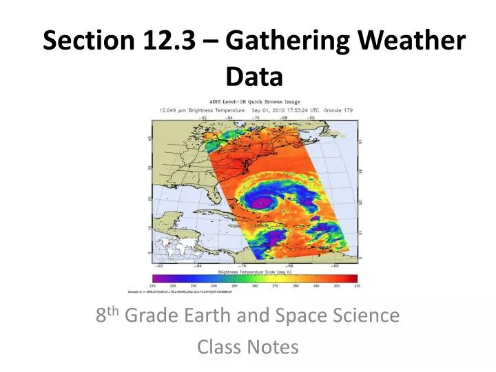
Section 12.3 – Gathering Weather Data. 8 th Grade Earth and Space Science Class Notes. Data from the Earth’s Surface. Quality of the data is important The greater the accuracy and the greater the amount of data available the more reliable the forecast. Temperature and Pressure.

E N D
Section 12.3 – Gathering Weather Data 8th Grade Earth and Space Science Class Notes
Data from the Earth’s Surface • Quality of the data is important • The greater the accuracy and the greater the amount of data available the more reliable the forecast.
Temperature and Pressure • Thermometer – measures temperature • Liquid in glass or bimetallic strip • Barometer – measures air pressure Barometer Bimetallic strip thermometer Liquid in glass thermometer
Wind Speed and Relative Humidity • Anemometer – measures wind speed • Hygrometer – measures humidity Anemometer Hygrometers
Automated Surface Observing System (ASOS) • Created by National Weather Service, Federal Aviation Administration, and Department of Defense • Allows weather data to be gathered and analyzed from various locations at the same time
Data from the Upper Atmosphere • Radiosonde/Rawinsonde - gathers upper atmospheric data using sensors, a battery powered radio transmitter, and balloon • Since the 1980s it has been used in conjunction with GPS
Weather Observation Systems • Two major types: • Radar – detects precipitation • Satellites – detect clouds Radar Satellite
Weather Radar • Radar = radio detection and ranging • Sends out radio waves programmed to only deflect from particles larger than a specific size • When these waves encounter rain drops they scatter • Doppler radar – uses the Doppler effect to determine speed of precipitation and wind
Weather Satellites • Use light to image and observe the atmosphere • Infrared imagery – detects cloud cover and the surface temperatures of clouds • Visible light imagery – takes digital pictures of clouds • Water vapor imagery – measures the amount of water vapor in the atmosphere; can be used to look at cloud patterns and air currents
Weather Satellite Images Infrared Imagery – colder clouds are higher up and more likely to produce strong storms Water Vapor Imagery Visible Light Imagery