Download
1 / 16
160 likes | 310 Views
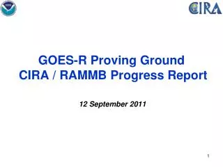
GOES-R Proving Ground CIRA / RAMMB Progress Report PG All-Hands Meeting 06 January 2014. Fort Collins High Park Fire. Outline. Systems Report NHC and Pacific Region Proving Grounds Selected User Interactions and Examples Snow /Cloud discriminator imagery - based on VIIRS

E N D
GOES-R Proving Ground CIRA / RAMMB Progress ReportPG All-Hands Meeting 06 January 2014 Fort Collins High Park Fire
Outline • Systems Report • NHC and Pacific Region Proving Grounds • Selected User Interactions and Examples Snow/Cloud discriminator imagery - based on VIIRS Wave cloud along the Front Range with DNB (18 Dec) Widespread Fog East of Rockies on 3 Dec GeoColor loop of Arctic Air Outbreak - Dec 3-9 • Conferences and Meetings
Systems Report • AWIPS II • CIRA Orographic Rain Index (ORI) products for US west coast, Hawaii and Puerto Rico are now available for AWIPS II. Product for Alaska Region is in the works. • AWIPS II software updates • 2 AWIPS II systems have been upgraded to OB13.5.2. • 1 system will remain at 13.5.1 until OB14.x/64 bit release. • 1 system has been configured w/ 64 bit RH 6.4 in preparation for OB14.x. • AWIPS II defect DR 16841 "McIDAS and satellite plugins need an overwrite capability" was created on Nov. 25 and assigned High priority. A Raytheon-ASM developer has been assigned. Approved Release: 14.2.1. This release is scheduled to be available for sites in May 2014. • This fix will allow the database overwrite of forecast simulated WRF & NAM imagery. • Participation in the SPoRT led Experimental Products Development Team (EPDT) bi-weekly telecons is ongoing. • Participation in the Raytheon AWIPS II Developers Forum is ongoing. • Participation in the monthly NDE-AWIPS telecons is ongoing. • Efforts are underway with NASA/IDPS to determine feasibility of limited near real-time access to global GRAVITE VIIRS SDR data until NDE is ready to supply the products. • Could provide a resource for OCONUS AWIPS II products.
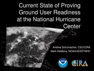
NHC Proving Ground Updateneeds update • NHC PG Aug 1-Nov 30 • LDM Feed from SPoRT • Most PG products obtained through SPoRT • wget script at NHC could not be modified due to lack of technical support staff experience • M. DeMaria was acting TSB chief Aug 14-Sep 25 • Permission obtained from NCEP/NCO to open LDM feed to SPoRT • NHC/SPoRT coordination allowed replacement of wget script • New products for NHC now available • Bandwidth analysis showed 30% reduction due to LDM efficiency • LDM Feeds requested from CIRA and CIMSS
Discriminating clouds from snow – 5 Dec example 05 December 2013 2015 UTC GOES-West VIS
VIIRS True Color Image 05 December 2013 2016 UTC VIIRS true color image
VIIRS Snow-Cloud-Discrimination Product 3-color-technique 05 December 2013 2016 UTC • First time based on VIIRS bands (previously only MODIS-based) • Demonstrating future capabilities of ABI • White/blue areas denote snow cover, yellow areas denote low cloud cover (liquid), magenta areas denote high cloud cover (mixed/ice), and green areas denote clear sky surface.
Lee wave cloudiness on 18 Dec – IR vs. VIIRS DNB Lee Wave clouds A large wave cloud is seen east of the Rockies in this GOES-15 IR image at 1000 UTC/18 Dec
Lee wave cloudiness on 18 Dec – VIIRS DNB image Lee Wave clouds WY KS CO UT Snow cover in Alamosa Valley Grand Junction city lights Denver city lights This DNB image swath is at 0956 UTC/18 Dec
CONUS-wide mosaic of the VIIRS DNB on 18 Dec Lee Wave clouds
A look at widespread fog and low clouds on 3 Dec Dense Fog Advisory NWS Watches, Warnings and Advisories as of 1324 UTC on 3 Dec 2013
CIRA Low cloud/fog overview product at 1145 UTC Fog/low clouds = white, higher clouds = colors, thin cirrus = black, ground = gray
CIRA GeoColor overview product at 1145 UTC The widespread fog and low cloudiness preceded the invasion of Arctic cold air into the nation. The next slide gives a 7-day loop of GeoColor imagery covering the big change, beginning just after the time of the image shown here. Fog/low clouds = magenta, higher clouds = white, true color background with city lights
Arctic Air Outbreak 3-9 December 2013 GeoColor 7 day hourly loop http://rammb.cira.colostate.edu/templates/loop_directory.asp?data_folder=dev/micke/loops/arctic_front_geocolor_conus4km_201312091447_hourly&image_width=960&image_height=737
Conferences / Meetings • Recent: • Nov 6 -- 7 GOES-R/JPSS COMET Working Group Meeting • Bernie Connell, Dan Bikos, Mark DeMaria • Upcoming: • Feb ? SPC High Impact Weather Workshop (Louis Grasso) • Feb 3 – 6 AMS Annual Meeting – Atlanta • (Dan Lindsey, Ed Szoke, Steve Miller, Don Hillger) • March 10-14 NOAA Satellite Science Week (virtual) - Madison • March 31 – April 4: AMS Conference on Hurricanes and Tropical Meteorology • Mark DeMaria, John Knaff, Andrea Schumacher, Kate Musgrave, Jack Dostalek, Galina Chirokova