Download
1 / 52
580 likes | 1.1k Views
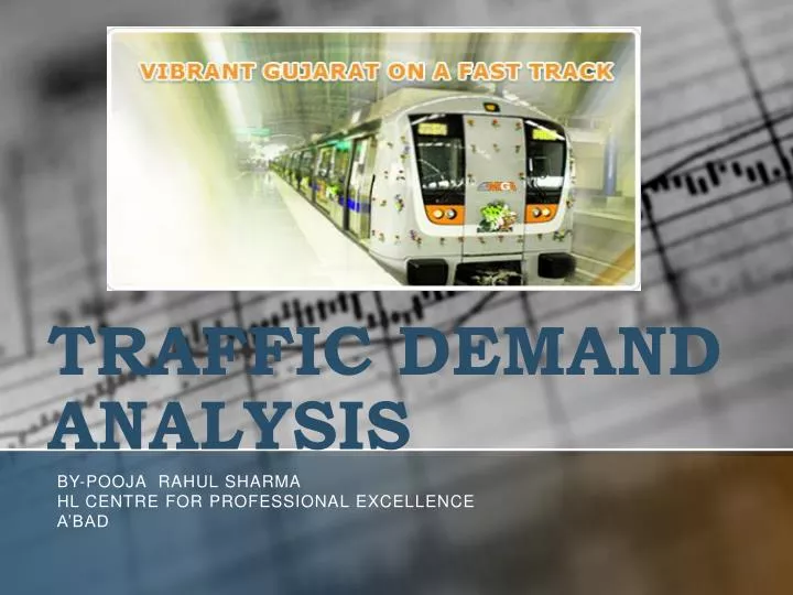
TRAFFIC DEMAND ANALYSIS. BY- Pooja Rahul Sharma HL centre for professional excellence A’bad. TRAFFIC DEMAND ANALYSIS. Introduction- The following steps are involved in traffic demand analysis towards, estimation of ridership on Mass Rapid Transit System: Preparation of Database:

E N D
TRAFFIC DEMAND ANALYSIS BY-PoojaRahul Sharma HL centre for professional excellence A’bad
TRAFFIC DEMAND ANALYSIS • Introduction-The following steps are involved in traffic demand analysis towards, estimation of ridership on Mass Rapid Transit System: • Preparation of Database: • Development of Transport Demand Models: • Estimation of Land use Parameters: • Formulation & Evaluation of Alternative MRTS Networks:
Database For The Study • Census data available for various wards has been reviewed in order to carry out household travel survey. • The sample size and distribution of samples over the Study Area to carry out the household travel survey is based on the zonal population and distribution of zonal households. • Additional details like major activity centers in each traffic zone have been collected to assess the trip generation/attraction potential of each zone.
Traffic Zone System • The Study Area was divided into a total of 197 zones (186 internal and 11external). The 186 internal zones consist of Ahmedabad Municipal Corporation (AMC) area, Area of Ahmedabad Development Authority(AUDA) and Gandhinagar.
Database For The Study • The primary surveys include Road Network Inventory, Speed and Delay • Survey, Traffic Volume Surveys, Origin and Destination Survey, Bus and Shared Auto Passenger Survey, Rail Terminal Survey and Household Travel Surveys. • The traffic volume data has been compiled both in terms of vehicles and passengers.
Database For The Study • Origin-Destination (O-D) matrices for public and private transport for various trip purposes are prepared for base year and projected for various horizon years. • Planning parameters consisting of population, employment and number of resident workers for the zone system for the base year (2003) and for the • horizon years (2010, 2025 & 2035) have been quantified.
Primary Surveys and Analysis The following primary traffic and travel surveys have been conducted as a part of the study: i) Road Network Inventory and Speed & Delay Surveys ii) Traffic Volume Counts iii) Public Transport Passengers’ Surveys iv) Household Travel Surveys
Road Network Inventory and Speed & Delay Surveys • Road network inventory has been carried out along all arterials and major roads totaling to 1042 km. Of which 41% of the road network is having 4 or more lanes of carriageway and about 48% is having 2-lane of carriageway. About 5% of the Study Area roads are provided with footpath on both sides and 15% of road length has footpath on one side. • Speed and delay survey has been conducted using moving car method during peak and off-peak periods. For private vehicles, during peak period about 71% road network is having journey speed of less than or equal to 30 Kmph and for public vehicles during peak period about 95% of the road
Traffic Volume Counts a)Mid-Block Traffic Counts • Mid-block traffic counts were conducted at 33 locations in the Study Area. • The locations were chosen in such a way that combination of some of the mid-blocks would act as screen line also. b) Outer Cordon Surveys • The outer cordon survey has been conducted at 11 locations along all the • major roads radiating from the Study Area. The volume and composition • of inter city traffic entering and leaving the Study Area is recorded at these locations for 16 hour duration on an average working day. c) Traffic Volume Counts at Screen Line Location • Traffic volume counts at 7 screen line points have been carried out as part • of the presented Study. The intensity of the traffic at screen line locations
Public Transport Passengers’ Survey • In order to assess the public transport passenger’s characteristics in the Study Area, two different types of surveys related to bus and other public modes such as shared auto, tempo and rail were carried out at selected locations. • Bus Stop survey covered bus passenger origin-destination interviews with boarding passenger count at 309 bus stops and 8 Terminals along the proposed Metro Corridor and its influence area.
Public Transport Passengers’ Survey • a) Bus and Shared Auto Passengers Survey • The boarding and alighting counts of passengers was carried out at 15 minutes interval for a period of 16 hrs. Income Tax office bus stop has the • maximum volume of boarding passengers (about 2700), • LaldarwajaTerminal has the maximum volume of boarding passengers (about 35000) • and for shared autos, the maximum boarding of passenger takes place near Kalupur Terminal.
Public Transport Passengers’ Survey • b) Rail Passengers’ Survey-Rail passengers’ boarding and alighting counts and origin– destination. surveys were conducted at 15 railway stations. • The maximum passenger traffic (boarding & alighting) is observed at Kalupur station (71715 numbers) and the minimum passenger traffic (boarding & alighting) is observed at Gandhi Nagar Station (275 numbers)
Land use Parameters • One of the important aspects of traffic demand modeling exercise is the • estimation of base year and horizon year land use parameters. The land • use parameters for the year 2010, 2025 & 2035 are worked out by Louis • Berger Report of 2000 in various zones of the Study Area. • The population of Study Area in the year 2003 was about 57.25 lakh. Out • of which 37.37 lakh population reside in Ahmedabad Municipal • Corporation (AMC) area, 17.64 lakh in Ahmedabad Urban Development • Area (AUDA) and about 2.25 lakh in Gandhi Urban Development • Area(GUDA). • The zone wise distribution of population & employment
Demand Modeling and Forecast The four stages of transportation planning process are: • Trip-end prediction or trip generation and attractions – the determination of the number of person trips leaving a zone irrespective of destination and the number of trips attracted to a zone, irrespective of origin. • Trip distribution – the linking of the trip origins (generation) with their destinations (attraction) • Modal split – the separation of trip by public transport modes or by private modes. • Assignment – the allocation of trips between a pair of zones to the network
Trip Distribution-The gravity model formulation has been used for developing the synthetic O-D matrix for the intra-city trips. The formulation of Gravity model used is as under:
Gravity Model – Calibration Process • The sequence of activities involved in the calibration of Gravity Model is Only the home based trips for purposes (work, education, other and total), which have been simulated for comparison with the observed flows. • The calibrated values of Gravity Model parameter for home-based trips for various purposes are presented in where W, E, O denote parameters for work, education and other purposes respectively. • Calibration process included comparison of observed and simulated mean trip lengths as well as shapes of the trip length frequency distribution.
The observed trip length frequency distributions for different purposes (work, education and other) were obtained from the 2003 Household Travel Survey data. For simulated trip length frequency distributions, the parameter values (negative exponential) were varied until the simulated and observed trip length frequency distributions for each purpose exhibited the following. • - The shape and position of both curves relatively close to each other when compared visually. • - The difference between mean trip lengths was within 3 percent variation • The calibration procedure developed by Bureau of Public Roads was used, which adjusts the measure of attraction used in the Gravity Model. • Eight such iterations of attraction trip and balancing procedure were carried out for each trip purpose separately
For a trip including one or more public transport links and walk links thereto, the public transport generalized cost would be made up of: a) Cost of walking time to bus stop (from notional centroid link) b) Cost of waiting time at bus stop c) Cost of traveling time on bus d) Bus fare e) Cost of interchange waiting time – where appropriate f) Further c) and d) – where appropriate g) Cost of walking time from bus stop to destination (by notional centroid link). • In a somewhat similar way, generalized cost for other modes is determined. The least-cost journey from any zone to another is determined by a tree building process. Separate least-cost journey trees are built for public transport trips and for trips by other modes. • For the purpose of analysis in this study, Cij values, which should normally be based on Generalized Cost, have been taken only in terms of travel time. Travel time matrices have been computed and ‘skim trees’ built representing shortest travel paths between each pair of zones taking road congestion into consideration.
Modal Split-The household travel survey carried out in 2003 shows a less modal split in favour of public transport. The lower modal split in favour of public transport system shows the deficiency in public Transport system and also the non-availability of public transport system in major routes of the city. The reduction in fleet size of AMTS bus services is also one of the major reason for lower public transport share. • A good mass transport system expected to increase a higher modal split in favour of public transport in the year 2010, 2025 and 2035.
Trip Assignment-For the purpose of this study, Capacity restrained assignment technique has been followed. In this method of assignment, private and public transport trip matrices are loaded onto their respective networks, using an incremental assignment method. • There is simultaneous building of shortest paths for the two networks (mass transport and private trips), and rules adopted are: 1. The paths are not allowed to be built through the zone centroids, other than the origin and the destination end. 2. Due to the type of signal phasing adopted for intersections, the right turning traffic has to wait for a few seconds more than the straight moving traffic. Also, as the right turners have to follow a curved and longer path through the intersection, a penalty of 30 seconds is adopted for such assignment.
TRANSPORT DEMAND FORECAST The following assumptions have been made while working out the traffic demand on the proposed Metro & Regional Rail System: 1. The basic inputs to the study i.e. the land use parameter for the year 2010, 2025 & 2035 are worked out by Louis Berger Report – 2000 presented in Table 2.10. The land use parameters population and Employment is available in AUDA and GUDA master plan up to the year 2011. 2. The integrated transport network includes the future road network proposals, Metro network & Regional Rail System. 3. For working out a path between an origin and destination, travel time has been considered. 4. Proper inter-modal integration facilities, including approach roads are assumed to be available at all stations of Metro a Regional & rail system
5. Feeder services have been assumed to be available at all stations • of Metro and Regional Rail System. • 6. Wherever possible, proper passenger integration has been • assumed between Metro Stations and Regional Rail System. • 7. Common ticketing for Metro corridors with regional rail system.
i) Vishala to Sachivalya via Vasna, Paldi, ITO, Usmanpura, Sabarmati, Moetra, Koba Circle. ii) Kalupur-PremDarwaja—ShahpurDarwaja-ITO-HL Commerce College-ManavMandir-Thaltej Village Road iii) 132’ Ring Road From Vasna (APMC)- Jivraj Park – Shivranjani Junction – Memnagar – ManavMandir – Naranpura – Nava Wadaj– RTO. iv) National Highway – 8 from Vishala – Narol – Isanpur - KhokaraMahamdabad- Rakhail – SahijpurBogha. v) Kalupur – Asarva - SahijpurBogha – Naroda GIDC – Naroda. vi) Sarkhej – Gandhinagar Highway (NH – 8C) from Sarkhej –Makarba-Vejalpur– Bodakdev – Thaltej – Sola – Oganj – Khodiyar– Adalaj – Indroda Circle. vii) Kalupur –Sarangpur – Jamalpur – Ellis Bridge – Ashram Road viii) On Baroda Highway from Jamalpur – Kankaria – Danilimda – Narol– Vatva – Jetalpur – Bareja. ix) Nadiad Highway from KhokaraMahamdabad – Mani Nagar – VatvaGIDC – Vinzol – Hatijan – Nandej / Barejadi – Raska - Mehmdabad
ROAD ONLY NETWORK • The road only network consists of all the roads with & above and covers the whole area of AMC,AUDA and Gandhi Nagar. • The origin – destination matrix for the year 2003, 2010, 2025 and 2035 assigned on road only network and shown in • The trip assignment on this network in the year 2035 shows that the following road corridors will carry out the maximum traffic more than 20000 peak hour trips. Some of these major corridors are;
IDENTIFICATION OF METRO AND REGIONAL RAIL CORRIDORS A) Metro System i) Line No. 1 – Vasna – Sabarmati – Gandhinagar ii) Line No. 2 – Kalupur – Thaltej / Vastrapur iii) Line No. 3 – Extension of Metro Corridor from Vasna to Changodar iv) Line No. 4 – Sarkhej to Gandhinagar via NH – 8C v) Line No. 5 – Vasna to Sabarmati along 132 feet wide road vi) Line No. 6 – Corridor along Sabarmati Riverfront B) Regional Rail System i) Corridor No. 1 – Barejadi – Kalupur – Sabarmati – Kalol ii) Corridor No. 2 – Kalupur – Naroda iii) Corridor No. 3 – Airport Link from Kalupur – Naroda Line iv) Corridor No. 4 – Development of Regional Rail system on the available ROW of Indian Railways from Vasna to Sabarmati v) Corridor No. 5 – Sarkhej to Gandhinagar via NH – 8C
1) Alternative – 1: (As given above) Via Koba Circle Vishala – Akshardham Temple (Ashram Road – SP Stadium - Motera – Koba Circle – Indroda Circle) 2) Alternative – 2: Via Adalaj Vishala – Akshardham Temple (Ashram Road – SP Stadium – Adalaj–IndrodaCircle) 3) Alternative – 3: Along Meter Gauge Railway line & via Koba Circle Sarkhej– Akshardham Temple (Via Meter Gauge - SP Stadium – Motera - Koba Circle - Indroda Circle) 4) Alternative - 4: Along Meter Gauge Railway line & via Adalaj Sarkhej – Akshardham Temple (Via Meter Gauge – SP Stadium – Adalaj - Indroda Circle)
Corridor Loading • The description of no of passengers using the Phase - 1 system as follows • A) Metro Phase – 1: The phase 1 of Metro system comprises of the following two lines Line - 1: APMC-Vasana –AayakarBhavan –Sabarmati –Motera- Indroda – Akshardham along Ashram road of length of about 32 km. Consisting of 31 stations with interstation distance of 1 km. The number of passengers carried by this line is 4.16 lakh, 7.40 lakh and 11.95 lakhs in the years 2010, 2025 and 2035 respectively. • Line - 2: Ahmedabad Junction – PremDarwaja – AayakarBhavan– ManavMandir – Drive in Cinema – Thaltej of length 9.65 km.consistingof 11 stations. The number of passengers carried by this line is 2.59 lakh, 3.94 lakh and 5.15 lakhs in the years 2010, 2025 and 2035 respectively.
B) Regional Rail System Phase – 1: • Line - 1: Barajadi- Vatva – Maninagar – Kalupur –Kodiyar – Kalol of length about 44km. The number of passengers carried by this line Phase-1 is 2.80 lakh, 4.30 lakh and 5.97 lakhs in the years 2010, 2025 and 2035 respectively. • Line - 2: Ahmedabad Junction – Naroda via Asarva and Sardargram of length 9.47 km. The number of passengers carried by this line in Phase - 1 is 1.75 lakh, 2.30 lakh and 2.83 lakhs in the years 2010, 2025 and 2035 respectively.
Summary of Transport Demand Forecast • The summary of transport demand forecast are for the year 2010 & 2035, for the phase 1 Metro and Regional Rail corridors. It is seen that, with a network length of 94.7 km would carry 11.30 lakh & 25.90 lakh passengers per day, the passenger km carried would be 105.02 lakh & 263.77 lakhs and the intensity of utilization (passenger km carried per km) would be 1.11 lakh & 2.79 lakh for the year 2010 and 2035 respectively
Competition • Summarize the competition. • Outline your company’s competitive advantage.
The Team • List CEO and key management by name. • Include previous accomplishments to show that these are people with a record of success. • Summarize number of years of experience in this field.
Market Summary • Summarize your market in the past, present, and future. • Review those changes in market share, leadership, players, market shifts, costs, pricing, or competition that provide the opportunity for your company’s success.
Opportunities • Identify problems and opportunities. • State consumer problems and define the nature of product/service opportunities that are created by those problems.
Business Concept • Summarize the key technology, concept, or strategy on which your business is based.
Goals and Objectives • List five-year goals • State specific, measurable objectives for achieving your five-year goals. • List market-share objectives. • List revenue/profitability objectives.
Financial Plan • Outline a high-level financial plan that defines your financial model and pricing assumptions. • This plan should include expected annual sales and profits for the next three years. • Use several slides to cover this material appropriately.
Resource Requirements • List requirements for the following resources: • Personnel • Technology • Finances • Distribution • Promotion • Products • Services