Download
1 / 20
200 likes | 330 Views
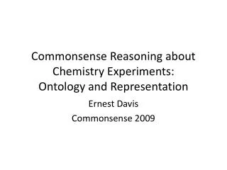
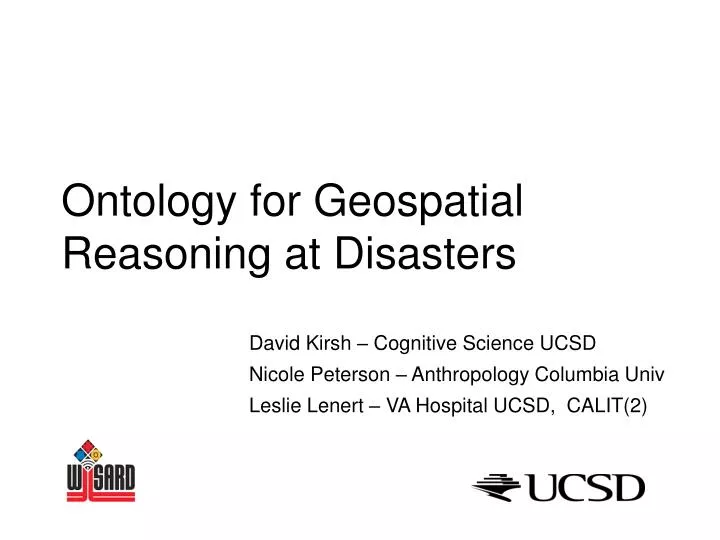
Ontology for Geospatial Reasoning at Disasters. David Kirsh – Cognitive Science UCSD Nicole Peterson – Anthropology Columbia Univ Leslie Lenert – VA Hospital UCSD, CALIT(2). Zone. Incident Command Center. Warm Zone. Release. Hot Zone. Cold Zone. Problem.

E N D
Ontology for Geospatial Reasoning at Disasters David Kirsh – Cognitive Science UCSD Nicole Peterson – Anthropology Columbia Univ Leslie Lenert – VA Hospital UCSD, CALIT(2)
Zone Incident Command Center Warm Zone Release Hot Zone Cold Zone Problem • How do incident commanders and medical response team leaders: • Conceptualize the physical space of a disaster • Is the hot zone shifting? - where’s the plume? • What’ s in the shooter’s line of sight? • Think about their response in spatial terms • Who’s in the transport area? • Clear that region and rendezvous back here • Have we made a safe refuge area? • Let’s put the staging areas over there. Line of sight Triage Area Treatment Areas Transport Area Staging Areas Decontamination Areas Cleared by SWAT Regrouping spot
Background • We’re designing wireless devices to attach to personnel, victims and equipment • Concern: information overload • data from 100’s of such devices distributed around a site • Solution: interpret data in terms of • spatial concepts and reference points which incident commanders already use to understand situation • use the language of situation awareness How safe is the initial refuge area? What’s it like at transport? How long is the queue for decon?
Goals Errors: cost x frequency • reduce error • number of errors • cost of errors • increase coordination • Stay in control • Aware of who is where, doing what, how • Better quality of messages • improve the efficiency of response • Increase victim flow through key areas • Reduce bottlenecks DSR 2 > DSR 1
Four Sources of Data • Pre-drill interviews and simulations: video’ed five 2-hour interviews • Drill observation: video’ed disaster drill using 5 video cameras 4 hour each camera 2 on top of building, 2 stationed, 1 roaming • Event debriefing: took notes of the post-event debriefing • Post-event follow-up interviews: follow-up with the experts from our pre-drill interviews – video’ed four 2-hour interviews. Coding interviews and drill footage: ensured inter-coder reliability through joint coding using two to four coders
Conceptually different types of space • Zones • formal, taught in class • objective basis • hot zone based on physics of release, trajectory of shooter • Areas • formal, taught in class • driven by functional needs • Staging areas – Fire, Hazmat, MMST • Stations – decon, triage, treatment, transport • Refuge – size depends on needs • Ad Hoc • not taught per se • driven by tactical demands of activity – inferred from language & gesture • SWAT – regroup near door • rendezvous pt, cleared so far Zones Refuge Area Safe Refuge Area Areas
Helps identify and reduce errors • Thinking about attributes of zones, areas and regions explains certain sorts of errors • Dimension Errors • Zone: wind changes, but the dimensions are not updated • Area: a space is wrongly assumed vacant when in fact reserved for someone else (hazmat trucks took the wrong place) • Permission Errors • A fireman marked the hot zone when he should have waited for Hazmat – firemen lack permission • Who has the right to move a resource into, within, or out of a zone, • Fire shouldn’t move crime scene items • Marking Errors • Hazmat assumed no need to mark all their staging space (4 trucks) – so were distributed • Tree used to mark hot zone edge but information not propagated • Wrong tape
It’s good to think spatially • Responders and commanders think spatially in terms of: • Zones • Areas • Ad Hoc Regions • Information from geospatial systems needs to be translated into responder meaningful terms – more abstract than geospatial location
It’s good to think spatially • Ethnographic analysis can expose the attributes of spatial concepts that is implicit in discourse and gesture • An attribute ontology provides a principled method for discovering and classifying responder errors • When data is represented more meaningfully • Messages are cognitively more efficient – better speed-accuracy • Situation awareness propagates faster – higher awareness diffusion rate • Distributed activity is better coordinated – better hand-offs, time to respond, victim flow rate • Fewer and less costly errors are made • Sets the stage for more comprehensive evaluations • Victim flows through areas, coordination of data between stations
Errors • If we think about these attributes it is apparent how certain sorts of errors may arise. Here is a simple list of 25 errors. • Dimension errors: • zone: a space has reasonably precise dimensions but the team miscalculates them • zone: conditions alter, such as when the wind changes, but the dimensions are not updated • zone: team members misread their instruments and so propagate incorrect information about dimensions • zone: team members do not realize that their instruments tell them about boundaries (e.g. beepers indicate radiological perimeters) and so they do not think they can discover boundaries • areas: a space is assumed vacant when in fact it is reserved for someone else (hazmat trucks took the wrong place) • Ad hoc regions: the SWAT team leader did not take into account the shooters height and so incorrectly assumed a safe retreat zone was also safe in the vertical dimension. • Permissions Errors • All spaces: Person A enters but lacks permission to enter, and should have known it. E.g perimeter guard approaches the ICC • All spaces: A does not have the right to move a resource into, within, or out of a zone. E.g fireman move crime scene item. • Zones, areas: Person A marks the boundaries of a zone or area but lacks permission to do this, and should have known it. Fireman marks the hot zone when he should have waited for Hazmat. • All spaces: A lacks permission to do a specific activity in that space. • Zones, Areas: A gatekeeper should prevent A from entering but does not realize that a permission is required; or that A has the wrong permissions. E.g. Gatekeeper at site perimeter mistakenly keeps out authorized responders. • With respect to evidence: different perspective on situation, don’t share information • Rule Errors: a zone/area may have primary owners fpr certain time then pass ownership Ad Hoc are uniquely owned • All spaces: Different groups have their own set of dos and don’ts with respect to the scene. To the FBI, the setting represents the scene of the crime. To the MMST, the setting is filled with victims needing medical attention. To the SWAT strike team, the setting represents an unsecured space that may harbor shooters or bombs. Errors arise when responders perform actions that are correct for their own team but which have unintended negative consequences for other teams. E.g. MMST move victims whose physical disposition is of forensic value. • Marking Errors • Areas: one area encroaches on another because future needs were not marked. E.g. Hazmat truck 1 arrived early to the scene and did not mark sufficient space for the remaining 4 trucks to arrive soon. Another team moved their trucks into that large opening blocking truck 1 in and preventing Hazmat from being close enough to the site. • Use mark which changes location, such as a truck or even cone that might be moved unwittingly. • Zone is marked in a way that requires special knowledge to interpret. E.g. special markings or use of a feature such as a tree or a bush that hasn’t been communicated to everybody else. • Zone is marked incorrectly with respect to size or type • Zone isn’t explicitly marked and needs to be because it is not self-identifying in the way the boundary of a building is self-identifying (hazmat area) • Entry point to a zone may not be well marked or by leaving a large entry corridor the boundary of the hot zone near that corridor may be unclear. • Location Errors • Area is put in the wrong location. E.g. The decon area was set in a bad location given the topography of the area. Water would run downhill to ICC and to treatment areas. • more of these • Boundary Errors • some of these
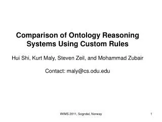
Cold Zone Treatment area Nested
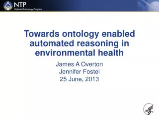
Dril Drill May 2004 Ambulance Staging