Download
1 / 25
250 likes | 355 Views
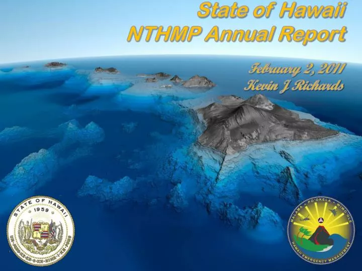
State of Hawaii NTHMP Annual Report February 2, 2011 Kevin J Richards. Hawaii’s – Accomplishments NA5 - FY09. Mapping and Modeling Status* Outreach Activities School Visits Committee Meetings Workshops & Seminars Tsunami Observer Program Current Status Chile Tsunami Event*

E N D
State of Hawaii NTHMP Annual Report February 2, 2011 Kevin J Richards
Hawaii’s – AccomplishmentsNA5 - FY09 • Mapping and Modeling Status* • Outreach Activities • School Visits • Committee Meetings • Workshops & Seminars • Tsunami Observer Program • Current Status • Chile Tsunami Event* • Hawaii’s Lessons Learned
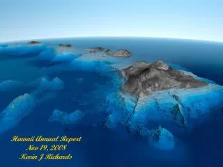
1964 1957 1952 1946 Japan Cascadia Mariana Hawaii Kalapana on west shore Solomon Tonga 1960 Tsunami Inundation Mapping • Tsunami Evacuation Maps: • First state to develop tsunami evacuation maps for emergency management (1991) • Cover 725 of 1500 km of Hawaii coastlines • Based on five most-destructive trans-Pacific tsunamis to Hawaii during the last century • Inferred from 1D modeling of recorded run-up • Update of Evacuation Maps: • In coordination with National Tsunami Hazard Mitigation Program • Latest topographic and land use data and 2D modeling techniques • Evaluation of hypothetical distant and regional tsunamis Historical and hypothetical events for inundation mapping
Mapping Milestones : • Oahu • Mapped and Modeled • Tsunami Inundation Mapping – Review Panel Oahu • State Approved and Released Data to City and County • City and County Developed Evacuation Map • Public Information Campaign and Publishing • Hawaii • Mapped and Modeled • Tsunami Inundation Mapping – Review Panel Hawaii • State Approved and Released Data to Hawaii County • Hawaii County Developed Evacuation Maps • Public Information Campaign and Publishing • Maui • Mapping and Modeling in Progress • Kauai • Slated to Begin 4th Quarter 2011
Address for Ala Moana Hotel
Language Identification and Emergency Cards (LIEC) Translations: Cantonese Cebuano Chuukese Ilokano Japanese Korean Kosraean Mandarin Marshallese Pohnpean Samoan Spanish Tagalog Tongan Vietnamese Yapese
Chile Event - Lessons Learned Chile Tsunami WARNING Event 2/27/10 • Mixed messages from the media and government to the public • Not enough planning and exercising at the county level (Hawaii County the exception) • C&C of Honolulu designated only 5 Tsunami Evacuation Sites • Public expected emergency shelters to be open • Shut down of pumping stations at WWTP on Maui two hours before wave arrival • Evacuation of ports and harbors was outstanding • Excellent support from the public
Gas Station, Ewa, Honolulu Last Minute Shopping
Waipio Valley, Big Island Pali Lookout, Oahu Head To High Ground Round Top Drive, Honolulu Lookout At Diamond Head