Download
1 / 47
470 likes | 647 Views
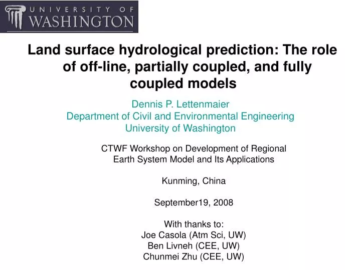
Land surface hydrological prediction: The role of off-line, partially coupled, and fully coupled models. Dennis P. Lettenmaier Department of Civil and Environmental Engineering University of Washington. CTWF Workshop on Development of Regional Earth System Model and Its Applications

E N D
Land surface hydrological prediction: The role of off-line, partially coupled, and fully coupled models Dennis P. Lettenmaier Department of Civil and Environmental Engineering University of Washington CTWF Workshop on Development of Regional Earth System Model and Its Applications Kunming, China September19, 2008 With thanks to: Joe Casola (Atm Sci, UW) Ben Livneh (CEE, UW) Chunmei Zhu (CEE, UW)
Outline of this talk • The role of the land surface in earth system models, and the heritage of Land Surface Parameterizations • Three examples of coupled and uncoupled applications • Climate change – Projections of Colorado River runoff • Climate change – sensitivity of Pacific Northwest snowpack to regional warming • Regional climate predictability – The North American Monsoon System • Concluding thoughts
The role of the land surface in earth system models (or, what is the difference between a land surface scheme and a hydrologic model?) Hydrologic Model: Predict Q (and perhaps other variables related to surface and subsurface moisture) given P and Ep Land surface model: Predict partitioning of Rn given downward solar and longwave radiation
Streamflow simulation as a measure of model performance Hydrographs of routed runoff show good correspondence with observed and naturalized flows.
Surface energy flux simulation as a measure of model performance Rnet Rnet 300 Rnet 100 -100 250 H H 150 H 50 -50 120 LE LE LE 60 0 0 3 6 9 12 15 18 21 24 0 3 6 9 12 15 18 21 24 0 3 6 9 12 15 18 21 24 Observed Fluxes Simulated Fluxes Rnet Net Radiation H Sensible Heat Flux LE Latent Heat Flux Point Evaluation of a Surface Hydrology Model for BOREAS – Summer 1994 - Mean Diurnal Cycle SSA Mature Black Spruce NSA Mature Black Spruce SSA Mature Jack Pine Flux (W/m2) Local time (hours)
General situation c. 1990 • Hydrologic model: Typically compute Ep given T (and perhaps other variables) but often w/o explicit representation of vegetation. The calibrate for parameters related to soil properties. Often implicit assumption (if needed) is that Ts = Ta • L/S model: Given vegetation and associated parameters, iterate for Ts by closing water and energy balances simultaneously. Runoff is essentially residual of P, E, and storage change.
Trends last 10-15 years • Hydrology models have been driven toward explicit vegetation representations by the need to predict land cover change implications, among other factors • L/S models have been driven to do a better job wrt land surface hydrologic variables via realization that errors in water cycle representation affect surface energy balance, i.e., errors in runoff errors in ET errors in energy partitioning (and timing)
Coupled vs uncoupled (off-line) simulation • Coupled land-atmosphere modeling • Represents full effect of land-atmosphere feedbacks • Biases at the land surface (e.g., in precipitation and other surface variables) are inevitable • Biases can dominate the climate signal • Uncoupled (prescribed surface forcing) • Allows opportunity to deal with effects of bias • No representation of feedback effects • Partially coupled • Off-line simulations with output of coupled model simulations, with bias correction • Partially (but only partially) accounts for feedback effects
NCAR/DOE Parallel Climate Model at ~ 2.8 degrees lat-long) – global grid mesh, representation of western U.S.
bias-corrected climate scenario from NCDC observations month m month m raw climate scenario from PCM historical run Bias Correction Note: future scenario temperature trend (relative to control run) removed before, and replaced after, bias-correction step.
monthly PCM anomaly (T42) interpolated to VIC scale VIC-scale monthly simulation observed mean fields (1/8-1/4 degree) Downscaling
Bias Correction and Downscaling Approach • climate model scenario • meteorological outputs hydrologic model inputs • snowpack runoff streamflow • 2.8 (T42)/0.5 degree resolution • monthly total P, avg. T • 1/8-1/4 degree resolution • daily P, Tmin, Tmax
Christensen and Lettenmaier (HESSD, 2007) – multimodel ensemble analysis with 11 IPCC AR4 models (downscaled as in C&L, 2004)
Magnitude and Consistency of Model-Projected Changesin Annual Runoff by Water Resources Region, 2041-2060 Median change in annual runoff from 24 numerical experiments (color scale) and fraction of 24 experiments producing common direction of change (insetnumerical values). +25% 58% +10% 67% Increase 62% +5% 58% 87% 96% +2% 62% 62% 71% 87% -2% 75% 67% 67% 67% -5% 100% Decrease -10% -25% (After Milly, P.C.D., K.A. Dunne, A.V. Vecchia, Global pattern of trends in streamflow andwater availability in a changing climate, Nature, 438, 347-350, 2005.)
~6% annual flow reduction in Christensen and Lettenmaier (2007) 10-25% by Milly et al (2005) > 35% by Seager et al (2007) Question: Why such a large discrepancy in projected Colorado River flow changes?
Unconditional histograms of 1/8 degree grid cell precipitation elasticities from model runs for 20 years, ~1985-2005 VIC NOAH SAC
Summary of precipitation elasticities and temperatures sensitivities for Colorado River at Lees Ferry for VIC, NOAH, and SAC models
a) Lowest mid-century estimate (Christensen and Lettenmaier, 2007) is based on a precipitation downscaling method that yields smaller mid-century precipitation changes (by about a factor of two on multimodel average). Adjusting for this difference doubles the projected change to around 12% by mid century – not far from Milly et al (2005), but still well below Seager et al (2007) b) On the other hand, from Seager et al (2007), very roughly, mid-century ΔP -18%, so for = 1.5-1.9, and temperature sensitivity -0.02 - -0.03, and ΔT 2 oC, ΔQ 35% (vs > 50% + from GCM multimodel average)
Example 2: Sensitivity of Pacific Northwest snowpack to regional warming
Off-line land surface models: • NOAH 2.0 (problems with albedo, lack of re-freeze in pack; surface turbulent exchange (generally biases snow water equivalent (SWE) down • NOAH 2.8 (resolves most problems with V 2.0) • Coupled model simulations: MM5 nested to ~15 km spatial resolution; with boundary forcings for decade of 1990s from ECHAM 5 GCM • Off-line model forcing data sets: • Maurer et al 2002 (1/8 degree hourly; based on daily gridded gage observations with precipitation and temperature adjusted for orography using PRISM • MM5 15 km output, aggregated to daily, then disaggregated using Maurer et al methods – for decade of 1990s, and 2020s • Maurer et al 2002 with temperature (only) adjusted to have same monthly (grid cell) means as MM5 for 1990s and 2020s
What have been (and will be) the implications of a warming climate on PNW snowpacks? Winter daily minima 1916-2003 Winter daily maxima 1916-2003
1) Calculating SWE using a simple sensitivity approach and hypsometric relationship for Cascade Mountains, WA =23% mean Apr 1 SWE lost for +1°C warming Elevation (m) SWE Volume (S(z) x A(z))
Regression of SWE vs. Mean Winter Temperature =27% mean Apr 1 SWE lost for +1°C warming, but range is 12-42% SWE Volume (km3) Winter Temp (deg C)
Temperature Data Used r2 Clim. Div. 4 27% (12-42%) 0.28 Clim. Div. 5 21% (9-33%) 0.28 Nearby HCN stations, All 18% (3-33%) 0.15 Nearby HCN, just West 25% (9-41%) 0.23 Nearby HCN, just East 10% (+2-22%) 0.07 2) Regression results • 95% confidence limits are LARGE • Regressions explain small portion of variance
3) Model-based results (coupled and uncoupled) All model results (coupled and uncoupled) use NOAH land scheme, earlier versions (2.7 and prior) have substantial downward bias in SWE, especially for deep mountain snowpacks
Description of Forcings • Maurer et al. 1990s Forcings: set of regridded daily observed station data (P,Tmax,Tmin,W) from 1949-2000 following the procedure outlined in Maurer el al., 2002 (only 1990s used in this study) • MM5-ECHAM-5 Forcings: GCM computed fields of Tmax,Tmin,Wind,etc…at 6-hour intervals used to force Noah model, for 1990s and 2020s* (*warming scenario). • MM5 delta-T applied to Maurer et al: The long-term monthly mean temperature departures between the MM5-ECHAM-5 Tmax, Tmin and Maurer et al, were applied to the Maurer et al. set to yield a forcing set with Maurer et al P and W, that has the same long-term monthly mean Tmax,Tmin as the MM5 GCM-output forcings.
Δ: Noah 2.8 – Noah 2.0 Noah 2.0 Seasonal Snow water storage Noah 2.8
Δ: Noah 2.8 – Noah 2.0 Noah 2.0 Seasonal Snow water storage Noah 2.8
Δ: Noah 2.8 – Noah 2.0 Noah 2.0 Seasonal Snow water storage Noah 2.8
Δ: Noah 2.8 – Noah 2.0 Noah 2.0 Seasonal Snow water storage Noah 2.8
Δ: SWEMM5-1990s - SWEMM5-2020s MM5 SWE 2020s Seasonal Snow water storage MM5 – SWE 1990s
Example 3: Role of soil moisture in the onset of the North American Monsoon North American monsoon is experienced as a pronounced increase in rainfall from extremely dry May to rainy June. North American Monsoon Experiment (NAME): Tier 1,2,3. (http://www.cpc.ncep.noaa.gov/products/precip/monsoon/NAME.html) ( Comrie & Glenn, 1998 )
The NAMS concept --- thermal contrast between land and adjacent oceanic regions The importance to explore possible links between NAMS and antecedent surface conditions. ( http://www.ifm.uni-kiel.de )
Winter Precipitation - Monsoon Rainfall feedback hypothesis Higher (lower) winter precipitation & spring snowpack More (less) spring & early summer soil moisture Lower (higher) spring & early summer surface temperature Weak (strong) monsoon Higher (lower) winter precipitation and spring snowpack More (less) spring or early summer soil moisture lower (higher) spring and early summer surface temperature Weak (strong) monsoon
2) Relationship between Antecedent Land Surface Conditions with Summer Monsoon Rainfall over Southwestern US Zhu C. M., D. P. Lettenmaier, and Tereza Cavazos, 2005: Role of Antecedent Land Surface Conditions on North American Monsoon Rainfall Variability. J. Climate, 18, 2824-2841.
DRY WET WET DRY Wet Monsoon Dry Monsoon JFM Precipitation in extreme monsoon years Apr-May Soil Moisture in extreme monsoon years
Dry Wet Cold Warm June Sm in extreme monsoon years × × June Ts in extreme monsoon years
Links Docum Publicatios PNNLUW vegetation type:Single Multiple elevation band: Single Multiple Parameters: Soil, veg type dependent cell dependent initialization: Spin up 3 months Offline VIC First coupled by Drs. Ruby Leung at PNNL and Xu Liang at University of California, Berkeley MM5-VIC coupled model system Precipitation Pressure Radiation Wind Humidity Air temperature Sensible heat flux Latent heat fluxes … Modification of coupled MM5/VIC modeling system by UW
2 May 15 SM free running June July Aug Sep Oct Experimental Design ►The initial soil wetness condition on May 15 is a surrogate for previous winter precipitation condition. ►Control simulation s. moisture prescribed from offline VIC (1 year spin-up). Initial soil moisture prescribed at Field capacity Wilting point ► Simulations performed on wet and dry monsoon years to represent different atmospheric circulation conditions
June July June July Aug Sep Aug Sep PositiveSoil Moisture-Monsoon Rainfall Feedback ? mean monthly precipitation difference 1984-wet minus 1984-dry 1989-wet minus 1989-dry
Summary and Conclusions • Main purpose of land surface representation to the atmosphere in coupled simulations is partitioning of net radiation into latent, sensible, and ground heat flux • As coupled simulations have begun to focus on a range of issues beyond prediction of free atmosphere variables, demands on their performance have increased • A key diagnostic of coupled model performance with respect to land surface predictions (e.g., soil moisture, snow, runoff, ET) is performance of the land model in both a) off-line, and b) partially coupled configurations • Hence, it is important to have access to off-line simulations with the same version of the land model as is used in the coupled simulations • Off-line simulations have to potential to allow synthesis of land variables (e.g., soil moisture) that are not directly observed, but off-line simulations need to be carefully verified