Download
1 / 46
460 likes | 531 Views
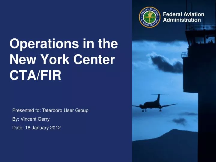
Operations in the New York Center CTA/FIR. NAT Organized Track System (OTS). A series of highly organized tracks generated twice daily in the light of wind information. The density of traffic on these tracks is such that few crossing opportunities exist.

E N D
NAT Organized Track System (OTS). A series of highly organized tracks generated twice daily in the light of wind information. The density of traffic on these tracks is such that few crossing opportunities exist. Europe to North America (EUR-NAM). Random tracks are used which can become more complex due to the random nature of the crossing tracks. Europe to the Caribbean (EUR-CAR). A series of flexible tracks which are aligned to upper winds. Western Atlantic Route System (WATRS). A fixed set of tracks of high complexity which experiences peaks of high traffic density. Atlantic Operations 4 distinct traffic flows affect US Atlantic oceanic operations, controlled from New York Center:
Limitations of Legacy System- Controller Perspective Integration and decisions performed here • Lack of Integrated Tools and Flight Data: • Communications • Navigation • Surveillance The Bottom Line Time-intensive process to access and calculate information for decision making. Manual Paper Strip Maintenance
Technology Enables Change: The FAA Ocean21 System • The FAA’s Ocean21 system is the most advanced CNS/ATM systems in the world. • Fully operational in New York, Oakland and Anchorage oceanic airspace. Operational at New York Since June 2005 • Ocean21 is a COTS product customized by Lockheed-Martin for the FAA.
Ocean21 Provides: • Complete 4D Profile Protection in Oceanic Airspace • Automated Conflict Detection for All Oceanic Separation Standards • Monitoring and Control by Exception • Separation Criteria Based on Individual Aircraft Performance and Equipage • Full Integration of RADAR and non-RADAR Traffic • Dual Channel Architecture with full redundancy on all processors • Fully ICAO 2012 complaint system. Supports all ICAO flight plan messages such as FPL, CHG, DEP, CNL, ARR. Ocean21 Functionality Today
Ocean21 Provides: • Dynamic Airspace Allocation • Satellite based Controller Pilot Data Link Communication (CPDLC) • Satellite based Automatic Dependent Surveillance – Contract (ADS-C) • Automatic Dependent Surveillance-Broadcast (ADS-B) • Paperless Environment • Automatic Weather Dissemination • Air Traffic Services Inter-facility Data Communications 2.0 (AIDC) • RADAR Data Processing • Elimination of voice communication between RADAR and non-RADAR Ocean21 Sectors Ocean21 Functionality Today
Conflict Probe • Ocean21 Detects All Conflicts - Controller Resolves Conflicts • Aircraft/Aircraft and Aircraft/Airspace • Probe Runs Automatically on All Trajectory Updates • Applies Appropriate Separation Standard • System Enforces Pre-Delivery Probe for All Clearances
Conflict Resolution • Conflict Probe is 4-dimensional and calculated down to the second. • As a result, almost all clearances are time based. • Probed and accepted clearances are protected against other aircraft and airspace • This provides us the capability to issue future altitude and route changes and “reserve” those altitudes and routes
Straight Climb With Long Term Conflict Not often issued
Straight Climb With Long Term Conflict Conflict would exist until AFR488 reported level
At Time By Time Climb • By using time restrictions, we can provide climb clearances and reserve altitudes or routes that may otherwise become unavailable at a later time.
San Juan Re-alignment • In 2009, New York Center assumed the non-RADAR airspace of San Juan Center. • Benefits: • Use of Ocean21 Conflict Probe for all non-RADAR airspace. • Greater use of ADS-C and CPDLC • New York can now provide descends into TNCM and TAPA. • San Juan has RADAR coverage overlap into New York non-RADAR airspace.
Route Optimization • Done on a daily basis for CPDLC and ADS-C connected aircraft. • Aircraft makes request and we try to fulfill it based on adjacent facility coordination agreements. • UL80 CLEARED [route] and UL76 At [time] PROCEED DIRECT TO [fix] are the two MOPS elements used for reroutes. • Due to the fact that we are the only ATSP using Periodic Waypoint Reporting, we can issue directs to fixes a long way downstream without the need for any intermittent waypoints.
Route Optimization We can display route and ETA’s
Ocean21 has Enabled Improved Airspace Efficiency and Capacity via Reduced Separation Standards Lateral Separation 200 Miles 50 Miles Longitudinal Separation 10 mins (~80 Miles) 30 Miles 30 Miles 30 Miles
Initiatives • WATRS Plus Route Structure Redesign and CTA/FIR Lateral Separation Reduction to 50 NM- DONE • 30 NM Lateral/30 NM Longitudinal Separation (30/30)- 4Q 2012 • Oceanic Tailored Arrivals- On Going • Oceanic Trajectory Management 4-D /Dynamic Route Optimization- On Going
The Bottom Line • Best Equipped-Best Served • RNP4/10 and FANS-1/A aircraft receive better routes, altitudes, WX deviations, etc • Greater Flexibility • More planes are able fly their preferred routes • Greater Capacity • Automation handles all of the tasks that once had to be manually done. • Allows controller to handle more aircraft with less effort • Response times to aircraft requested have dropped dramatically. Average response time in now 2.7 minutes for HF aircraft and less then two minutes for CPDLC aircraft
ICAO Flight Plan AFTN Addressing For Operations in the entire New York Oceanic CTA/FIR (including WATRS). • The standard lateral separation between RNP4/RNP10 aircraft in the New York FIR is 50 nm. • All flights entering the New York Oceanic CTA/FIR shall address flight plans to KZWYZOZX. • CHG messages should be filed to update the FPL. • All flights entering the New York Oceanic CTA/FIR and a U.S. ARTCC (except Boston) and/or Bermuda airspace shall address flight plans to both KZWYZOZX and the appropriate U.S. ARTCC.
Flight Planning Requirements • 50 NM lateral separation is applied in the entire New York Oceanic CTA/FIR with aircraft authorized RNP10 or RNP4, regardless of altitude. • If operating in WATRS only, you must file your RNP4 or RNP10 capability in Item 18 • If operating in the NAT, you must file both your MNPS and RNP4/RNP10 capability. • If operators do not address flight plans to KZWYZOZX and with the proper information, 50 NM lateral separation cannot be applied. This will affect your ability to get certain altitudes or routes.
Flight Planning Requirements • To inform ATC that they have obtained RNP4 or RNP10 authorization and are eligible for 50 NM lateral separation, operators shall: • (1) annotate ICAO Flight Plan Item 10 (Equipment) with the letters “R” and “Z” and… • (2) annotate Item 18 (Other Information) with, as appropriate, “NAV/RNP10” or “NAV/RNP4” (no space between letters and numbers). • It is recommended that operators show their RNAV capability for domestic U.S. and capabilities for oceanic operations (RNP4 or RNP10) by filing: “NAV/”, then the domestic US alphanumeric sequence, then a mandatory space and then “RNP10” or “RNP4”, as appropriate. The following is an example: “NAV/RNVD1E2A1 RNP10” • Operators that have not obtained RNP 10 or RNP 4 authorization shall not annotate ICAO flight plan Item 18 (Other information) with “NAV/RNP10” or “NAV/RNP4”, but shall follow the practices detailed in paragraph 4 of this notice.
Flight Planning Requirements • Provisions for Accommodation of NonRNP10 Aircraft (Aircraft Not Authorized RNP 10 or RNP 4). • Operators of non-RNP4 or non-RNP10 aircraft shall annotate ICAO flight plan Item 18 as follows: • “STS/NONRNP10” (no space between letters and numbers). • b. Operators of non-RNP4 or non-RNP10 aircraft shall not annotate ICAO flight plan Item 18 (Other Information) with “NAV/RNP10” or “NAV/RNP4”,if they have not obtained RNP 10 or RNP 4 authorization.
Data Link Services • New York Center provides both ADS-C and CPDLC services in the Oceanic FIR. • The New York Oceanic FIR log-on address is KZWY • 25% Equipage rate in WATRS • 50% Equipage rate in the NAT
FANS-1/A Data Link Support • AFN • Logon automatically accepted • When FPL with REG is available • Automatic transfer of datalink to next facility • ADS-C • Automatic Contract Initiation for Equipped Aircraft • Periodic (20 min), Event (5nm) and Waypoint • On- Demand available on each aircraft • Contract Parameters Can be Modified by Controller at any time • CPDLC • Nearly Instantaneous. Messages received on both ends within seconds • Clearances can be auto loaded into FMC • Highly Integrated With Other Sector Operations • Full message set is supported • Clearances Always Composed Same Way • Automation Determines Appropriate Routing (HF or Datalink) • Downlinks Routed to Correct Sector • Indicators on ASD and Strips Datalink
LOGON Procedures for Aircraft entering the KZWY Data-link service area from NON-Data-link airspace. • Log on to KZWY at least 15 minutes but not more than 45 minutes prior to entering the KZWY Data-link service area.
LOGON Procedures for Aircraft Entering the KZWY Data-link Service Area From Adjacent Data-link Airspace. • ADS-C and CPDLC services will transfer automatically from Santa Maria or Gander Oceanic to New York. • Pilots should check the ACTIVE Center as they cross the FIR boundary inbound to New York to ensure that the KZWY is the ACTIVE Center. • If the active center is not correct within 5 minutes after the boundary is crossed, pilots shall ensure all open uplinks from the previous ATC unit have been responded to, then terminate the CPDLC connection and log on to KZWY.
KZWY Data-link Service Area Exit Procedures to non-Data-Link Facility • Aircraft exiting the KZWY Data-link service area to adjacent NON-CPDLC airspace (Piarco, San Juan, New York Center Domestic, Miami, Jacksonville, Bermuda Radar, Moncton, and Gander Domestic): • Aircraft approaching the airspaces above can expect the CPDLC “CONTACT” message containing the frequency for the next facility for VHF assignments only. HF frequency assignments will be managed by ARINC. CPDLC will be terminated approximately 5 minutes prior to the boundary crossing point. • ADS-C Connection will be automatically terminated by Ocean21.
KZWY Data-link Service Area Exit Procedures to Adjacent Data-Link Facility • ADS-C and CPDLC services will transfer automatically from New York to Santa Maria or Gander. • Pilots should check the ACTIVE Center as they cross the FIR boundary outbound and ensure that the FIR they are entering is the ACTIVE Center. • Pilots should check the ACTIVE Center as they cross the FIR boundary to ensure that the FIR they are entering is the ACTIVE Center. • If the active center is not correct within 5 minutes after the boundary is crossed, pilots shall ensure all open uplinks from the previous ATC unit have been responded to, then terminate the CPDLC connection and log on to the correct address.
Position Reporting- Data-Link • After entering the New York Oceanic FIR (KZWY), normal waypoint position reports will be received via ADS. • Due to the types of ADS contracts that are established, time revisions need not be passed via CPDLC or HF. • Operators should not use CPDLC for position reports unless ADS is not available. • Use CPDLC for clearance requests, or for communication not associated with waypoint position reports. • ZWY cannot accept CPDLC position reports containing latitude and longitude (Lat/Long) in ARINC 424 format (e.g. 4050N). CPDLC position reports containing Lat/Long waypoints within the KZWY Data-link service area will be accepted in whole latitude and longitude format only (e.g. 40N050W).
HF Communications Requirement for Data-Link Aircraft • Prior to entering the KZWY Oceanic area, contact New York Radio (ARINC) on HF or VHF and; • If the flight will exit ZNY oceanic airspace into oceanic airspace: • identify the flight as A-D-S equipped • state the name of the next OCA/FIR to be entered • request a SELCAL check • Expect to receive primary and secondary HF frequency assignments from New York Radio for the route of flight within the Data-link service area. Pilots must maintain HF communications capability with New York Radio at all times within the entire New York Oceanic FIR. It should be noted that ARINC may require flights to contact them at 60 West for HF frequency updates.
More Information http://www.faa.gov/air_traffic/publications/notices/
Position Reporting- HF • Position Reports should be forwarded through HF for all charted compulsory reporting points. • Position Reports should be forwarded through HF for all non-charted compulsory reporting points filed in the flight plan.
Preferential Routings • Moncton • M201 all the way to CARAC • M202 all the way to LOMPI • U.S. Domestic- All aircraft exiting the New York Oceanic FIR into San Juan, Miami, Jacksonville, or New York Domestic shall file a route that exits over a five letter boundary fix.
Requests in the vicinity of the FIR Boundary • Due to the nature of manual coordination, requests should be kept to a minimum when within 30 minutes of the FIR boundary.
Weather Deviations • Deviation Requests as a result of weather is one of our top priorities. • Response times are very low. • Every attempt should be made to request a clearance to deviate. • In the event that a clearance cannot be granted, the procedures in ICAO 4444, Chapter 15 should be followed. • Procedures document on: http://www.faa.gov/pilots/intl/oceanic_ops/media/oceanic_wx_deviation_proc_land.pdf
Oceanic Clearances • Eastbound-Issued by New York Center one of three ways: • Via VHF prior to entering the NAT. When issued via HF, route will stop at second landfall fix. • Via HF prior to entering the NAT. When issued via HF, route will stop at second landfall fix. • Via CPDLC prior to entering the NAT. When issued via CPDLC, route will be all the way to destination. • Westbound-Issued by Gander, Shanwick, or Santa Maria. Route is only to a point in the New York FIR, followed by the term “flight planned route” or “then as filed”. • The intent is that the route clearance shall merge with what was filed so no further clearance is needed. • FAA is working to expand on this procedure and eliminate the route portion of the Oceanic Clearance.