Download
1 / 16
160 likes | 242 Views
Bureau of Land Management: Identifying Land with Wilderness Characteristics. By: Heather Evans. What is Wilderness?. Wilderness Act 1964 Land untrammeled by man, where man is a visitor and does not remain Generally affected by the forces of nature Outstanding opportunity for solitude

E N D
Bureau of Land Management:Identifying Land with Wilderness Characteristics By: Heather Evans
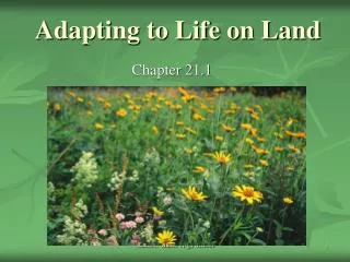
What is Wilderness? Wilderness Act 1964 • Land untrammeled by man, where man is a visitor and does not remain • Generally affected by the forces of nature • Outstanding opportunity for solitude • Has at least 5,000 acres of contiguous land with said features -Wilderness.net
What are Lands with Wilderness Characteristics Managed by The BLM?
Human Influence • Substantially natural, with no signs of human influence:
Recreation • Land must provide ample opportunity for solitude and primitive recreation: No sights, sounds, or human destruction
Supplemental Size Areas must have at least 5,000 acres of contiguous land without roads
Road or Route Was the route initially constructed? Has the route received mechanical maintenance? Does it receive regular and continuous use?
Supplemental value? Evidence of human use?
Supplemental Values • Historic sites Cultural sites
Communication site Old vehicle body Are these significant impacts to naturalness?
Determine BLM Administered Lands USFS Roadless Areas administered under three categories: 1B: Road const & re-const prohibited. 1B-1: Admin endorsed for wilderness mgt 1-C Temp Road const & re-const is allowed. Exclude Lands not Administered By BLM USFS Acreage: 15,070 Acres State Acreage: 3,380 Acres Private Acreage 750 Acres
Aerial Photography identify possible intrusions Review the area using aerial photography 1 Reviewing aerial photos provides an overview of potential intrusions and other uses in the area such as stock ponds or mining activity. 2 1 1: Vegetation Manipulation 2 2 2: Vehicle route 1
My Map • Layers: Rich County, BLM, Roads • Measuring Tool: Road width averages • Buffer: road layer • Creation of New Layers/Attribute fields • Exploded: 5,000 contiguous acres
What I Found • 269 County, State, and Private roads in Rich County • 8 polygons with at least 5,000 contiguous acres • BLM officials must do field work to inventory found polygons
Thank You • Scott Festin • West Desert District BLM GIS Specialists and Recreation Planners • Utah GIS Portal