Download
1 / 19
190 likes | 325 Views
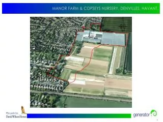
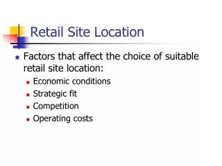
Forest site in J ä rvselja, Estonia: Summary of ground-based LAI measurements Tiit Nilson, Tartu Observatory. Site location. SPOT4 26.06.2003. Coniferous forests appear in dark, deciduous forests in green tones, recent clear cuts and open areas in pink and violet.

E N D
Forest site in Järvselja, Estonia: Summary of ground-based LAI measurementsTiit Nilson, Tartu Observatory
SPOT4 26.06.2003 Coniferous forests appear in dark, deciduous forests in green tones, recent clear cuts and open areas in pink and violet
Ground-based measurements: LAI-2000 and digital hemispheric photos • Mixed forest dominated by birch, spruce and pine • Managed forests, some forest have been cut, so some changes take place from year to year • 50-60 sample plots measured • 3x3 km region measured in summer conditions 2001,2002 and 2003; in leafless broadleaves conditions November 2003. For some plots, LAI-2000 measurements are available from yr 2000 • Angular distribution of gap fraction used • Forest canopy LAI derived by Nilson’s algorithm, uses ancillary data from the forestry database
LAI tree storey LAI ground LAI total Year Nilson’s algorithm Forestry database LAI-2000 LAI-2000 2001 3.24 3.71 0.84 4.12 2002 3.54 3.56 0.86 4.40 2003 3.62 3.54 0.80 4.43 LAI-2000 results, average over all sample plots. Summer conditions
Comparison of LAI-2000 and hemispheric photos • CAN_EYE and GLA programs used to process the photos • A tendency to overestimate gap fraction by the photographic method was noted, especially for broadleaves • With automatic exposition control, typically the crowns and branches from the upper canopy are over-exposed in photos and could be treated as sky • After the processing of photos is finished, a new round of the LAI estimation is foreseen
Agreement between LAI-2000 and photos can be rather good, especially for conifers A pine dominated stand
Agreement is typically worse for broadleaves A dense birch-dominated forest In some cases, large differences are found
LAI-2000 estimates on the same plots. Temporal trajectories from year to year Larger drops in LAI are related to documented cuttings LAI-2000 measurement error is quite large, partly because of non-favorable weather conditions during measurements
A candidate for the transfer function: Reduced Simple Ratio (RSR). An example from an atmospherically corrected SPOT4 image of 2 July 2002. Total LAI from ground-based LAI-2000 measurements