Download
1 / 17
170 likes | 315 Views
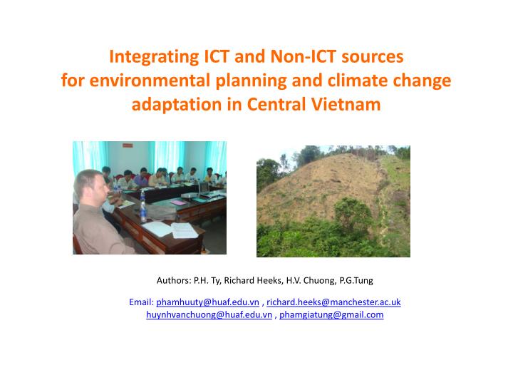
Integrating ICT and Non-ICT sources for environmental planning and climate change adaptation in Central Vietnam. Authors: P.H. Ty, Richard Heeks, H.V. Chuong, P.G.Tung Email: phamhuuty@huaf.edu.vn , richard.heeks@manchester.ac.uk huynhvanchuong@huaf.edu.vn , phamgiatung@gmail.com.

E N D
Integrating ICT and Non-ICT sources for environmental planning and climate change adaptation in Central Vietnam Authors: P.H. Ty, Richard Heeks, H.V. Chuong, P.G.Tung Email: phamhuuty@huaf.edu.vn , richard.heeks@manchester.ac.ukhuynhvanchuong@huaf.edu.vn , phamgiatung@gmail.com
WHY DESIGN THIS RESEARCH? • Top-down environmental planning process in upland districts in Vietnam is not really effective • Environmental planning less takes into account the local participation leading to the failed program or selecting expensive measures for instance Lo O (bamboo) tree plantation in A Luoi district (uplands) of Vietnam is not feasible because the authority made themselves without the consultation with local people • The aim is to design and implement an integrated framework for environmental protection planning using participatory methods (non-ICT source) in combination with GIS and RS (ICT – Source) while taking into account the importance of rural livelihood improvement through environmental planning process
RESEARCH QUESTIONS • What is the situation of soil erosion and landslide in the study area (uplands)? • Can Non-ICT and ICT sources combine to support the environmental protection planning model for livelihood?
LITERATURE REVIEW • ICT source: Binary – based GIS modelling for suitability analysis • Uses logical expressions to select map features from a composite map or multiple grids. Output of binary model is in binary format • 1 – True for map features that satisfy the logical expression • 0 – False for map features that do not • In addition, several query and map analysis methods are used to process the model such as select by them, geo-processing in GIS software packages.
Vector model Grid model
LITERATURE REVIEW (cont..) • Non-ICT source: Local knowledge can be integrated into the AHP (Analytical Hierarchy Process) to make a participatory mapping and planning. Step 1: Development an AHP hierarchy by local people Step 2: Next, the decision-maker expresses opinion regarding the relative importance of the criteria. Step 3: These preference scores after decision makers opinion Step 4: The final step in the AHP process is to complete the synthesis in order to obtain a vector of normalized unit-less weighted preference scores for each of the three alternative sites.
FINDINGS CLIMATE CHANGE EVIDENCES FROM LOCAL MEETINGS • Rainy season period changes significantly. • Wet season appears later than previous years (2009 and 2010). • Temperature variation between winter and summer has been increasingly expanded and more severe. • The number of floods has increased every year. • Droughts tends to last longer than – many forest fires (April to September). • The scale of river bank erosion and landslide are more severe due to floods and droughts. at study area in 2010
Planning for erosion and landslide protection: Integration of ICT and Non-ICT sources • Step 1: Participatory GIS mapping of soil erosion and landslide
Step 2: Selecting the community-based option for soil erosion and landslideLo O bamboo is local people’s choice
Step 3: Identity criteria for Lo O bamboo plantation planning
Step 4: Building Binary-based GIS model and participatory planning
Step 6: Make the final soil erosion and landslide planning • A report of soil erosion and landslide planning was completed to share with local authority and farmers. • Local people was chosen to plant Lo O bamboo according to the planning • The plantation of Lo O Bamboo was organized in different local community group to manage Lo O bamboos were planted in selected areas to prevent river bank erosion and landslide and to protect cassava areas
CONCLUSIONS • Participatory GIS mapping and planning is an effective way to make environmental planning in order to adapt with changing environment in Vietnam, especially for rural areas. • Local knowledge is very crucial and useful to achieve a feasible environmental planning. • GIS supports well to ensure the accuracy of spatial distribution and modeling environmental phenomenon. • However, the model needs higher quality data to have better modeling and a community-based Lo O bamboo plantation model for long-term environmental planning management should be formulated during the planning process.
ONGOING WORK OF TEAM Development the result: “Integrating ICT and Non-ICT sources for environmental planning and climate change adaptation in Central Vietnam” for publishing a chapter of book.
ACKNOWLEDGEMENT We deeply thank for the support of SIRCA project at NANYANG University, Singapore THANK YOU SO MUCH FOR LISTENING !